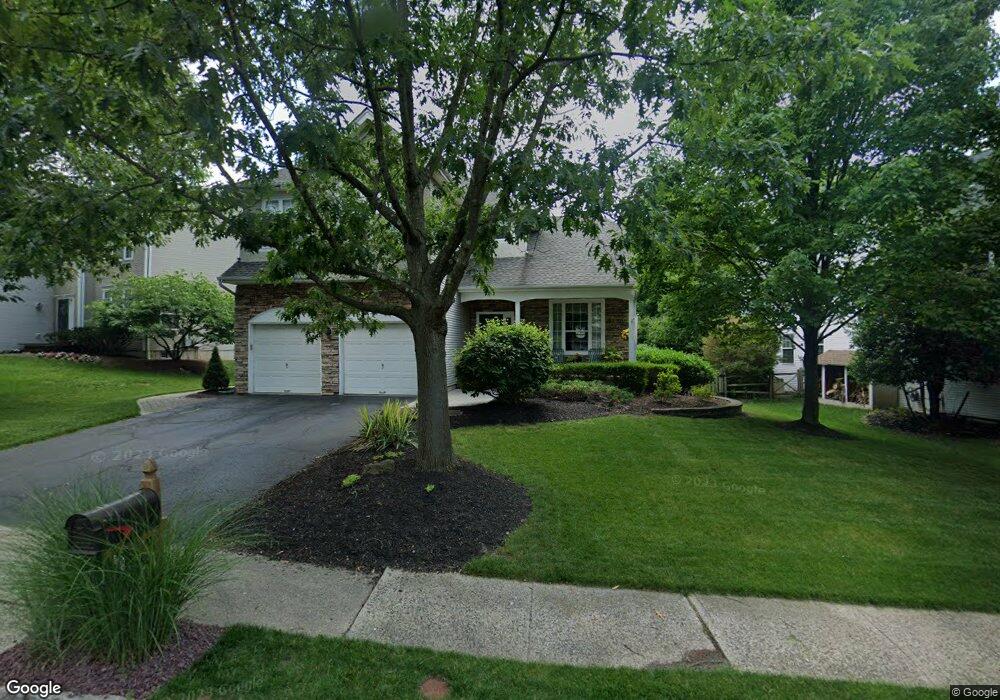
10 King Dr Bridgewater, NJ 08807
Estimated Value: $860,284 - $940,000
Studio
--
Bath
2,073
Sq Ft
$428/Sq Ft
Est. Value
About This Home
This home is located at 10 King Dr, Bridgewater, NJ 08807 and is currently estimated at $886,571, approximately $427 per square foot. 10 King Dr is a home located in Somerset County with nearby schools including Van Derveer School, Somerville Middle School, and Somerville High School.
Ownership History
Date
Name
Owned For
Owner Type
Purchase Details
Closed on
Jun 27, 1997
Sold by
K Hovnanian At Bridgewater
Bought by
Phillips James and Phillips Caryn
Current Estimated Value
Home Financials for this Owner
Home Financials are based on the most recent Mortgage that was taken out on this home.
Original Mortgage
$185,000
Outstanding Balance
$27,360
Interest Rate
7.86%
Estimated Equity
$859,211
Create a Home Valuation Report for This Property
The Home Valuation Report is an in-depth analysis detailing your home's value as well as a comparison with similar homes in the area
Home Values in the Area
Average Home Value in this Area
Purchase History
| Date | Buyer | Sale Price | Title Company |
|---|---|---|---|
| Phillips James | $269,848 | -- |
Source: Public Records
Mortgage History
| Date | Status | Borrower | Loan Amount |
|---|---|---|---|
| Open | Phillips James | $185,000 |
Source: Public Records
Tax History
| Year | Tax Paid | Tax Assessment Tax Assessment Total Assessment is a certain percentage of the fair market value that is determined by local assessors to be the total taxable value of land and additions on the property. | Land | Improvement |
|---|---|---|---|---|
| 2025 | $14,065 | $719,300 | $293,000 | $426,300 |
| 2024 | $14,065 | $720,900 | $293,000 | $427,900 |
| 2023 | $13,143 | $662,100 | $293,000 | $369,100 |
| 2022 | $12,347 | $601,400 | $283,000 | $318,400 |
| 2021 | $11,859 | $570,400 | $283,000 | $287,400 |
| 2020 | $11,863 | $566,500 | $283,000 | $283,500 |
| 2019 | $11,859 | $560,700 | $283,000 | $277,700 |
| 2018 | $11,708 | $554,900 | $283,000 | $271,900 |
| 2017 | $11,426 | $541,000 | $273,000 | $268,000 |
| 2016 | $11,237 | $540,000 | $273,000 | $267,000 |
| 2015 | $11,132 | $535,200 | $273,000 | $262,200 |
| 2014 | $10,636 | $503,600 | $268,000 | $235,600 |
Source: Public Records
Map
Nearby Homes
- 10 King Arthurs Ct
- 14 King Arthurs Ct
- 14 King Arthurs Ct
- 15 E Young St
- 21 E Young St
- 15 King Arthurs Ct
- 11 E Young St
- 11 King Arthurs Ct
- 25 E Young St
- 18 King Arthurs Ct
- 18 King Arthurs Ct
- 29 E Young St
- 9 E Young St
- 35 E Young St
- 286 N Bridge St
- 274 N Bridge St
- 22 King Arthurs Ct
- 22 King Arthurs Ct
- 19 King Arthurs Ct
- 298-300 N Bridge St Unit 1
Your Personal Tour Guide
Ask me questions while you tour the home.