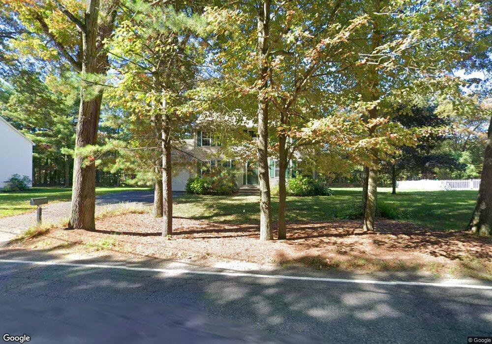
10 Lancaster Rd Clinton, MA 01510
Estimated Value: $550,776 - $677,000
3
Beds
3
Baths
1,632
Sq Ft
$382/Sq Ft
Est. Value
About This Home
This home is located at 10 Lancaster Rd, Clinton, MA 01510 and is currently estimated at $623,944, approximately $382 per square foot. 10 Lancaster Rd is a home located in Worcester County with nearby schools including Clinton Elementary School, Clinton Senior High School, and Clinton Middle School.
Ownership History
Date
Name
Owned For
Owner Type
Purchase Details
Closed on
Mar 29, 2010
Sold by
Fitch Charles A and Fitch Zora E
Bought by
Gibree Lee Ann and Laurello Lauren
Current Estimated Value
Purchase Details
Closed on
Jan 15, 1999
Sold by
Comford Homes Inc
Bought by
Fitch Charles A and Fitch Zora E
Home Financials for this Owner
Home Financials are based on the most recent Mortgage that was taken out on this home.
Original Mortgage
$40,000
Interest Rate
6.7%
Mortgage Type
Purchase Money Mortgage
Create a Home Valuation Report for This Property
The Home Valuation Report is an in-depth analysis detailing your home's value as well as a comparison with similar homes in the area
Home Values in the Area
Average Home Value in this Area
Purchase History
| Date | Buyer | Sale Price | Title Company |
|---|---|---|---|
| Gibree Lee Ann | -- | -- | |
| Fitch Charles A | $188,475 | -- |
Source: Public Records
Mortgage History
| Date | Status | Borrower | Loan Amount |
|---|---|---|---|
| Previous Owner | Fitch Charles A | $40,000 |
Source: Public Records
Tax History
| Year | Tax Paid | Tax Assessment Tax Assessment Total Assessment is a certain percentage of the fair market value that is determined by local assessors to be the total taxable value of land and additions on the property. | Land | Improvement |
|---|---|---|---|---|
| 2025 | $6,512 | $489,600 | $145,100 | $344,500 |
| 2024 | $6,280 | $477,900 | $145,100 | $332,800 |
| 2023 | $5,820 | $435,300 | $131,900 | $303,400 |
| 2022 | $5,712 | $383,100 | $119,900 | $263,200 |
| 2021 | $5,195 | $325,900 | $114,300 | $211,600 |
| 2020 | $5,048 | $325,900 | $114,300 | $211,600 |
| 2019 | $5,045 | $316,700 | $110,900 | $205,800 |
| 2018 | $5,048 | $297,300 | $106,500 | $190,800 |
| 2017 | $5,119 | $289,700 | $106,500 | $183,200 |
| 2016 | $5,077 | $294,000 | $106,500 | $187,500 |
| 2015 | $4,562 | $273,800 | $103,500 | $170,300 |
| 2014 | $4,422 | $273,800 | $103,500 | $170,300 |
Source: Public Records
Map
Nearby Homes
- 18 Sargent Rd
- 6 Mcnulty Rd
- 15 Bufton Farm Rd
- 308 Ridgefield Cir Unit C
- 610 Ridgefield Cir Unit B
- 167 Lancaster Rd
- 920 Ridgefield Cir Unit C
- 155 Cedar St
- 46 Woodruff Rd
- 12 Woodruff Rd
- 30 Henry St Unit 30B
- 23 Coyne St
- 93 Forest St
- 43 Berlin St Unit 411
- 11 Lindbergh Street Rear
- 25 Pearl St
- 114 Oak Trail
- 459 High St
- 508 High St
- 115117 Mechanic St Unit 4
- 6 Lancaster Rd
- 14 Lancaster Rd
- 19 Mount View Dr
- 16 Lancaster Rd
- 31 Lancaster Rd
- 21 Mount View Dr
- 20 Lancaster Rd
- 17 Mount View Dr
- 23 Mount View Dr
- 17 Lancaster Rd
- 35 Bolton Rd
- 47 Lancaster Rd
- 24 Lancaster Rd
- 25 Mount View Dr
- 15 Mount View Dr
- 20 Mount View Dr
- 22 Mount View Dr
- 18 Mount View Dr
- 1 Colonial Dr
- 11 Mount View Dr
Your Personal Tour Guide
Ask me questions while you tour the home.