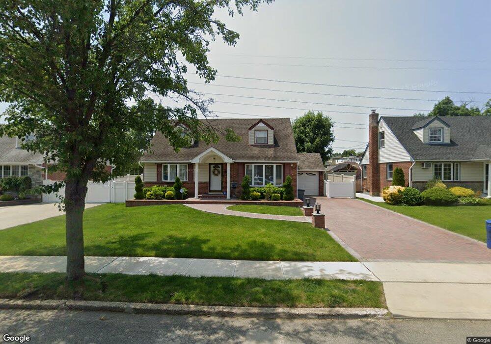
10 Langdon Rd Carle Place, NY 11514
Estimated Value: $856,576 - $888,000
4
Beds
2
Baths
1,380
Sq Ft
$632/Sq Ft
Est. Value
About This Home
This home is located at 10 Langdon Rd, Carle Place, NY 11514 and is currently estimated at $872,288, approximately $632 per square foot. 10 Langdon Rd is a home located in Nassau County with nearby schools including Rushmore Avenue School, Cherry Lane School, and Carle Place High School.
Ownership History
Date
Name
Owned For
Owner Type
Purchase Details
Closed on
Apr 1, 2022
Sold by
Mathew Charles and Mathew Sheena
Bought by
Gaffney Kevin T and Gaffney Amanda A
Current Estimated Value
Home Financials for this Owner
Home Financials are based on the most recent Mortgage that was taken out on this home.
Original Mortgage
$647,000
Outstanding Balance
$610,359
Interest Rate
4.67%
Mortgage Type
New Conventional
Estimated Equity
$261,929
Purchase Details
Closed on
Jan 15, 2016
Sold by
Clayton Charlie and Clayton Jane
Bought by
Mathew Charles and Mathew Sheena
Home Financials for this Owner
Home Financials are based on the most recent Mortgage that was taken out on this home.
Original Mortgage
$456,000
Interest Rate
3.97%
Mortgage Type
New Conventional
Purchase Details
Closed on
Jun 10, 2002
Sold by
Guarino Michael
Bought by
Clayton Charlie
Create a Home Valuation Report for This Property
The Home Valuation Report is an in-depth analysis detailing your home's value as well as a comparison with similar homes in the area
Home Values in the Area
Average Home Value in this Area
Purchase History
| Date | Buyer | Sale Price | Title Company |
|---|---|---|---|
| Gaffney Kevin T | $873,000 | Reliance Title Agency Llc | |
| Mathew Charles | $570,000 | Secured Perimeter Title | |
| Clayton Charlie | $425,000 | -- |
Source: Public Records
Mortgage History
| Date | Status | Borrower | Loan Amount |
|---|---|---|---|
| Open | Gaffney Kevin T | $647,000 | |
| Previous Owner | Mathew Charles | $456,000 |
Source: Public Records
Tax History Compared to Growth
Tax History
| Year | Tax Paid | Tax Assessment Tax Assessment Total Assessment is a certain percentage of the fair market value that is determined by local assessors to be the total taxable value of land and additions on the property. | Land | Improvement |
|---|---|---|---|---|
| 2025 | $13,546 | $550 | $328 | $222 |
| 2024 | $4,004 | $550 | $328 | $222 |
| 2023 | $12,091 | $550 | $328 | $222 |
| 2022 | $12,091 | $550 | $328 | $222 |
| 2021 | $11,671 | $565 | $323 | $242 |
| 2020 | $11,667 | $779 | $778 | $1 |
| 2019 | $12,596 | $855 | $854 | $1 |
| 2018 | $12,596 | $912 | $0 | $0 |
| 2017 | $7,811 | $1,070 | $924 | $146 |
| 2016 | $11,572 | $1,007 | $856 | $151 |
| 2015 | $3,476 | $1,007 | $856 | $151 |
| 2014 | $3,476 | $1,007 | $856 | $151 |
| 2013 | $3,307 | $1,007 | $856 | $151 |
Source: Public Records
Map
Nearby Homes
- 23 Park Cir
- 253 Raff Ave
- 323 Barwick Blvd
- 227 Brown St
- 215 Sheridan Blvd
- 120 Bruce Terrace
- 180 Evelyn Rd
- 135 Barwick Blvd
- 296 Jerome Ave
- 43 Shortridge Dr
- 216 Raff Ave
- 332 Jamaica Blvd
- 101 Brown St
- 128 Charles St
- 239 Mckinley Pkwy
- 410 Congress Ave
- 84 Charles St
- 201 Jamaica Blvd
- 30 School St
- 211 Mineola Ave