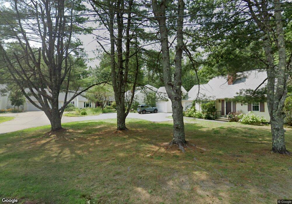
10 Laurel Cir Kennebunk, ME 04043
Estimated Value: $478,000 - $504,533
4
Beds
3
Baths
1,898
Sq Ft
$260/Sq Ft
Est. Value
About This Home
This home is located at 10 Laurel Cir, Kennebunk, ME 04043 and is currently estimated at $494,383, approximately $260 per square foot. 10 Laurel Cir is a home located in York County with nearby schools including Kennebunk High School, School Around Us, and The New School.
Ownership History
Date
Name
Owned For
Owner Type
Purchase Details
Closed on
Mar 29, 2021
Sold by
Flip Flop Llc
Bought by
B Gray Hirshfield Ret
Current Estimated Value
Purchase Details
Closed on
May 7, 2019
Sold by
Jones Mark P
Bought by
Flip Flop Llc
Purchase Details
Closed on
Jan 5, 2019
Sold by
Wachtel Jacqueline H
Bought by
Jones Mark P
Home Financials for this Owner
Home Financials are based on the most recent Mortgage that was taken out on this home.
Original Mortgage
$165,000
Interest Rate
4.8%
Mortgage Type
Purchase Money Mortgage
Purchase Details
Closed on
Sep 24, 2018
Sold by
Wachtel Jacqueline H and Wachtel Mitchell J
Bought by
Wachtel Jacqueline H
Purchase Details
Closed on
Nov 21, 2013
Sold by
Buckley Andrew M and Greene Cynthia D
Bought by
Wachtel Mitchell J and Wachtel Jacqueline H
Create a Home Valuation Report for This Property
The Home Valuation Report is an in-depth analysis detailing your home's value as well as a comparison with similar homes in the area
Home Values in the Area
Average Home Value in this Area
Purchase History
| Date | Buyer | Sale Price | Title Company |
|---|---|---|---|
| B Gray Hirshfield Ret | -- | None Available | |
| Flip Flop Llc | -- | -- | |
| Jones Mark P | -- | -- | |
| Wachtel Jacqueline H | -- | -- | |
| Wachtel Mitchell J | -- | -- |
Source: Public Records
Mortgage History
| Date | Status | Borrower | Loan Amount |
|---|---|---|---|
| Previous Owner | Jones Mark P | $165,000 |
Source: Public Records
Tax History Compared to Growth
Tax History
| Year | Tax Paid | Tax Assessment Tax Assessment Total Assessment is a certain percentage of the fair market value that is determined by local assessors to be the total taxable value of land and additions on the property. | Land | Improvement |
|---|---|---|---|---|
| 2024 | $4,919 | $290,200 | $80,000 | $210,200 |
| 2023 | $4,547 | $283,300 | $80,000 | $203,300 |
| 2022 | $4,136 | $283,300 | $80,000 | $203,300 |
| 2021 | $3,681 | $283,300 | $80,000 | $203,300 |
| 2020 | $4,009 | $283,300 | $80,000 | $203,300 |
| 2019 | $3,895 | $283,300 | $80,000 | $203,300 |
| 2018 | $3,719 | $212,500 | $60,000 | $152,500 |
| 2017 | $3,517 | $212,500 | $60,000 | $152,500 |
| 2016 | $3,379 | $212,500 | $60,000 | $152,500 |
| 2015 | $3,251 | $212,500 | $60,000 | $152,500 |
| 2014 | $3,166 | $212,500 | $60,000 | $152,500 |
Source: Public Records
Map
Nearby Homes
- 14 Glenwood Dr
- 18 Longwood Dr
- 121 Fletcher St
- 31 Oakwood Ln
- 28 Longfellow Ln Unit 15
- 10 Intervale Rd
- 7 Acorn Cir
- 3 Hardwood Dr
- 19 Old Alewive Rd
- 20 Wonderbrook Dr
- 7 Wonderbrook Dr
- 14 Wiggins Pond Ln
- 61 Fletcher St
- 7 Coastal Woods Dr Unit 102
- 59 Plymouth Grove Unit 11
- 12 Chipmunk Trail
- 3 Nichols Ln
- 40 Powder Mill Dr Unit 40
- 39 Powder Mill Dr
- 0 Old Post Rd Unit 1628980
- 10 Laurel Cir Unit 13
- 8 Laurel Cir Unit 8
- 12 Laurel Cir Unit 4
- 14 Laurel Cir Unit 11
- 5 Laurel Cir Unit 4
- 2 Laurel Cir Unit 17
- 21 Rosewood Cir Unit 17
- 21 Rosewood Cir Unit 16
- 21 Rosewood Cir Unit 15
- 21 Rosewood Cir Unit 14
- 21 Rosewood Cir Unit 13
- 21 Rosewood Cir Unit 12
- 21 Rosewood Cir Unit 11
- 21 Rosewood Cir Unit 10
- 21 Rosewood Cir Unit 9
- 21 Rosewood Cir Unit 8
- 21 Rosewood Cir Unit 7
- 21 Rosewood Cir Unit 6
- 21 Rosewood Cir Unit 5
- 21 Rosewood Cir Unit 4