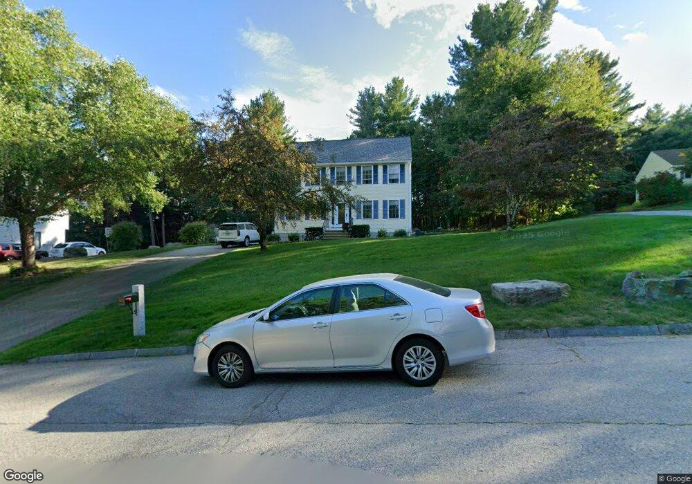
10 Laurel Ln Tyngsboro, MA 01879
Estimated Value: $666,000 - $829,000
3
Beds
2
Baths
1,802
Sq Ft
$396/Sq Ft
Est. Value
About This Home
This home is located at 10 Laurel Ln, Tyngsboro, MA 01879 and is currently estimated at $713,689, approximately $396 per square foot. 10 Laurel Ln is a home located in Middlesex County with nearby schools including Tyngsborough Elementary School, Tyngsborough Middle School, and Innovation Academy Charter School.
Ownership History
Date
Name
Owned For
Owner Type
Purchase Details
Closed on
May 24, 1996
Sold by
Harrington Barbara
Bought by
Gillis Michael J and Gillis Cynthia
Current Estimated Value
Home Financials for this Owner
Home Financials are based on the most recent Mortgage that was taken out on this home.
Original Mortgage
$160,000
Interest Rate
8.01%
Mortgage Type
Purchase Money Mortgage
Create a Home Valuation Report for This Property
The Home Valuation Report is an in-depth analysis detailing your home's value as well as a comparison with similar homes in the area
Home Values in the Area
Average Home Value in this Area
Purchase History
| Date | Buyer | Sale Price | Title Company |
|---|---|---|---|
| Gillis Michael J | $70,000 | -- |
Source: Public Records
Mortgage History
| Date | Status | Borrower | Loan Amount |
|---|---|---|---|
| Open | Gillis Michael J | $200,000 | |
| Closed | Gillis Michael J | $160,000 |
Source: Public Records
Tax History Compared to Growth
Tax History
| Year | Tax Paid | Tax Assessment Tax Assessment Total Assessment is a certain percentage of the fair market value that is determined by local assessors to be the total taxable value of land and additions on the property. | Land | Improvement |
|---|---|---|---|---|
| 2025 | $78 | $629,500 | $300,600 | $328,900 |
| 2024 | $7,768 | $610,700 | $289,700 | $321,000 |
| 2023 | $7,329 | $518,300 | $241,800 | $276,500 |
| 2022 | $6,964 | $466,100 | $211,300 | $254,800 |
| 2021 | $59,982 | $422,800 | $191,700 | $231,100 |
| 2020 | $60,874 | $422,100 | $191,700 | $230,400 |
| 2019 | $6,550 | $386,900 | $178,600 | $208,300 |
| 2018 | $61,424 | $378,800 | $178,600 | $200,200 |
| 2017 | $6,299 | $367,100 | $178,600 | $188,500 |
| 2016 | $6,190 | $352,500 | $178,600 | $173,900 |
| 2015 | $5,683 | $335,100 | $161,200 | $173,900 |
Source: Public Records
Map
Nearby Homes