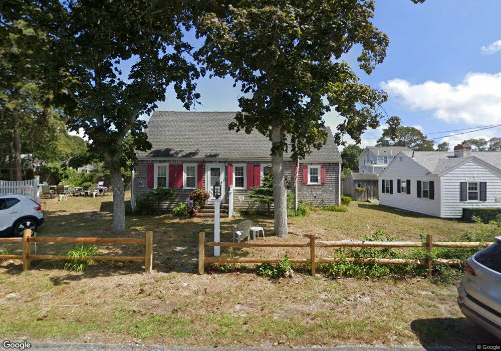
10 Laurel Rd Dennis Port, MA 02639
Dennis Port NeighborhoodEstimated Value: $528,000 - $638,000
3
Beds
1
Bath
820
Sq Ft
$730/Sq Ft
Est. Value
About This Home
This home is located at 10 Laurel Rd, Dennis Port, MA 02639 and is currently estimated at $598,671, approximately $730 per square foot. 10 Laurel Rd is a home located in Barnstable County with nearby schools including Dennis-Yarmouth Regional High School and St. Pius X. School.
Ownership History
Date
Name
Owned For
Owner Type
Purchase Details
Closed on
May 12, 2020
Sold by
Schofield David A and Schofield Linda F
Bought by
Schofield Irt
Current Estimated Value
Purchase Details
Closed on
Nov 14, 1991
Sold by
Schofield Dorothy M
Bought by
Schofield David A and Scofield Linda F
Create a Home Valuation Report for This Property
The Home Valuation Report is an in-depth analysis detailing your home's value as well as a comparison with similar homes in the area
Home Values in the Area
Average Home Value in this Area
Purchase History
| Date | Buyer | Sale Price | Title Company |
|---|---|---|---|
| Schofield Irt | -- | None Available | |
| Schofield David A | $75,000 | -- |
Source: Public Records
Mortgage History
| Date | Status | Borrower | Loan Amount |
|---|---|---|---|
| Previous Owner | Schofield David A | $114,000 |
Source: Public Records
Tax History Compared to Growth
Tax History
| Year | Tax Paid | Tax Assessment Tax Assessment Total Assessment is a certain percentage of the fair market value that is determined by local assessors to be the total taxable value of land and additions on the property. | Land | Improvement |
|---|---|---|---|---|
| 2025 | $2,331 | $538,300 | $293,800 | $244,500 |
| 2024 | $2,185 | $497,700 | $282,600 | $215,100 |
| 2023 | $2,113 | $452,500 | $256,900 | $195,600 |
| 2022 | $1,960 | $350,000 | $202,500 | $147,500 |
| 2021 | $1,886 | $312,800 | $198,500 | $114,300 |
| 2020 | $1,868 | $306,300 | $198,500 | $107,800 |
| 2019 | $1,897 | $307,500 | $211,300 | $96,200 |
| 2018 | $1,851 | $291,900 | $201,100 | $90,800 |
| 2017 | $1,698 | $276,100 | $185,300 | $90,800 |
| 2016 | $1,643 | $251,600 | $174,700 | $76,900 |
| 2015 | $1,610 | $251,600 | $174,700 | $76,900 |
| 2014 | $1,515 | $238,600 | $164,100 | $74,500 |
Source: Public Records
Map
Nearby Homes
- 22 Ferncliff Rd
- 102 Sea St
- 37-A Beach Hills Rd
- 37 Beach Hills Rd
- 262 Old Wharf Rd Unit 67
- 262 Old Wharf Rd Unit 5
- 262 Old Wharf Rd Unit 5
- 262 Old Wharf Rd Unit 20
- 262 Old Wharf Rd Unit 87
- 402 Old Wharf Rd
- 402 Old Wharf Rd
- 405 Old Wharf Rd Unit B204
- 405 Old Wharf Rd Unit B204
- 31 Easy St
- 241 Old Wharf Rd Unit 82
- 241 Old Wharf Rd Unit 127
- 241 Old Wharf Rd Unit 90
- 11 Ocean Park W
- 22 Wixon Rd
- 217 Old Wharf Rd Unit 64
- 14 Laurel Rd
- 5 Laurel Rd
- 17 Myrtle Rd
- 9 Laurel Rd
- 291 Lower County Rd
- 1 Laurel Rd
- 1 Laurel Rd Unit 1
- 1 Laurel Rd Unit U3
- 2 Laurel Rd
- 3 Laurel Rd
- 16 Laurel Rd
- 291 Lower County Rd Unit G
- 291 Lower County Rd Unit F
- 291 Lower County Rd Unit E
- 291 Lower County Rd Unit D
- 291 Lower County Rd Unit C
- 291 Lower County Rd Unit B
- 291 Lower County Rd Unit A
- 291 Lower County Rd Unit UN-A
- 291 Lower County Rd