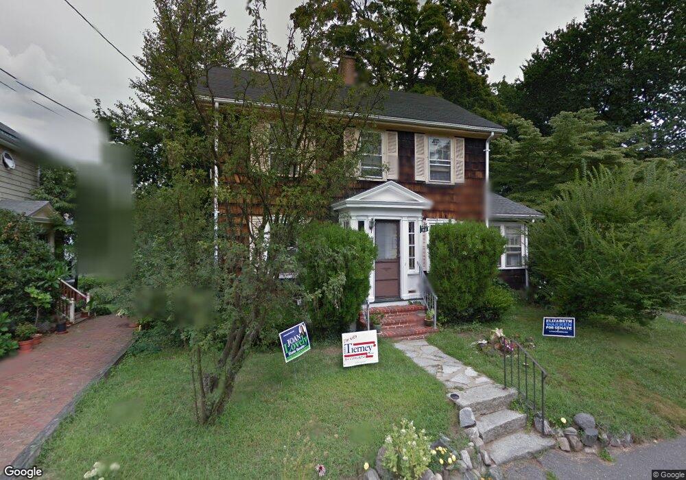
10 Lee St Salem, MA 01970
North Salem NeighborhoodEstimated Value: $701,000 - $787,000
3
Beds
2
Baths
1,432
Sq Ft
$510/Sq Ft
Est. Value
About This Home
This home is located at 10 Lee St, Salem, MA 01970 and is currently estimated at $730,336, approximately $510 per square foot. 10 Lee St is a home located in Essex County with nearby schools including Bates Elementary School, Saltonstall School, and Carlton Elementary School.
Ownership History
Date
Name
Owned For
Owner Type
Purchase Details
Closed on
Oct 23, 1998
Sold by
Capers Dorothy A
Bought by
Sullivan J Michael and Sullivan Clare White
Current Estimated Value
Home Financials for this Owner
Home Financials are based on the most recent Mortgage that was taken out on this home.
Original Mortgage
$162,000
Interest Rate
6.74%
Mortgage Type
Purchase Money Mortgage
Create a Home Valuation Report for This Property
The Home Valuation Report is an in-depth analysis detailing your home's value as well as a comparison with similar homes in the area
Home Values in the Area
Average Home Value in this Area
Purchase History
| Date | Buyer | Sale Price | Title Company |
|---|---|---|---|
| Sullivan J Michael | $202,500 | -- |
Source: Public Records
Mortgage History
| Date | Status | Borrower | Loan Amount |
|---|---|---|---|
| Open | Sullivan J Michael | $250,000 | |
| Closed | Sullivan J Michael | $217,000 | |
| Closed | Sullivan J Michael | $50,000 | |
| Closed | Sullivan J Michael | $162,000 |
Source: Public Records
Tax History Compared to Growth
Tax History
| Year | Tax Paid | Tax Assessment Tax Assessment Total Assessment is a certain percentage of the fair market value that is determined by local assessors to be the total taxable value of land and additions on the property. | Land | Improvement |
|---|---|---|---|---|
| 2025 | $6,824 | $601,800 | $230,200 | $371,600 |
| 2024 | $6,795 | $584,800 | $230,200 | $354,600 |
| 2023 | $6,420 | $513,200 | $209,500 | $303,700 |
| 2022 | $6,381 | $481,600 | $209,500 | $272,100 |
| 2021 | $6,583 | $477,000 | $209,500 | $267,500 |
| 2020 | $6,302 | $436,100 | $187,600 | $248,500 |
| 2019 | $6,331 | $419,300 | $187,600 | $231,700 |
| 2018 | $6,146 | $399,600 | $178,600 | $221,000 |
| 2017 | $6,000 | $378,300 | $164,900 | $213,400 |
| 2016 | $5,928 | $378,300 | $164,900 | $213,400 |
| 2015 | $6,016 | $366,600 | $164,900 | $201,700 |
Source: Public Records
Map
Nearby Homes
- 5 Larchmont Rd Unit 3
- 41 Dearborn St
- 29R Upham St
- 29R Upham St Unit 29R
- 27 Appleton St
- 18 Franklin St Unit 303
- 112 North St
- 3 S Mason St
- 103 Bridge St Unit 2
- 156 Bridge St Unit B
- 14 Lathrop St
- 12 Thorndike St
- 19 Cushing St
- 0 Lot 41 Map 10 Unit 73335079
- 0 Lot 61 Map 10 Unit 73335091
- 78 Federal St
- 47 Federal St
- 15 Lynde St Unit 26
- 17 North St Unit 2
- 304 Essex St Unit 1