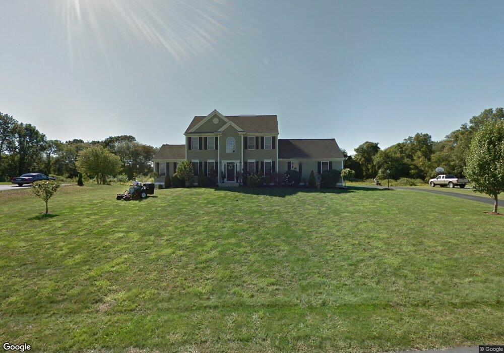
10 Lighthouse Ln Westport, MA 02790
North Westport NeighborhoodEstimated Value: $701,000 - $870,000
3
Beds
--
Bath
2,108
Sq Ft
$363/Sq Ft
Est. Value
About This Home
This home is located at 10 Lighthouse Ln, Westport, MA 02790 and is currently estimated at $766,020, approximately $363 per square foot. 10 Lighthouse Ln is a home located in Bristol County with nearby schools including Alice A. Macomber Primary School, Westport Elementary School, and Westport Middle-High School.
Ownership History
Date
Name
Owned For
Owner Type
Purchase Details
Closed on
Nov 29, 2022
Sold by
Vieira Brenton J and Vieira Andrea L
Bought by
Brebton J Vieira Ret and Vieira
Current Estimated Value
Purchase Details
Closed on
Aug 20, 2019
Sold by
Vieira Brenton J and Dodge Andrea L
Bought by
Vieira Andrea L and Vieira Brenton J
Home Financials for this Owner
Home Financials are based on the most recent Mortgage that was taken out on this home.
Original Mortgage
$400,000
Interest Rate
3.7%
Mortgage Type
New Conventional
Create a Home Valuation Report for This Property
The Home Valuation Report is an in-depth analysis detailing your home's value as well as a comparison with similar homes in the area
Home Values in the Area
Average Home Value in this Area
Purchase History
| Date | Buyer | Sale Price | Title Company |
|---|---|---|---|
| Brebton J Vieira Ret | -- | None Available | |
| Vieira Andrea L | -- | -- |
Source: Public Records
Mortgage History
| Date | Status | Borrower | Loan Amount |
|---|---|---|---|
| Previous Owner | Vieira Andrea L | $400,000 |
Source: Public Records
Tax History Compared to Growth
Tax History
| Year | Tax Paid | Tax Assessment Tax Assessment Total Assessment is a certain percentage of the fair market value that is determined by local assessors to be the total taxable value of land and additions on the property. | Land | Improvement |
|---|---|---|---|---|
| 2025 | $4,255 | $571,200 | $210,800 | $360,400 |
| 2024 | $4,231 | $547,400 | $195,300 | $352,100 |
| 2023 | $4,169 | $510,900 | $186,100 | $324,800 |
| 2022 | $4,014 | $473,300 | $186,100 | $287,200 |
| 2021 | $3,934 | $456,400 | $169,200 | $287,200 |
| 2020 | $3,790 | $449,600 | $162,400 | $287,200 |
| 2019 | $3,689 | $446,100 | $162,400 | $283,700 |
| 2018 | $3,324 | $406,800 | $130,300 | $276,500 |
| 2017 | $3,266 | $409,800 | $132,800 | $277,000 |
| 2016 | $3,048 | $385,300 | $137,800 | $247,500 |
| 2015 | $3,020 | $380,800 | $140,300 | $240,500 |
Source: Public Records
Map
Nearby Homes
- 218 American Legion Hwy
- 47 Devol Ave
- 33 Moniz Dr
- 40 Robert St
- 51 Newton St
- 771 Sanford Rd
- 0 Tickle Rd Unit 73453134
- 6 Angel Ct
- 219 Tickle Rd
- 47 Robert St
- 100 Cory's Ln
- 100 Corys Ln
- 8 Campion Ave
- 308 Robert St
- 14 Glendale Ave
- 0 Crandall Rd
- 1125 Stafford Rd Unit 5
- 75 Montgomery St
- 374 Crandall Rd
- 100 D Dr
- 6 Lighthouse Ln
- 14 Lighthouse Ln
- 13 Lighthouse Ln
- 9 Lighthouse Ln
- 17 Lighthouse Ln
- 2 Lighthouse Ln
- 18 Lighthouse Ln
- 5 Lighthouse Ln
- 21 Lighthouse Ln
- 3 Lighthouse Ln
- 22 Lighthouse Ln
- 25 Lighthouse Ln
- 1 Lighthouse Ln
- 26 Lighthouse Ln
- 40 Meadow Rd
- 36 Meadow Rd
- 44 Meadow Rd
- 210 American Legion Hwy
- 48 Meadow Rd
- 28 Meadow Rd