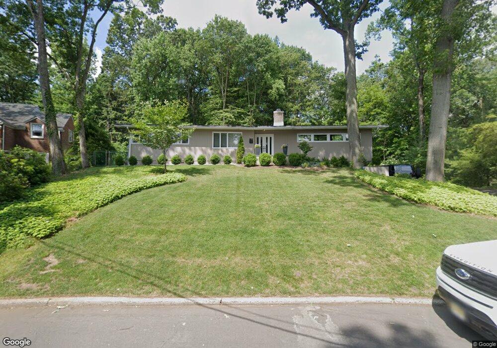
10 Londonderry Way Summit, NJ 07901
Estimated Value: $1,314,000 - $2,256,000
5
Beds
4
Baths
3,167
Sq Ft
$595/Sq Ft
Est. Value
About This Home
This home is located at 10 Londonderry Way, Summit, NJ 07901 and is currently estimated at $1,884,725, approximately $595 per square foot. 10 Londonderry Way is a home located in Union County with nearby schools including L C Johnson Summit Middle School, Summit Sr High School, and Kent Place School.
Ownership History
Date
Name
Owned For
Owner Type
Purchase Details
Closed on
May 31, 2018
Sold by
Morcheles Bernard and Morcheles Barbara
Bought by
Ores John R and Ores Lauren
Current Estimated Value
Home Financials for this Owner
Home Financials are based on the most recent Mortgage that was taken out on this home.
Original Mortgage
$972,000
Outstanding Balance
$840,617
Interest Rate
4.5%
Mortgage Type
New Conventional
Estimated Equity
$1,044,108
Purchase Details
Closed on
Mar 16, 1998
Sold by
Callender David and Callender Kathleen M
Bought by
Morcheles Bernard and Morcheles Barbara
Home Financials for this Owner
Home Financials are based on the most recent Mortgage that was taken out on this home.
Original Mortgage
$585,000
Interest Rate
6.92%
Create a Home Valuation Report for This Property
The Home Valuation Report is an in-depth analysis detailing your home's value as well as a comparison with similar homes in the area
Home Values in the Area
Average Home Value in this Area
Purchase History
| Date | Buyer | Sale Price | Title Company |
|---|---|---|---|
| Ores John R | $1,215,000 | Acres Land Title Agency Llc | |
| Morcheles Bernard | $639,000 | -- |
Source: Public Records
Mortgage History
| Date | Status | Borrower | Loan Amount |
|---|---|---|---|
| Open | Ores John R | $972,000 | |
| Previous Owner | Morcheles Bernard | $585,000 |
Source: Public Records
Tax History Compared to Growth
Tax History
| Year | Tax Paid | Tax Assessment Tax Assessment Total Assessment is a certain percentage of the fair market value that is determined by local assessors to be the total taxable value of land and additions on the property. | Land | Improvement |
|---|---|---|---|---|
| 2025 | $21,257 | $552,700 | $232,500 | $320,200 |
| 2024 | $21,116 | $488,000 | $232,500 | $255,500 |
| 2023 | $21,116 | $488,000 | $232,500 | $255,500 |
| 2022 | $20,901 | $488,000 | $232,500 | $255,500 |
| 2021 | $21,067 | $488,000 | $232,500 | $255,500 |
| 2020 | $21,277 | $488,000 | $232,500 | $255,500 |
| 2019 | $21,301 | $488,000 | $232,500 | $255,500 |
| 2018 | $17,417 | $401,600 | $232,500 | $169,100 |
| 2017 | $17,530 | $401,600 | $232,500 | $169,100 |
| 2016 | $17,273 | $401,600 | $232,500 | $169,100 |
| 2015 | $16,935 | $401,600 | $232,500 | $169,100 |
| 2014 | $16,498 | $401,600 | $232,500 | $169,100 |
Source: Public Records
Map
Nearby Homes
- 59 West Rd
- 60 Fernwood Rd
- 55 Oxbow Ln
- 181 Summit Ave
- 149 Hillcrest Ave
- 16 West Rd
- 58 Prospect Hill Ave
- 30 Wildwood Ln
- 133 Summit Ave Unit 10
- 10 Waldron Ave
- 115 Beechwood Rd
- 12 Coniston Rd
- 23 Euclid Ave
- 50 Parmley Place Unit 203
- 39 Huntley Rd
- 160 Springfield Ave
- 50 Bellevue Ave
- 1 Irving Place
- 285 Taylor Rd S
- 368 Hartshorn Dr
- 12 Londonderry Way
- 9 Londonderry Way
- 17 Londonderry Way
- 90 Essex Rd
- 82 Essex Rd
- 2 Londonderry Way
- 21 Londonderry Way
- 78 Essex Rd
- 94 Essex Rd
- 23 Londonderry Way
- 100 Essex Rd
- 74 Essex Rd
- 27 Londonderry Way
- 2 Robin Hood Rd
- 104 Essex Rd
- 5 Robin Hood Rd
- 34 Dogwood Dr
- 28 Londonderry Way
- 97 Essex Rd
- 165 Hobart Ave