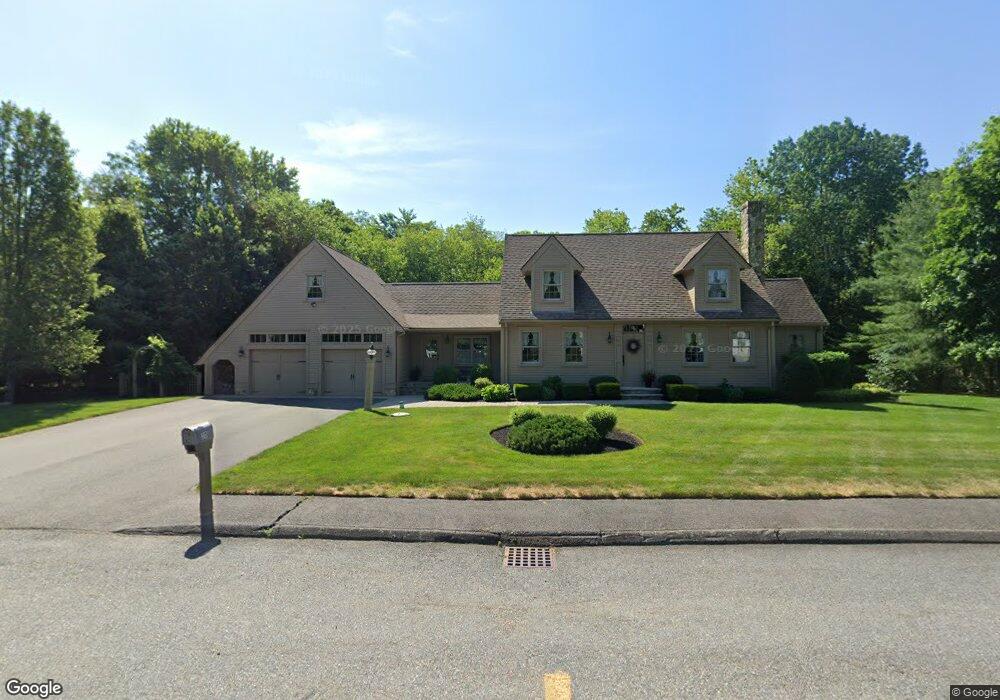
10 Lordan Rd Raynham, MA 02767
Estimated Value: $635,000 - $724,000
4
Beds
2
Baths
2,568
Sq Ft
$268/Sq Ft
Est. Value
About This Home
This home is located at 10 Lordan Rd, Raynham, MA 02767 and is currently estimated at $687,535, approximately $267 per square foot. 10 Lordan Rd is a home located in Bristol County with nearby schools including Merrill Elementary School, LaLiberte Elementary School, and Williams Intermediate School.
Ownership History
Date
Name
Owned For
Owner Type
Purchase Details
Closed on
Mar 23, 2020
Sold by
Lapointe Linda M and Lapoine Richard A
Bought by
Lordan 10 Rt
Current Estimated Value
Purchase Details
Closed on
Sep 24, 2010
Sold by
Lester Robert E and Jp Morgan Chase Bk
Bought by
Lapointe Richard A and Lapointe Linda M
Create a Home Valuation Report for This Property
The Home Valuation Report is an in-depth analysis detailing your home's value as well as a comparison with similar homes in the area
Home Values in the Area
Average Home Value in this Area
Purchase History
| Date | Buyer | Sale Price | Title Company |
|---|---|---|---|
| Lordan 10 Rt | -- | None Available | |
| Lapointe Richard A | $261,000 | -- |
Source: Public Records
Tax History
| Year | Tax Paid | Tax Assessment Tax Assessment Total Assessment is a certain percentage of the fair market value that is determined by local assessors to be the total taxable value of land and additions on the property. | Land | Improvement |
|---|---|---|---|---|
| 2025 | $7,558 | $624,600 | $203,500 | $421,100 |
| 2024 | $7,409 | $596,500 | $195,700 | $400,800 |
| 2023 | $7,114 | $523,100 | $176,100 | $347,000 |
| 2022 | $6,733 | $454,000 | $156,600 | $297,400 |
| 2021 | $6,406 | $436,100 | $148,700 | $287,400 |
| 2020 | $6,227 | $432,100 | $148,700 | $283,400 |
| 2019 | $6,149 | $432,100 | $148,700 | $283,400 |
| 2018 | $6,119 | $410,700 | $148,700 | $262,000 |
| 2017 | $5,778 | $384,400 | $140,900 | $243,500 |
| 2016 | $5,712 | $381,300 | $137,800 | $243,500 |
| 2015 | $5,785 | $379,600 | $138,600 | $241,000 |
Source: Public Records
Map
Nearby Homes
- 75 Warren St W Unit 16
- 208 S Main St
- 152 Forgeriver
- 21 Sully Rd
- 4-B High Ridge Dr
- 30 Edward Rd
- 68 Michael Rd
- 0 Cape Highway Route 44 Unit 73474847
- 5 Parcels Cape Highway Route 44
- 53 Queens Cir
- 0 S Main St Unit 73443212
- 2 Maplewood Ln Unit 21-1
- 0 Maplewood Unit 21.3 73426136
- 173 Titicut Rd
- 84 Diniz Dr
- 36 Stony Brook Rd
- 136 Dean St
- 136 Dean St Unit A&B
- 110 Dean St Unit 93
- 935 King St
- 28 Lordan Rd
- 0 Tanning Unit 71767828
- Parcel 3 New State Highway (Rt 44)
- Parcel 4 New State Highway (Rt 44)
- 23 Lordan Rd
- 37 N Main St
- 35 N Main St Unit Floor 2
- 35 N Main St
- 35 N Main St Unit 1
- 38 Lordan Rd
- 31 N Main St
- 68 N Main St
- 33 Lordan Rd
- 50 Lordan Rd
- 2 Kenny Rd
- 43 Lordan Rd
- 26 Kenny Rd
- 2 N Main St
- 0 No Main St Lot 1
- 2 Pleasant St
Your Personal Tour Guide
Ask me questions while you tour the home.