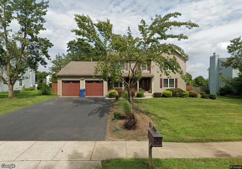
10 Lyndhurst Dr Somerset, NJ 08873
Estimated Value: $767,476 - $810,000
--
Bed
--
Bath
2,368
Sq Ft
$332/Sq Ft
Est. Value
About This Home
This home is located at 10 Lyndhurst Dr, Somerset, NJ 08873 and is currently estimated at $786,869, approximately $332 per square foot. 10 Lyndhurst Dr is a home located in Somerset County with nearby schools including Franklin High School, Thomas Edison EnergySmart Charter School, and Central Jersey College Prep Charter School.
Ownership History
Date
Name
Owned For
Owner Type
Purchase Details
Closed on
Oct 2, 1998
Sold by
Wamble Marvin
Bought by
Gianes Jim and Gaines Judy
Current Estimated Value
Home Financials for this Owner
Home Financials are based on the most recent Mortgage that was taken out on this home.
Original Mortgage
$207,000
Outstanding Balance
$45,282
Interest Rate
6.89%
Estimated Equity
$741,587
Purchase Details
Closed on
Aug 6, 1996
Sold by
Goslin Nancy
Bought by
Wamble Marvin and Wamble Anita
Home Financials for this Owner
Home Financials are based on the most recent Mortgage that was taken out on this home.
Original Mortgage
$209,000
Interest Rate
7.81%
Purchase Details
Closed on
May 25, 1994
Sold by
Felton Raymond
Bought by
Goslin Paul and Goslin Nancy
Home Financials for this Owner
Home Financials are based on the most recent Mortgage that was taken out on this home.
Original Mortgage
$170,000
Interest Rate
8.49%
Create a Home Valuation Report for This Property
The Home Valuation Report is an in-depth analysis detailing your home's value as well as a comparison with similar homes in the area
Home Values in the Area
Average Home Value in this Area
Purchase History
| Date | Buyer | Sale Price | Title Company |
|---|---|---|---|
| Gianes Jim | $230,000 | -- | |
| Wamble Marvin | $232,000 | -- | |
| Goslin Paul | $248,000 | -- |
Source: Public Records
Mortgage History
| Date | Status | Borrower | Loan Amount |
|---|---|---|---|
| Open | Gianes Jim | $207,000 | |
| Previous Owner | Wamble Marvin | $209,000 | |
| Previous Owner | Goslin Paul | $170,000 |
Source: Public Records
Tax History Compared to Growth
Tax History
| Year | Tax Paid | Tax Assessment Tax Assessment Total Assessment is a certain percentage of the fair market value that is determined by local assessors to be the total taxable value of land and additions on the property. | Land | Improvement |
|---|---|---|---|---|
| 2025 | $11,148 | $810,900 | $417,400 | $393,500 |
| 2024 | $11,148 | $613,200 | $317,400 | $295,800 |
| 2023 | $10,875 | $563,200 | $267,400 | $295,800 |
| 2022 | $10,459 | $513,200 | $217,400 | $295,800 |
| 2021 | $10,371 | $468,200 | $172,400 | $295,800 |
| 2020 | $10,374 | $458,200 | $162,400 | $295,800 |
| 2019 | $10,548 | $458,200 | $162,400 | $295,800 |
| 2018 | $9,960 | $428,200 | $132,400 | $295,800 |
| 2017 | $9,994 | $428,200 | $132,400 | $295,800 |
| 2016 | $10,067 | $428,200 | $132,400 | $295,800 |
| 2015 | $9,998 | $428,200 | $132,400 | $295,800 |
| 2014 | $9,857 | $428,200 | $132,400 | $295,800 |
Source: Public Records
Map
Nearby Homes
- 58 Boxgrove Place
- 76 Avebury Place
- 77 Avebury Place
- 139 Skipton Place
- 450 Saint Giles Ct
- 169 Becket Place
- 266 Dochery Place
- 130 Selby Ct
- 110 Wycombe Place
- 5 Alton Dr
- 77 Haverhill Place
- 112 Aimwick Ct
- 342 Smithwold Rd
- 9 Henley Dr
- 11 Henley Dr
- 55 Cherrywood Dr
- 1303 Fir Ct
- 90 Almond Dr
- 591 Post Ln
- 146 Carson Ct
- 12 Lyndhurst Dr
- 1 Burnham St
- 3 Burnham St
- 5 Burnham St
- 9 Lyndhurst Dr
- 7 Lyndhurst Dr
- 11 Lyndhurst Dr
- 2 Burnham St
- 5 Lyndhurst Dr
- 21 Avebury Place
- 4 Burnham St
- 20 Avebury Place
- 20 Avebury Place Unit na
- 22 Avebury Place
- 7 Burnham St
- 19 Avebury Place
- 6 Burnham St
- 18 Avebury Place
- 23 Avebury Place
- 17 Avebury Place