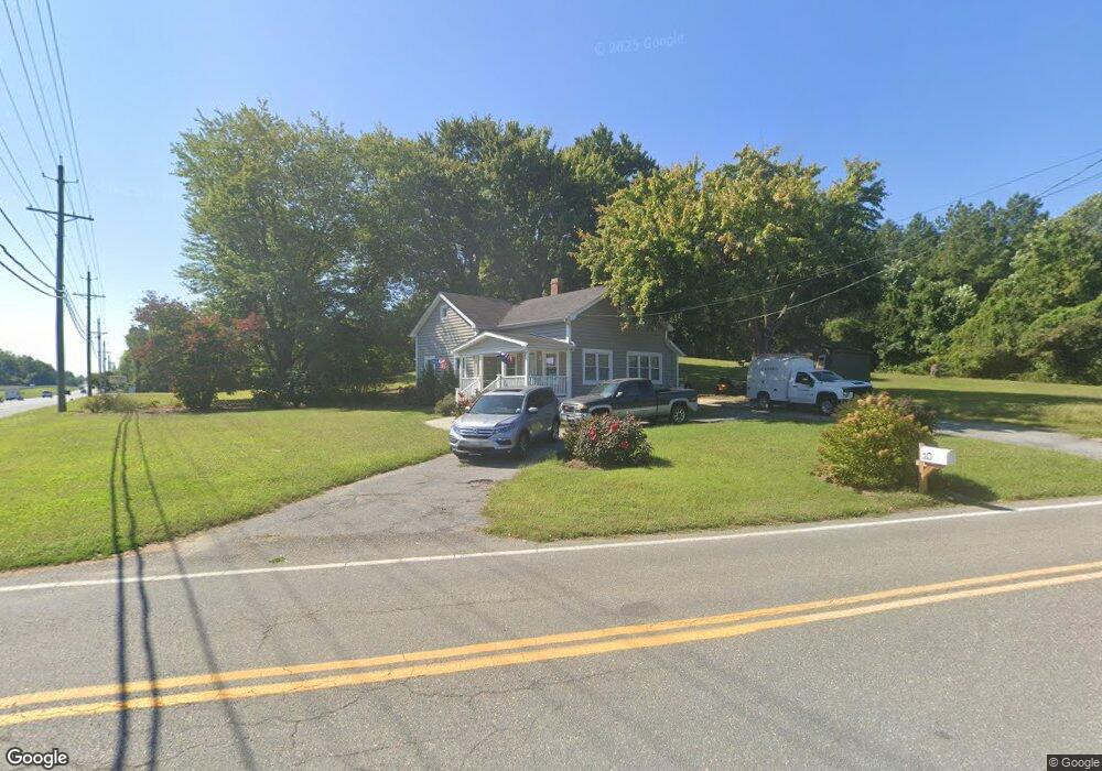
10 M f Bowen Rd Huntingtown, MD 20639
Estimated Value: $320,000 - $360,000
3
Beds
2
Baths
1,342
Sq Ft
$256/Sq Ft
Est. Value
About This Home
This home is located at 10 M f Bowen Rd, Huntingtown, MD 20639 and is currently estimated at $342,961, approximately $255 per square foot. 10 M f Bowen Rd is a home located in Calvert County with nearby schools including Huntingtown Elementary School, Plum Point Middle School, and Huntingtown High School.
Ownership History
Date
Name
Owned For
Owner Type
Purchase Details
Closed on
Nov 21, 2022
Sold by
Ducharme Paula L
Bought by
Robinson Daniel B
Current Estimated Value
Purchase Details
Closed on
Jan 5, 2012
Sold by
Robinson Merle
Bought by
Knee Beverly S and Knee Ivan J
Purchase Details
Closed on
Nov 8, 2010
Sold by
Elliott Barbarra B and Elliott Leroy H
Bought by
Robinson Merle
Purchase Details
Closed on
Mar 8, 2001
Sold by
Elliott Barbara B
Bought by
Elliott Barbara B and Elliott Leroy H
Purchase Details
Closed on
Feb 15, 2000
Sold by
Bowen J Benson Virginia H
Bought by
Elliott Barbara B
Create a Home Valuation Report for This Property
The Home Valuation Report is an in-depth analysis detailing your home's value as well as a comparison with similar homes in the area
Home Values in the Area
Average Home Value in this Area
Purchase History
| Date | Buyer | Sale Price | Title Company |
|---|---|---|---|
| Robinson Daniel B | -- | -- | |
| Knee Beverly S | $171,000 | None Available | |
| Robinson Merle | $150,000 | -- | |
| Elliott Barbara B | -- | -- | |
| Elliott Barbara B | -- | -- |
Source: Public Records
Mortgage History
| Date | Status | Borrower | Loan Amount |
|---|---|---|---|
| Closed | Elliott Barbara B | -- |
Source: Public Records
Tax History Compared to Growth
Tax History
| Year | Tax Paid | Tax Assessment Tax Assessment Total Assessment is a certain percentage of the fair market value that is determined by local assessors to be the total taxable value of land and additions on the property. | Land | Improvement |
|---|---|---|---|---|
| 2025 | $2,422 | $212,800 | $0 | $0 |
| 2024 | $2,422 | $204,400 | $142,000 | $62,400 |
| 2023 | $2,283 | $199,133 | $0 | $0 |
| 2022 | $2,225 | $193,867 | $0 | $0 |
| 2021 | $2,159 | $188,600 | $142,000 | $46,600 |
| 2020 | $2,159 | $187,200 | $0 | $0 |
| 2019 | $2,151 | $185,800 | $0 | $0 |
| 2018 | $2,123 | $184,400 | $142,000 | $42,400 |
| 2017 | $2,095 | $179,400 | $0 | $0 |
| 2016 | -- | $174,400 | $0 | $0 |
| 2015 | $2,079 | $169,400 | $0 | $0 |
| 2014 | $2,079 | $169,400 | $0 | $0 |
Source: Public Records
Map
Nearby Homes
- 1362 Solomons Island Rd
- 70 S View Dr
- 210 Buckler Rd
- 355 M f Bowen Rd
- 1950 Quiet Meadows Ct
- 379 Cambridge Place
- 362 Cambridge Place
- 1080 Westfield Dr
- 35 Walton Rd
- 641 Walton Rd
- 10 Hillside Ct
- 2250 Huntingfields Dr
- 84 Potomac Ct
- 185 Radio Dr
- The Benedict A Plan at Patuxent Commons
- The Benedict B2 Plan at Patuxent Commons
- The Benedict C Plan at Patuxent Commons
- 1755 Lottie Fowler Rd
- 1719 Lottie Fowler Rd
- 0 Armory Rd
- 1520 Solomons Island Rd
- 1495 Solomons Island Rd
- 1460 Solomons Island Rd
- 1540 Solomons Island Rd
- 1435 Solomons Island Rd
- 1435 Solomons Island Rd N
- 55 M f Bowen Rd
- 1430 Solomons Island Rd
- 1376 Solomons Island Rd
- 1425 Solomons Island Rd
- 1380 Solomons Island Rd
- 1405 Solomons Island Rd
- 1370 Solomons Island Rd
- 1366 Solomons Island Rd
- 110 M f Bowen Rd
- 85 M f Bowen Rd
- 1360 Solomons Island Rd
- 1364 Solomons Island Rd
- 1441 Solomons Island Rd
- 1475 Solomons Island Rd