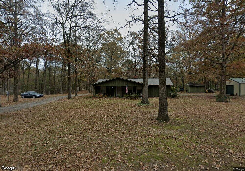
10 Mae Ln Casscoe, AR 72026
Estimated Value: $93,000 - $119,070
Studio
--
Bath
1,431
Sq Ft
$73/Sq Ft
Est. Value
About This Home
This home is located at 10 Mae Ln, Casscoe, AR 72026 and is currently estimated at $104,023, approximately $72 per square foot. 10 Mae Ln is a home with nearby schools including Park Avenue Elementary School, Meekins Middle School, and Stuttgart Junior High School.
Ownership History
Date
Name
Owned For
Owner Type
Purchase Details
Closed on
Dec 28, 2018
Sold by
Selby Phillip S and Selby Gwendolyn S
Bought by
Light Joe and Light Magan
Current Estimated Value
Home Financials for this Owner
Home Financials are based on the most recent Mortgage that was taken out on this home.
Original Mortgage
$63,822
Outstanding Balance
$56,852
Interest Rate
5.37%
Mortgage Type
FHA
Estimated Equity
$47,171
Purchase Details
Closed on
Jul 1, 2003
Bought by
Stokes
Purchase Details
Closed on
Jun 9, 2000
Bought by
Yarbrough
Purchase Details
Closed on
Jun 7, 1999
Bought by
First United Bank
Create a Home Valuation Report for This Property
The Home Valuation Report is an in-depth analysis detailing your home's value as well as a comparison with similar homes in the area
Purchase History
| Date | Buyer | Sale Price | Title Company |
|---|---|---|---|
| Light Joe | $65,000 | Professional Land Title Comp | |
| Stokes | $55,000 | -- | |
| Yarbrough | $42,000 | -- | |
| First United Bank | -- | -- |
Source: Public Records
Mortgage History
| Date | Status | Borrower | Loan Amount |
|---|---|---|---|
| Open | Light Joe | $63,822 |
Source: Public Records
Tax History
| Year | Tax Paid | Tax Assessment Tax Assessment Total Assessment is a certain percentage of the fair market value that is determined by local assessors to be the total taxable value of land and additions on the property. | Land | Improvement |
|---|---|---|---|---|
| 2025 | $239 | $17,047 | $1,905 | $15,142 |
| 2024 | $305 | $17,047 | $1,905 | $15,142 |
| 2023 | $345 | $17,047 | $1,905 | $15,142 |
| 2022 | $598 | $13,036 | $1,905 | $11,131 |
| 2021 | $602 | $13,110 | $1,900 | $11,210 |
| 2019 | $602 | $13,110 | $1,900 | $11,210 |
| 2018 | $252 | $13,110 | $1,900 | $11,210 |
| 2017 | $767 | $16,710 | $1,910 | $14,800 |
| 2016 | $417 | $16,710 | $1,910 | $14,800 |
| 2015 | -- | $16,710 | $1,910 | $14,800 |
| 2014 | -- | $16,710 | $1,910 | $14,800 |
| 2013 | -- | $16,710 | $1,910 | $14,800 |
Source: Public Records
Map
Nearby Homes
- 122 Owens Ln
- 512 Owens Ln
- 970 Arkansas 153
- 8416 Hwy 86
- 8416 Highway 86
- 40 Duncan Ln
- 18442 Hwy 33
- 357 Resort Rd
- 0 Lower Maddox Bay Rd Unit 25002563
- 0 Lower Maddox Bay Rd Unit 24024874
- 0 Lower Maddox Bay Rd Unit 23033644
- 0 Lower Maddox Bay Rd Unit LotWP001 20199905
- 227 Lower Maddox Bay Rd
- 2829 Highway 153
- 405 Honeycutt Way
- 3401 Arkansas 33
- 0 Hwy 86 Hwy Unit 26006944
- 0 Hwy 86 Hwy Unit LotWP001
- 169 E 2nd St
- 182 2nd St
Your Personal Tour Guide
Ask me questions while you tour the home.