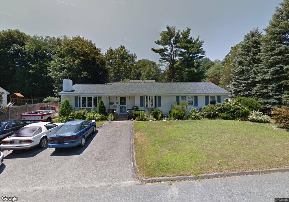
10 Main Blvd Shrewsbury, MA 01545
Estimated Value: $561,000 - $639,000
3
Beds
1
Bath
1,770
Sq Ft
$345/Sq Ft
Est. Value
About This Home
This home is located at 10 Main Blvd, Shrewsbury, MA 01545 and is currently estimated at $610,086, approximately $344 per square foot. 10 Main Blvd is a home located in Worcester County with nearby schools including Floral Street School, Sherwood Middle School, and Oak Middle School.
Ownership History
Date
Name
Owned For
Owner Type
Purchase Details
Closed on
Jul 25, 1991
Sold by
Caefer William R and Caefer Carol
Bought by
Portosa Mauro W and Portosa Italia
Current Estimated Value
Home Financials for this Owner
Home Financials are based on the most recent Mortgage that was taken out on this home.
Original Mortgage
$113,200
Interest Rate
9.58%
Mortgage Type
Purchase Money Mortgage
Create a Home Valuation Report for This Property
The Home Valuation Report is an in-depth analysis detailing your home's value as well as a comparison with similar homes in the area
Home Values in the Area
Average Home Value in this Area
Purchase History
| Date | Buyer | Sale Price | Title Company |
|---|---|---|---|
| Portosa Mauro W | $141,500 | -- | |
| Portosa Mauro W | $141,500 | -- |
Source: Public Records
Mortgage History
| Date | Status | Borrower | Loan Amount |
|---|---|---|---|
| Closed | Portosa Mauro W | $113,200 | |
| Previous Owner | Portosa Mauro W | $25,000 |
Source: Public Records
Tax History Compared to Growth
Tax History
| Year | Tax Paid | Tax Assessment Tax Assessment Total Assessment is a certain percentage of the fair market value that is determined by local assessors to be the total taxable value of land and additions on the property. | Land | Improvement |
|---|---|---|---|---|
| 2025 | $64 | $529,800 | $253,700 | $276,100 |
| 2024 | $5,755 | $464,900 | $241,700 | $223,200 |
| 2023 | $5,754 | $438,600 | $241,700 | $196,900 |
| 2022 | $5,685 | $402,900 | $241,700 | $161,200 |
| 2021 | $4,531 | $343,500 | $193,300 | $150,200 |
| 2020 | $4,180 | $335,200 | $193,300 | $141,900 |
| 2019 | $3,946 | $313,900 | $176,500 | $137,400 |
| 2018 | $3,690 | $291,500 | $167,400 | $124,100 |
| 2017 | $3,539 | $275,800 | $151,700 | $124,100 |
| 2016 | $3,416 | $262,800 | $141,700 | $121,100 |
| 2015 | $3,449 | $261,300 | $135,000 | $126,300 |
Source: Public Records
Map
Nearby Homes
- 39 Harvard Ave
- 39 Old Brook Rd
- 647 Main St
- 18 Eastwood Rd
- 49 Gates Rd
- 19 Grafton St
- 4 Horseneck Rd
- 114 Grafton St
- 243 Spring St
- 9 Arnold Rd
- 13 Kenilworth Rd
- 40 High St
- 26 High St
- 46-50 Wesleyan St
- 29 Elma Cir
- Lot 386R Clover Glen Cir
- 2 Applewood Cir
- 7 Northland Rd
- 8 Hunter Cir
- 60 Harrington Farms Way Unit 60
- 12 Main Blvd
- 17 Washington St
- 4 Main Blvd
- 11 Washington St
- 21 Washington St
- 7 Main Blvd
- 11 Main Blvd
- 9 Washington St
- 18 Main Blvd
- 21 Artemas Ave
- 11 Artemas Ave
- 15 Main Blvd
- 25 Washington St
- Lot 2 Artremas Ave
- 18 Washington St
- 14 Washington St
- 7 Artemas Ave
- 10 Washington St
- 30 General Ave
- 26 General Ave