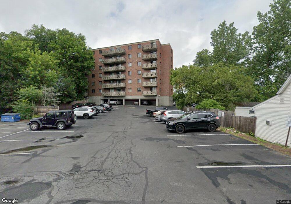
10 Main St Unit 606 Framingham, MA 01702
Estimated Value: $224,000 - $238,464
1
Bed
2
Baths
544
Sq Ft
$429/Sq Ft
Est. Value
About This Home
This home is located at 10 Main St Unit 606, Framingham, MA 01702 and is currently estimated at $233,488, approximately $429 per square foot. 10 Main St Unit 606 is a home located in Middlesex County with nearby schools including Framingham High School, Saint Bridget School, and Summit Montessori School.
Ownership History
Date
Name
Owned For
Owner Type
Purchase Details
Closed on
Sep 25, 1998
Sold by
Smith Michael L
Bought by
Daley Michael L
Current Estimated Value
Home Financials for this Owner
Home Financials are based on the most recent Mortgage that was taken out on this home.
Original Mortgage
$47,400
Outstanding Balance
$10,351
Interest Rate
6.87%
Mortgage Type
Purchase Money Mortgage
Estimated Equity
$223,137
Purchase Details
Closed on
Nov 3, 1993
Sold by
Ushani Lotfollah K and Ushani Rooholleh K
Bought by
Smith Michael L
Home Financials for this Owner
Home Financials are based on the most recent Mortgage that was taken out on this home.
Original Mortgage
$25,400
Interest Rate
6.83%
Mortgage Type
Purchase Money Mortgage
Create a Home Valuation Report for This Property
The Home Valuation Report is an in-depth analysis detailing your home's value as well as a comparison with similar homes in the area
Home Values in the Area
Average Home Value in this Area
Purchase History
| Date | Buyer | Sale Price | Title Company |
|---|---|---|---|
| Daley Michael L | $49,900 | -- | |
| Smith Michael L | $33,900 | -- |
Source: Public Records
Mortgage History
| Date | Status | Borrower | Loan Amount |
|---|---|---|---|
| Open | Smith Michael L | $47,400 | |
| Previous Owner | Smith Michael L | $25,400 |
Source: Public Records
Tax History Compared to Growth
Tax History
| Year | Tax Paid | Tax Assessment Tax Assessment Total Assessment is a certain percentage of the fair market value that is determined by local assessors to be the total taxable value of land and additions on the property. | Land | Improvement |
|---|---|---|---|---|
| 2025 | $2,049 | $171,600 | $0 | $171,600 |
| 2024 | $2,126 | $170,600 | $0 | $170,600 |
| 2023 | $2,053 | $156,800 | $0 | $156,800 |
| 2022 | $1,977 | $143,900 | $0 | $143,900 |
| 2021 | $1,724 | $122,700 | $0 | $122,700 |
| 2020 | $1,750 | $116,800 | $0 | $116,800 |
| 2019 | $1,435 | $93,300 | $0 | $93,300 |
| 2018 | $1,423 | $87,200 | $0 | $87,200 |
| 2017 | $1,467 | $87,800 | $0 | $87,800 |
| 2016 | $1,286 | $74,000 | $0 | $74,000 |
| 2015 | $1,140 | $64,000 | $0 | $64,000 |
Source: Public Records
Map
Nearby Homes
- 10 Main St Unit 507
- 2 Grove St
- 609 Union Ave Unit 609
- 86 Salem End Rd
- 17 Lilian Rd
- 1186 Worcester Rd Unit 720
- 1186 Worcester Rd Unit 610
- 230 Prospect St
- 20 Buckminster St
- 450 Mount Wayte Ave
- 337 Edgell Rd
- 4 Mclaughlin St Unit 3
- 411 Franklin St
- 67 Long Ave
- 1297 Old Worcester Rd
- 1321 Worcester Rd Unit 603
- 1321 Worcester Rd Unit 109
- 30 Elda Rd
- 342 Franklin St
- 128 Warren Rd
- 10 Main St Unit 608
- 10 Main St Unit 607
- 10 Main St Unit 605
- 10 Main St Unit 604
- 10 Main St Unit 603
- 10 Main St Unit 602
- 10 Main St Unit 601
- 10 Main St Unit 508
- 10 Main St Unit 506
- 10 Main St Unit 505
- 10 Main St Unit 504
- 10 Main St Unit 503
- 10 Main St Unit 502
- 10 Main St Unit 501
- 10 Main St Unit 408
- 10 Main St Unit 407
- 10 Main St Unit 406
- 10 Main St Unit 405
- 10 Main St Unit 404
- 10 Main St Unit 403