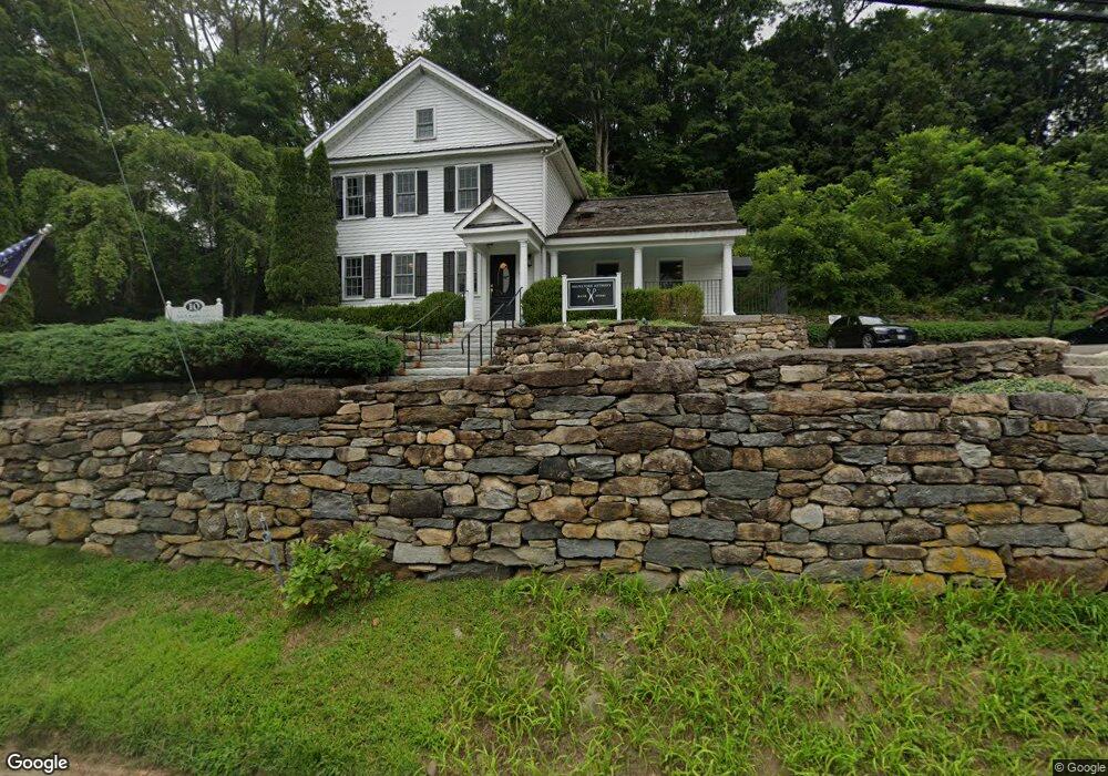
10 Main St New Preston Marble Dale, CT 06777
Estimated Value: $1,931,480
--
Bed
--
Bath
2,765
Sq Ft
$699/Sq Ft
Est. Value
About This Home
This home is located at 10 Main St, New Preston Marble Dale, CT 06777 and is currently estimated at $1,931,480, approximately $698 per square foot. 10 Main St is a home located in Litchfield County with nearby schools including Shepaug Valley School, Washington Montessori School, and Rumsey Hall School.
Ownership History
Date
Name
Owned For
Owner Type
Purchase Details
Closed on
Oct 10, 2018
Sold by
10 Main Llc
Bought by
Smf Universal Llc
Current Estimated Value
Purchase Details
Closed on
Dec 8, 2004
Sold by
Baker Robert and Baker Diane
Bought by
Smithy Llc
Purchase Details
Closed on
Apr 15, 1998
Sold by
Camp Signe Est
Bought by
Baker Robert and Baker Diane
Create a Home Valuation Report for This Property
The Home Valuation Report is an in-depth analysis detailing your home's value as well as a comparison with similar homes in the area
Home Values in the Area
Average Home Value in this Area
Purchase History
| Date | Buyer | Sale Price | Title Company |
|---|---|---|---|
| Smf Universal Llc | $1,100,000 | -- | |
| Smf Universal Llc | $1,100,000 | -- | |
| Smithy Llc | $462,500 | -- | |
| Smithy Llc | $462,500 | -- | |
| Baker Robert | $140,000 | -- | |
| Baker Robert | $140,000 | -- |
Source: Public Records
Mortgage History
| Date | Status | Borrower | Loan Amount |
|---|---|---|---|
| Previous Owner | Baker Robert | $337,500 | |
| Previous Owner | Baker Robert | $213,000 | |
| Previous Owner | Baker Robert | $30,000 |
Source: Public Records
Tax History Compared to Growth
Tax History
| Year | Tax Paid | Tax Assessment Tax Assessment Total Assessment is a certain percentage of the fair market value that is determined by local assessors to be the total taxable value of land and additions on the property. | Land | Improvement |
|---|---|---|---|---|
| 2025 | $7,063 | $651,000 | $148,190 | $502,810 |
| 2024 | $7,063 | $651,000 | $148,190 | $502,810 |
| 2023 | $8,044 | $564,460 | $149,180 | $415,280 |
| 2022 | $7,928 | $556,340 | $149,190 | $407,150 |
| 2021 | $7,928 | $556,340 | $149,190 | $407,150 |
| 2020 | $7,928 | $556,340 | $149,190 | $407,150 |
| 2019 | $7,928 | $556,340 | $149,190 | $407,150 |
| 2018 | $4,624 | $324,460 | $100,800 | $223,660 |
| 2017 | $4,624 | $324,460 | $100,800 | $223,660 |
| 2016 | $4,624 | $324,460 | $100,800 | $223,660 |
| 2015 | $4,461 | $324,460 | $100,800 | $223,660 |
| 2014 | $4,380 | $324,460 | $100,800 | $223,660 |
Source: Public Records
Map
Nearby Homes
- 77 New Milford Turnpike
- 1 N Shore Rd
- 31 June Rd
- 54 Scofield Hill Rd
- 93 Quarry Ridge Rd Unit 93
- 35 Quarry Ridge Rd Unit 35
- 29 Quarry Ridge Rd
- 198 Tinker Hill Rd
- 46 June Rd
- 226 Tinker Hill Rd
- 5 Kielwasser Rd
- 387 Lake Rd
- Lot 2 060804A Popple Swamp Rd
- LOT 1 060804 Popple Swamp Rd
- 217 Sawyer Hill Rd
- 35 Hillendale Dr
- Lot 3 060804C Upper Church Hill Rd
- Lot 4 060804B Upper Church Hill Rd
- 18 Arrow Point Rd
- 15 Connelly Rd
- 6 Main St
- 12 E Shore Rd
- 11 Main St
- 124 New Milford Turnpike
- 4 Main St
- 5 Schwab Rd
- 3 Schwab Rd
- 11 E Shore Rd
- 13 East Shore
- 18 E Shore Rd
- 1 Schwab Rd
- 273 Baldwin Hill Rd Unit 2C
- 273 Baldwin Hill Rd Unit B-1
- 273 Baldwin Hill Rd Unit 2B
- 273 Baldwin Hill Rd Unit 1C
- 273 Baldwin Hill Rd
- 6 Church St
- 7 Schwab Rd
- 131 New Milford Turnpike
- 131 New Milford Turnpike