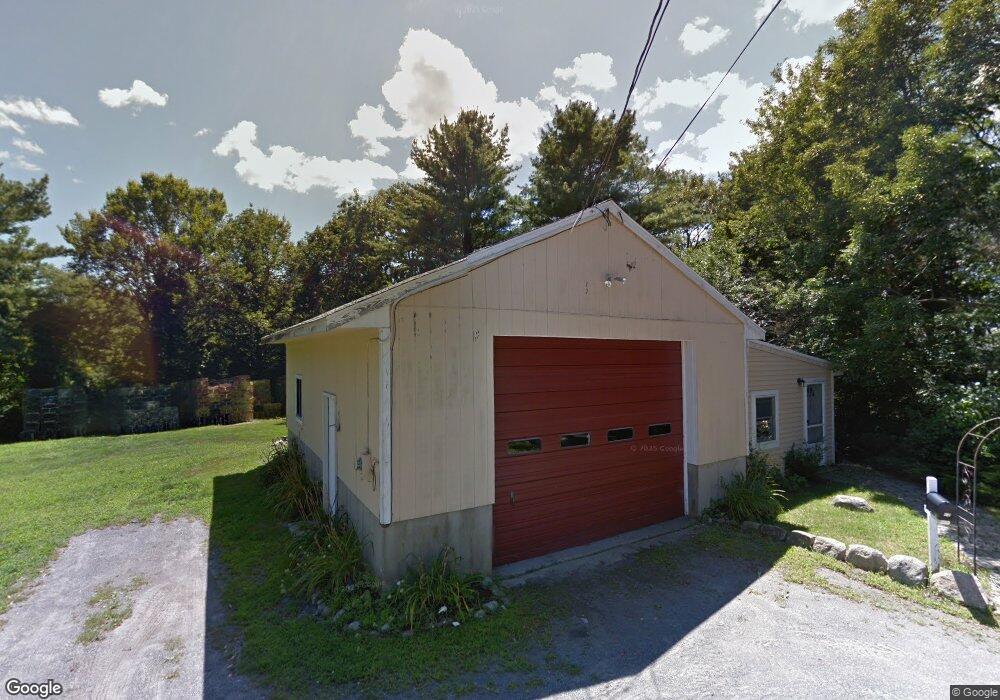
10 Mako Dr Gloucester, MA 01930
Riverview NeighborhoodEstimated Value: $555,000 - $680,000
1
Bed
1
Bath
478
Sq Ft
$1,309/Sq Ft
Est. Value
About This Home
This home is located at 10 Mako Dr, Gloucester, MA 01930 and is currently estimated at $625,521, approximately $1,308 per square foot. 10 Mako Dr is a home located in Essex County with nearby schools including Beeman Memorial, Ralph B O'maley Middle School, and Gloucester High School.
Ownership History
Date
Name
Owned For
Owner Type
Purchase Details
Closed on
Sep 13, 2019
Sold by
Vadala Denise M and Vadala Peter T
Bought by
Vadala 2019 T
Current Estimated Value
Purchase Details
Closed on
Sep 11, 2009
Sold by
Vadala Daniel P
Bought by
Vadala Peter T
Purchase Details
Closed on
Mar 21, 2007
Sold by
Vadala Denise M and Vadala Peter T
Bought by
Vadala Daniel P
Home Financials for this Owner
Home Financials are based on the most recent Mortgage that was taken out on this home.
Original Mortgage
$150,000
Interest Rate
6.33%
Mortgage Type
Purchase Money Mortgage
Create a Home Valuation Report for This Property
The Home Valuation Report is an in-depth analysis detailing your home's value as well as a comparison with similar homes in the area
Home Values in the Area
Average Home Value in this Area
Purchase History
| Date | Buyer | Sale Price | Title Company |
|---|---|---|---|
| Vadala 2019 T | -- | -- | |
| Vadala Peter T | $225,000 | -- | |
| Vadala Daniel P | $225,000 | -- |
Source: Public Records
Mortgage History
| Date | Status | Borrower | Loan Amount |
|---|---|---|---|
| Previous Owner | Vadala Daniel P | $150,000 | |
| Previous Owner | Vadala Daniel P | $75,000 |
Source: Public Records
Tax History
| Year | Tax Paid | Tax Assessment Tax Assessment Total Assessment is a certain percentage of the fair market value that is determined by local assessors to be the total taxable value of land and additions on the property. | Land | Improvement |
|---|---|---|---|---|
| 2025 | $4,537 | $466,800 | $281,900 | $184,900 |
| 2024 | $4,404 | $452,600 | $268,400 | $184,200 |
| 2023 | $4,372 | $412,800 | $239,600 | $173,200 |
| 2022 | $4,101 | $349,600 | $203,700 | $145,900 |
| 2021 | $4,067 | $326,900 | $185,400 | $141,500 |
| 2020 | $3,825 | $310,200 | $185,400 | $124,800 |
| 2019 | $3,770 | $297,100 | $185,400 | $111,700 |
| 2018 | $3,703 | $286,400 | $185,400 | $101,000 |
| 2017 | $3,602 | $273,100 | $176,600 | $96,500 |
| 2016 | $3,483 | $255,900 | $177,200 | $78,700 |
| 2015 | $3,460 | $253,500 | $177,200 | $76,300 |
Source: Public Records
Map
Nearby Homes
- 2 Finch Ln
- 167 Atlantic St
- 672 Washington St
- 226 Atlantic St
- 6 Monroe Ct
- 98 Maplewood Ave
- 16 Cleveland Place Unit 11
- 5 Samoset Rd Unit B
- 15 Harvard St
- 40 Sargent St
- 84 Centennial Ave
- 33 Maplewood Ave Unit 16
- 20 Beacon St Unit 2
- 20 Beacon St Unit 1
- 10 Oak St Unit 3
- 4 Mount Vernon St
- 118 Prospect St
- 33 Middle St
- 55 Mansfield St Unit A
- 55 Mansfield St Unit B
- 47R 8 Mako Dr
- 8 Mako Dr
- 27 Thurston Point Rd
- 25 Thurston Point Rd
- 31 Thurston Point Rd
- 35 Thurston Point Rd
- 13R Thurston Point Rd
- 13 Thurston Point Rd
- 6 Mako Dr
- 4 Mako Dr
- 21 Thurston Point Rd
- 37 Thurston Point Rd
- 23 Thurston Point Rd
- 23 Thurston Point Rd
- 3 Mako Dr
- 11 Thurston Point Rd
- 19 Thurston Point Rd
- 53 Thurston Point Rd
- 47 Thurston Point Rd
- 51 Thurston Point Rd