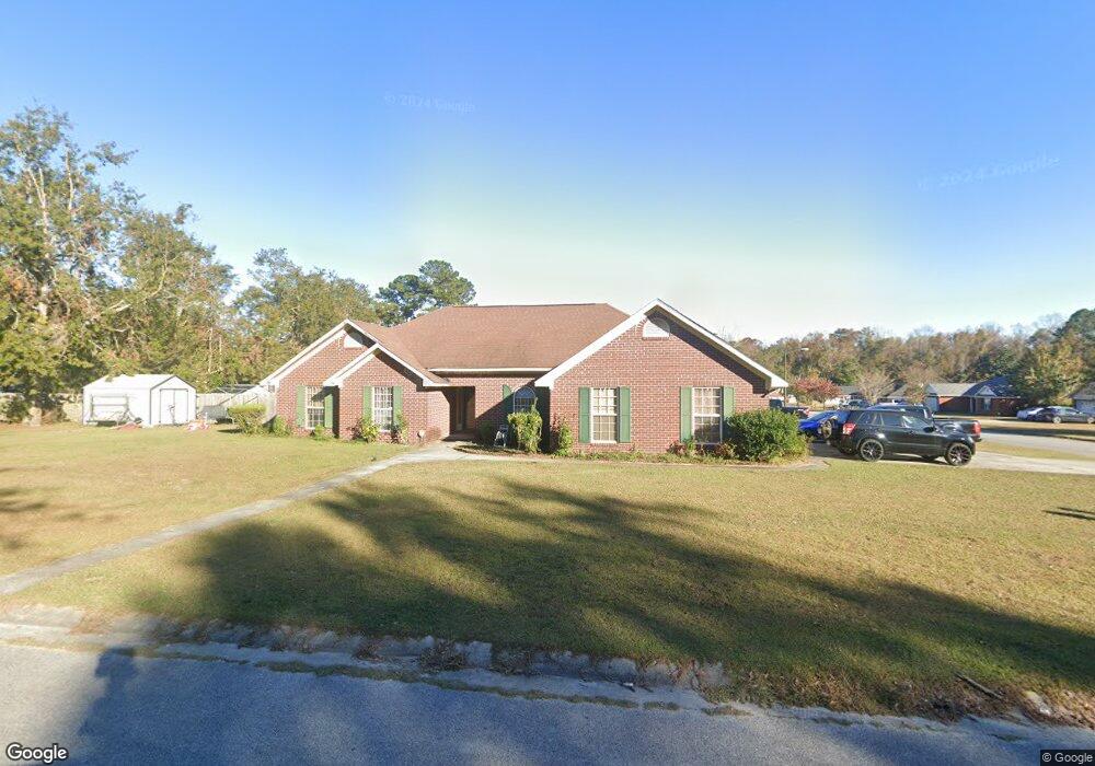
10 Martha St Allenhurst, GA 31301
Estimated Value: $254,000 - $285,000
4
Beds
3
Baths
2,150
Sq Ft
$125/Sq Ft
Est. Value
About This Home
This home is located at 10 Martha St, Allenhurst, GA 31301 and is currently estimated at $269,250, approximately $125 per square foot. 10 Martha St is a home located in Liberty County with nearby schools including Frank Long Elementary School, Lewis Frasier Middle School, and Liberty County High School.
Ownership History
Date
Name
Owned For
Owner Type
Purchase Details
Closed on
May 5, 2006
Sold by
Totten Jason H
Bought by
Bullock Vonita E
Current Estimated Value
Home Financials for this Owner
Home Financials are based on the most recent Mortgage that was taken out on this home.
Original Mortgage
$185,836
Outstanding Balance
$107,567
Interest Rate
6.39%
Mortgage Type
VA
Estimated Equity
$161,683
Purchase Details
Closed on
Nov 10, 2005
Sold by
Pinckney Allen
Bought by
Totten Jason H
Purchase Details
Closed on
Oct 14, 1998
Sold by
Tmy Inc
Bought by
Pinckney Allen
Purchase Details
Closed on
Jul 6, 1998
Bought by
Tmy Inc
Purchase Details
Closed on
Jul 3, 1996
Bought by
Mcdonald William David and Mcdonald Teresa
Create a Home Valuation Report for This Property
The Home Valuation Report is an in-depth analysis detailing your home's value as well as a comparison with similar homes in the area
Home Values in the Area
Average Home Value in this Area
Purchase History
| Date | Buyer | Sale Price | Title Company |
|---|---|---|---|
| Bullock Vonita E | $179,900 | -- | |
| Totten Jason H | $172,500 | -- | |
| Pinckney Allen | $122,500 | -- | |
| Tmy Inc | $13,500 | -- | |
| Mcdonald William David | -- | -- |
Source: Public Records
Mortgage History
| Date | Status | Borrower | Loan Amount |
|---|---|---|---|
| Open | Bullock Vonita E | $185,836 |
Source: Public Records
Tax History Compared to Growth
Tax History
| Year | Tax Paid | Tax Assessment Tax Assessment Total Assessment is a certain percentage of the fair market value that is determined by local assessors to be the total taxable value of land and additions on the property. | Land | Improvement |
|---|---|---|---|---|
| 2024 | $16 | $90,236 | $18,000 | $72,236 |
| 2023 | $16 | $80,132 | $10,000 | $70,132 |
| 2022 | $2,610 | $67,402 | $10,000 | $57,402 |
| 2021 | $2,382 | $61,730 | $10,000 | $51,730 |
| 2020 | $2,324 | $59,988 | $10,000 | $49,988 |
| 2019 | $2,287 | $60,598 | $10,000 | $50,598 |
| 2018 | $2,282 | $61,208 | $10,000 | $51,208 |
| 2017 | $2,518 | $59,350 | $10,000 | $49,350 |
| 2016 | $2,080 | $59,930 | $10,000 | $49,930 |
| 2015 | $2,014 | $57,434 | $10,000 | $47,434 |
| 2014 | $2,014 | $57,384 | $10,000 | $47,384 |
| 2013 | -- | $59,149 | $12,400 | $46,749 |
Source: Public Records
Map
Nearby Homes
- 1600 Dunlevie Rd Unit 50
- 128 Nashview Trail
- 50 Harold's Nook
- 40 Red Blossom Ct
- 151 Hunters Branch Dr
- 340 Hunters Branch Dr
- 744 Dunlevie Rd
- 194 Mccumber Dr
- 169 Wellspring Terrace
- 229 Wellspring Terrace
- 1343 Talmadge Rd
- 480 Mccumber Dr
- 619 Mccumber Dr
- 7.22 AC Dunlevie Rd
- 283 Fawn Ct
- 338 Whispering Pines Cir
- 593 Deer Meadow Way
- 356 Deer Meadow Way
- 575 Deer Meadow Way
- 534 Deer Meadow Way