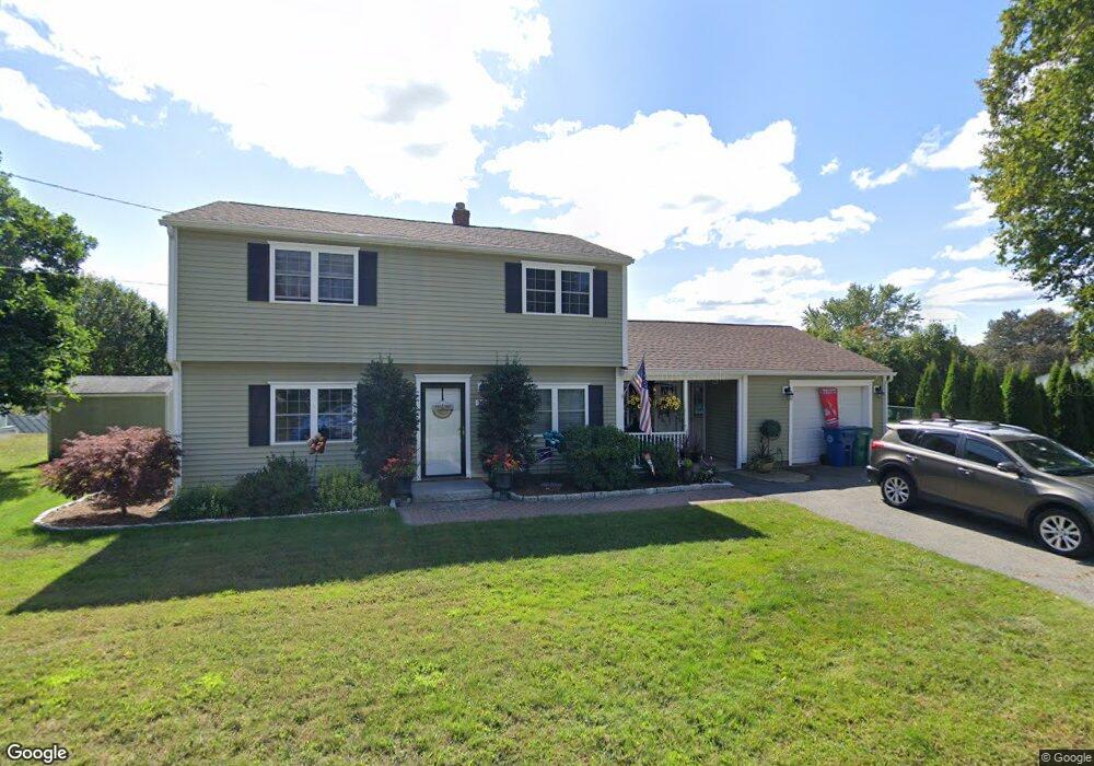
10 Matthew Rd Unit 1 Billerica, MA 01821
Estimated Value: $662,000 - $746,000
3
Beds
2
Baths
1,710
Sq Ft
$417/Sq Ft
Est. Value
About This Home
This home is located at 10 Matthew Rd Unit 1, Billerica, MA 01821 and is currently estimated at $712,772, approximately $416 per square foot. 10 Matthew Rd Unit 1 is a home located in Middlesex County with nearby schools including Billerica Memorial High School.
Ownership History
Date
Name
Owned For
Owner Type
Purchase Details
Closed on
Nov 10, 2011
Sold by
Elliott Michael D and Elliott Suzanne Z
Bought by
Petrosillo Girolamo and Barboza Kerry
Current Estimated Value
Home Financials for this Owner
Home Financials are based on the most recent Mortgage that was taken out on this home.
Original Mortgage
$268,003
Outstanding Balance
$182,664
Interest Rate
4.01%
Mortgage Type
Purchase Money Mortgage
Estimated Equity
$530,108
Create a Home Valuation Report for This Property
The Home Valuation Report is an in-depth analysis detailing your home's value as well as a comparison with similar homes in the area
Home Values in the Area
Average Home Value in this Area
Purchase History
| Date | Buyer | Sale Price | Title Company |
|---|---|---|---|
| Petrosillo Girolamo | $291,500 | -- |
Source: Public Records
Mortgage History
| Date | Status | Borrower | Loan Amount |
|---|---|---|---|
| Open | Petrosillo Girolamo | $268,003 |
Source: Public Records
Tax History Compared to Growth
Tax History
| Year | Tax Paid | Tax Assessment Tax Assessment Total Assessment is a certain percentage of the fair market value that is determined by local assessors to be the total taxable value of land and additions on the property. | Land | Improvement |
|---|---|---|---|---|
| 2025 | $6,952 | $611,400 | $287,200 | $324,200 |
| 2024 | $6,024 | $533,600 | $273,400 | $260,200 |
| 2023 | $5,897 | $496,800 | $252,700 | $244,100 |
| 2022 | $5,433 | $429,800 | $226,400 | $203,400 |
| 2021 | $5,472 | $420,900 | $221,900 | $199,000 |
| 2020 | $5,356 | $412,300 | $213,300 | $199,000 |
| 2019 | $5,039 | $373,800 | $200,200 | $173,600 |
| 2018 | $4,426 | $347,800 | $188,700 | $159,100 |
| 2017 | $4,757 | $337,600 | $188,700 | $148,900 |
| 2016 | $4,588 | $324,500 | $175,600 | $148,900 |
| 2015 | $4,556 | $324,500 | $175,600 | $148,900 |
| 2014 | $4,268 | $298,700 | $149,700 | $149,000 |
Source: Public Records
Map
Nearby Homes
- 64 Elizabeth Rd
- 30 Wyman Rd
- 88 Lexington Rd
- 86 Lexington Rd
- 32 Marshall St
- 8 Swan Ln
- 300 Albion Rd Unit 306
- 8 Water St
- 1 Albion Rd
- 483 Middlesex Turnpike
- 481 Middlesex Turnpike
- 11 Autumn St
- 463 Middlesex Turnpike
- 454 Middlesex Turnpike
- 10 Greenville St
- 7 Allendale Ave
- 37 Porter St
- 1 Purcell Dr
- 3 Cardington Ave
- 14 Kenmar Dr Unit 111