Estimated Value: $284,000 - $293,000
3
Beds
2
Baths
1,421
Sq Ft
$204/Sq Ft
Est. Value
About This Home
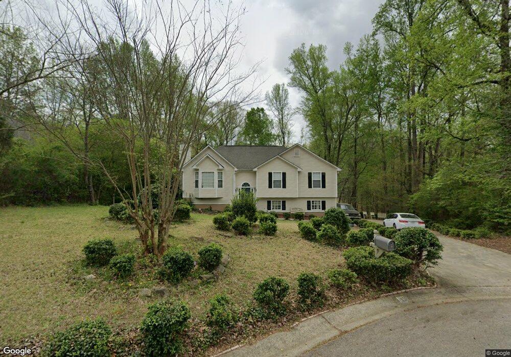
This home is located at 10 Mayfield Ct, Hiram, GA 30141 and is currently estimated at $289,521, approximately $203 per square foot. 10 Mayfield Ct is a home located in Paulding County with nearby schools including Sam D. Panter Elementary School, J. A. Dobbins Middle School, and Hiram High School.
Ownership History
Date
Name
Owned For
Owner Type
Purchase Details
Closed on
Dec 27, 2024
Sold by
Barks T Trust
Bought by
T Barks Family Trust and Spink Claude Alfred
Current Estimated Value
Purchase Details
Closed on
Nov 18, 2021
Sold by
Barks William H
Bought by
Barks Teresa M
Purchase Details
Closed on
May 29, 1997
Sold by
Larry Hunter Builder Inc
Bought by
Barks William H and Barks Teresa M
Home Financials for this Owner
Home Financials are based on the most recent Mortgage that was taken out on this home.
Original Mortgage
$62,100
Interest Rate
8.13%
Mortgage Type
New Conventional
Purchase Details
Closed on
Mar 17, 1997
Sold by
Larry Hunter Development Inc
Purchase Details
Closed on
Mar 11, 1997
Sold by
Hunter Devel
Bought by
Hunter Bldr
Create a Home Valuation Report for This Property
The Home Valuation Report is an in-depth analysis detailing your home's value as well as a comparison with similar homes in the area
Home Values in the Area
Average Home Value in this Area
Purchase History
| Date | Buyer | Sale Price | Title Company |
|---|---|---|---|
| T Barks Family Trust | -- | -- | |
| Barks T Trust | -- | -- | |
| Barks Teresa M | -- | -- | |
| Barks William H | $97,100 | -- | |
| -- | -- | -- | |
| Hunter Bldr | $16,000 | -- |
Source: Public Records
Mortgage History
| Date | Status | Borrower | Loan Amount |
|---|---|---|---|
| Previous Owner | Barks William H | $62,100 | |
| Closed | Hunter Bldr | $0 |
Source: Public Records
Tax History Compared to Growth
Tax History
| Year | Tax Paid | Tax Assessment Tax Assessment Total Assessment is a certain percentage of the fair market value that is determined by local assessors to be the total taxable value of land and additions on the property. | Land | Improvement |
|---|---|---|---|---|
| 2024 | $2,807 | $112,848 | $12,000 | $100,848 |
| 2023 | $3,087 | $118,416 | $12,000 | $106,416 |
| 2022 | $2,245 | $86,108 | $12,000 | $74,108 |
| 2021 | $663 | $68,340 | $8,000 | $60,340 |
| 2020 | $1,880 | $63,284 | $8,000 | $55,284 |
| 2019 | -- | $62,240 | $8,000 | $54,240 |
| 2018 | -- | $53,364 | $8,000 | $45,364 |
| 2017 | -- | $48,824 | $8,000 | $40,824 |
| 2016 | $475 | $45,824 | $8,000 | $37,824 |
Source: Public Records
Map
Nearby Homes
- 7131 Ridge Rd
- 2010 Laird Rd
- 493 Kyles Cir
- 6652 Ridge Rd
- 617 Kyles Cir
- 6994 Ridge Rd
- 1616 Mcclung Rd
- 115 Ashley Pointe Dr
- 6488 Nebo Rd
- 232 Bethel Church Rd
- 178 Hunters Mill Dr
- 51 White Path Dr
- 18 Hawk Dr
- 496 Hughes Rd
- 4970 Nebo Rd
- 1379 Rich Davis Rd
- 532 Poole Bridge Rd
- 245 London Ln
- 7012 Nebo Rd
- 322 London Ln
- 14 Harvest Way
- 2 Mayfield Ct
- 1 Mayfield Ct
- 13 Mayfield Ct
- 45 Mayfield Ct
- 45 Mayfield Ct Unit 45
- 45 Mayfield Ct
- 11 Harvest Way
- 5 Mayfield Ct
- 57 Mayfield Ct
- 82 Harvest Way
- 69 Harvest Way
- 88 Mayfield Ct
- 81 Mayfield Ct
- 96 Harvest Way
- 101 Harvest Way
- 101 Mayfield Ct
- 118 Harvest Way
- 369 Hickory Hill Path
- 204 Thornbrooke Dr