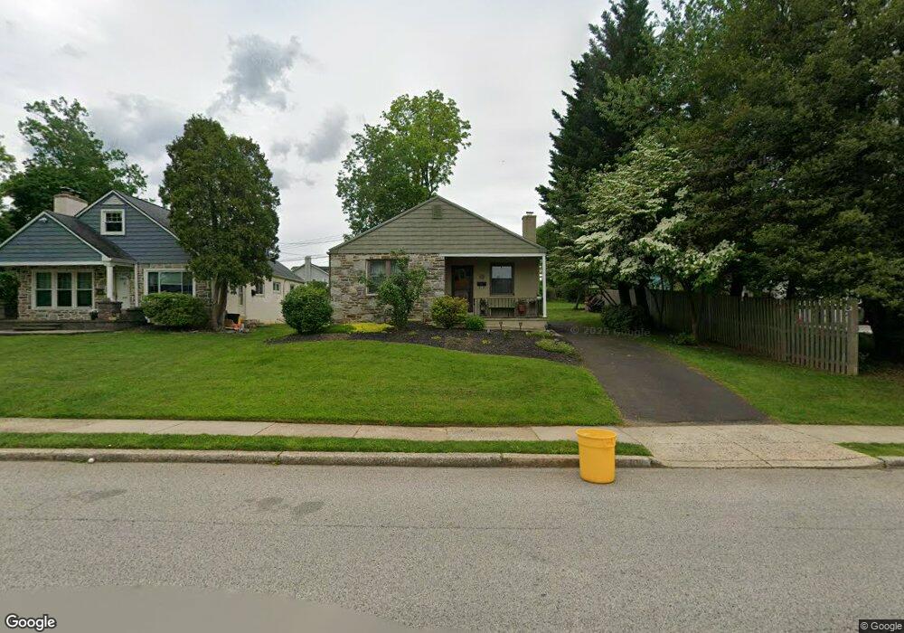
10 Mccloskey Rd Flourtown, PA 19031
Estimated Value: $373,000 - $422,000
2
Beds
1
Bath
1,036
Sq Ft
$378/Sq Ft
Est. Value
About This Home
This home is located at 10 Mccloskey Rd, Flourtown, PA 19031 and is currently estimated at $391,664, approximately $378 per square foot. 10 Mccloskey Rd is a home located in Montgomery County with nearby schools including Erdenheim Elementary School, Enfield Elementary School, and Springfield Township Middle School.
Ownership History
Date
Name
Owned For
Owner Type
Purchase Details
Closed on
Nov 24, 2009
Sold by
Hall Janine
Bought by
Wolpert Eileen
Current Estimated Value
Home Financials for this Owner
Home Financials are based on the most recent Mortgage that was taken out on this home.
Original Mortgage
$168,000
Outstanding Balance
$109,809
Interest Rate
5.02%
Estimated Equity
$281,855
Purchase Details
Closed on
Jul 28, 1997
Sold by
Cipparone Ruth E
Bought by
Fliegelman Harold N and Cipparone Ruth E
Create a Home Valuation Report for This Property
The Home Valuation Report is an in-depth analysis detailing your home's value as well as a comparison with similar homes in the area
Home Values in the Area
Average Home Value in this Area
Purchase History
| Date | Buyer | Sale Price | Title Company |
|---|---|---|---|
| Wolpert Eileen | $210,000 | None Available | |
| Fliegelman Harold N | -- | -- |
Source: Public Records
Mortgage History
| Date | Status | Borrower | Loan Amount |
|---|---|---|---|
| Open | Wolpert Eileen | $168,000 |
Source: Public Records
Tax History Compared to Growth
Tax History
| Year | Tax Paid | Tax Assessment Tax Assessment Total Assessment is a certain percentage of the fair market value that is determined by local assessors to be the total taxable value of land and additions on the property. | Land | Improvement |
|---|---|---|---|---|
| 2025 | $4,967 | $105,460 | $37,660 | $67,800 |
| 2024 | $4,967 | $105,460 | $37,660 | $67,800 |
| 2023 | $4,794 | $105,460 | $37,660 | $67,800 |
| 2022 | $4,657 | $105,460 | $37,660 | $67,800 |
| 2021 | $4,535 | $105,460 | $37,660 | $67,800 |
| 2020 | $4,429 | $105,460 | $37,660 | $67,800 |
| 2019 | $4,361 | $105,460 | $37,660 | $67,800 |
| 2018 | $4,361 | $105,460 | $37,660 | $67,800 |
| 2017 | $4,163 | $105,460 | $37,660 | $67,800 |
| 2016 | $4,122 | $105,460 | $37,660 | $67,800 |
| 2015 | $3,918 | $105,460 | $37,660 | $67,800 |
| 2014 | $3,918 | $105,460 | $37,660 | $67,800 |
Source: Public Records
Map
Nearby Homes
- 21 Jones Ave
- 21 Franklin Ave
- 32 Jones Ave
- 28 Grove Ave
- 9 Comly Ct
- 1005 Harston Ln
- 402 Longfield Rd
- 303 Glenway Rd
- 401 Pennybrook Ct Unit 1 REDFORD END
- 001 Pennybrook Ct Unit REDFORD INTERIOR
- 403 Pennybrook Ct Unit 2 REDFORD INTERIOR
- 405 Pennybrook Ct Unit 3 REDFORD INTERIOR
- 404 Pennybrook Ct Unit 15 REDFORD INTERIOR
- 407 Pennybrook Ct Unit 4 REDFORD END
- 406 Pennybrook Ct Unit 14 REDFORD INTERIOR
- 5 Erdenheim Rd
- Redford Plan at The Towns at Pennybrook
- 106 Montgomery Ave
- 418 Glenway Rd
- 2106 Carolton Way
- 12 Mccloskey Rd
- 14 Mccloskey Rd
- 9 Mccloskey Rd
- 11 Mccloskey Rd
- 16 Mccloskey Rd
- 13 Mccloskey Rd
- 9A Jones Ave
- 7 Jones Ave
- 5 Jones Ave
- 9 Jones Ave
- 11 Jones Ave
- 13 Jones Ave
- 15 Jones Ave
- 18 Mccloskey Rd
- 1300 Bethlehem Pike Unit 32
- 1300 Bethlehem Pike Unit 110
- 1300 Bethlehem Pike Unit 310
- 1300 Bethlehem Pike
- 1300 Bethlehem Pike Unit 12
- 1300 Bethlehem Pike Unit 11