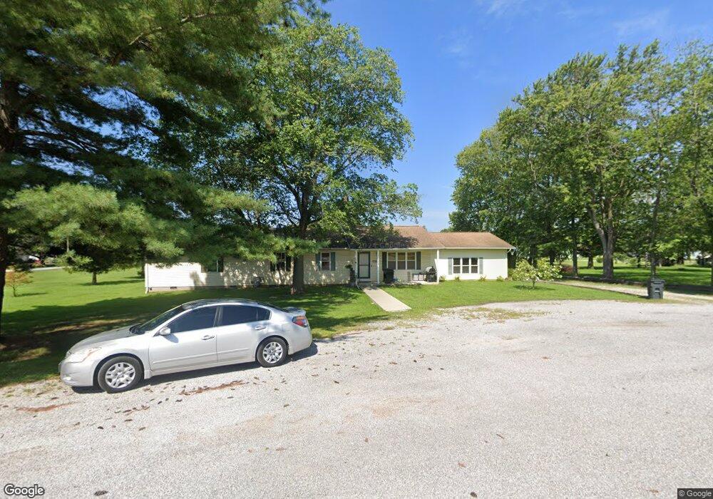
10 Meadowlark Ln Woodlawn, IL 62898
Estimated Value: $181,000 - $244,000
3
Beds
3
Baths
2,112
Sq Ft
$99/Sq Ft
Est. Value
About This Home
This home is located at 10 Meadowlark Ln, Woodlawn, IL 62898 and is currently estimated at $209,742, approximately $99 per square foot. 10 Meadowlark Ln is a home located in Jefferson County with nearby schools including Woodlawn School and Woodlawn Community High School.
Ownership History
Date
Name
Owned For
Owner Type
Purchase Details
Closed on
Oct 6, 2008
Sold by
The Bank Of New York Mellon Trust Compan
Bought by
Sprehe Jason D and Sprehe Amber N
Current Estimated Value
Home Financials for this Owner
Home Financials are based on the most recent Mortgage that was taken out on this home.
Original Mortgage
$91,836
Outstanding Balance
$58,979
Interest Rate
5.73%
Mortgage Type
Purchase Money Mortgage
Estimated Equity
$150,763
Purchase Details
Closed on
Apr 15, 2008
Sold by
Hassler Thomas and Hassler Elizabeth A
Bought by
The Bank Of New York Trust Co Na
Create a Home Valuation Report for This Property
The Home Valuation Report is an in-depth analysis detailing your home's value as well as a comparison with similar homes in the area
Home Values in the Area
Average Home Value in this Area
Purchase History
| Date | Buyer | Sale Price | Title Company |
|---|---|---|---|
| Sprehe Jason D | $90,000 | Title Professionals Inc | |
| The Bank Of New York Trust Co Na | -- | None Available |
Source: Public Records
Mortgage History
| Date | Status | Borrower | Loan Amount |
|---|---|---|---|
| Open | Sprehe Jason D | $91,836 |
Source: Public Records
Tax History Compared to Growth
Tax History
| Year | Tax Paid | Tax Assessment Tax Assessment Total Assessment is a certain percentage of the fair market value that is determined by local assessors to be the total taxable value of land and additions on the property. | Land | Improvement |
|---|---|---|---|---|
| 2024 | $3,063 | $57,827 | $2,417 | $55,410 |
| 2023 | $3,150 | $57,827 | $2,417 | $55,410 |
| 2022 | $3,473 | $56,694 | $2,370 | $54,324 |
| 2021 | $2,681 | $44,368 | $2,675 | $41,693 |
| 2020 | $2,535 | $41,614 | $2,649 | $38,965 |
| 2019 | $2,563 | $41,614 | $2,649 | $38,965 |
| 2018 | $2,749 | $41,614 | $2,649 | $38,965 |
| 2017 | $2,775 | $41,614 | $2,649 | $38,965 |
| 2016 | $2,751 | $41,614 | $2,649 | $38,965 |
| 2015 | $2,767 | $41,614 | $2,649 | $38,965 |
| 2014 | $2,747 | $41,614 | $2,649 | $38,965 |
| 2013 | $2,747 | $41,202 | $2,623 | $38,579 |
Source: Public Records
Map
Nearby Homes
- 108 Mockingbird Ln
- 109 E Galaxy Dr
- 510 N Main St
- 13162 N Dayton Ln
- N N Drivers Ln
- 000 E Mozart Rd
- 16154 N Hickory Ln
- 12782 N Blackhawk Ln
- 12326 N Ring Ln
- 0 N Potomac Blvd Unit RMAEB455575
- 9758 E Richview Rd
- 0000 E Savanna Rd
- 12165 Wells Bypass
- 12165 N Wells Bypass Rd
- 4211 Fox Creek Dr
- 501 Cardinal Dr
- 000 N Wells Bypass Rd
- 616 Seville Dr
- 0000 Heritage Ave
- 417 Jay Dr
- 9 Meadowlark Ln
- 12 Country Aire Trailer Ct
- 102 Mockingbird Ln
- 701 Green St
- 108 Pheasant Run
- 107 Mockingbird Ln
- 112 Mockingbird Ln
- 711 S Main St
- 109 Mockingbird Ln
- 100 Mockingbird Ln
- 111 Mockingbird Ln
- 103 Mockingbird Ln
- 106 Pheasant Run
- 103 E Galaxy Dr
- 101 Mockingbird Ln
- 104 Pheasant Run
- 110 Pheasant Run
- 619 Green St
- 107 Pheasant Run
- 705 S Main St