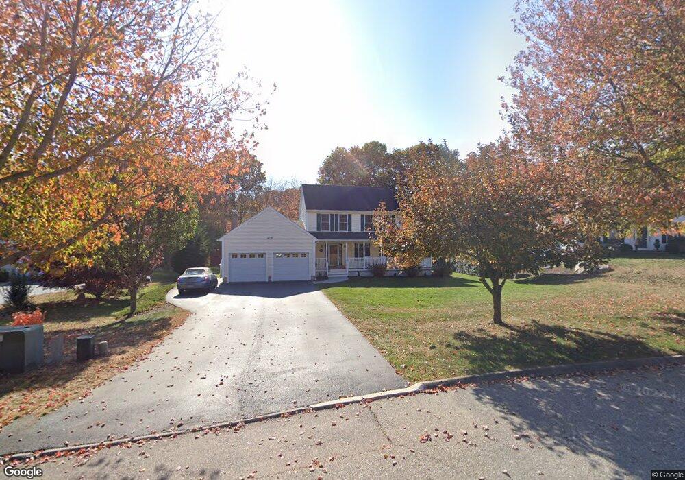
10 Memory Ln Waterford, CT 06385
Estimated Value: $655,000 - $685,000
4
Beds
4
Baths
2,501
Sq Ft
$271/Sq Ft
Est. Value
About This Home
This home is located at 10 Memory Ln, Waterford, CT 06385 and is currently estimated at $677,077, approximately $270 per square foot. 10 Memory Ln is a home located in New London County with nearby schools including Clark Lane Middle School, Waterford High School, and New London High School Multi-Magnet Campus.
Ownership History
Date
Name
Owned For
Owner Type
Purchase Details
Closed on
Jul 6, 1999
Sold by
Aldrich Glen
Bought by
Kramer Christopher D and Kramer Nicole D
Current Estimated Value
Create a Home Valuation Report for This Property
The Home Valuation Report is an in-depth analysis detailing your home's value as well as a comparison with similar homes in the area
Home Values in the Area
Average Home Value in this Area
Purchase History
| Date | Buyer | Sale Price | Title Company |
|---|---|---|---|
| Kramer Christopher D | $85,000 | -- |
Source: Public Records
Mortgage History
| Date | Status | Borrower | Loan Amount |
|---|---|---|---|
| Open | Kramer Christopher D | $105,000 | |
| Open | Kramer Christopher D | $200,545 | |
| Closed | Kramer Christopher D | $50,000 | |
| Closed | Kramer Christopher D | $184,100 |
Source: Public Records
Tax History
| Year | Tax Paid | Tax Assessment Tax Assessment Total Assessment is a certain percentage of the fair market value that is determined by local assessors to be the total taxable value of land and additions on the property. | Land | Improvement |
|---|---|---|---|---|
| 2025 | $8,906 | $381,240 | $92,760 | $288,480 |
| 2024 | $8,502 | $381,240 | $92,760 | $288,480 |
| 2023 | $8,082 | $381,240 | $92,760 | $288,480 |
| 2022 | $7,636 | $277,060 | $63,130 | $213,930 |
| 2021 | $7,658 | $277,060 | $63,130 | $213,930 |
| 2020 | $7,722 | $277,060 | $63,130 | $213,930 |
| 2019 | $7,752 | $277,060 | $63,130 | $213,930 |
| 2018 | $7,597 | $277,060 | $63,130 | $213,930 |
| 2017 | $7,684 | $284,290 | $63,250 | $221,040 |
| 2016 | $7,613 | $284,290 | $63,250 | $221,040 |
| 2015 | $7,343 | $284,290 | $63,250 | $221,040 |
| 2014 | $7,050 | $284,290 | $63,250 | $221,040 |
Source: Public Records
Map
Nearby Homes
- 310 Boston Post Rd Unit 76
- 6 Fulmore Dr
- 9 Arrowhead Trail
- 398 & 402 Boston Post Rd
- 398 Boston Post Rd
- 3 E Wood St
- 276 Niantic River Rd
- 3 Springdale Rd
- 20 North Rd
- 49 Cross Rd
- 22 Woodlawn Ave
- 47 Oswegatchie Hills Rd
- 36 Sandy Hollow Dr
- 52B Millstone Rd W
- 22 Sandy Hollow Dr
- 213 Boston Post Rd
- 163 Oswegatchie Rd
- 54 Rope Ferry Rd Unit C55
- 54 Rope Ferry Rd Unit I154
- 54 Rope Ferry Rd Unit C45
Your Personal Tour Guide
Ask me questions while you tour the home.