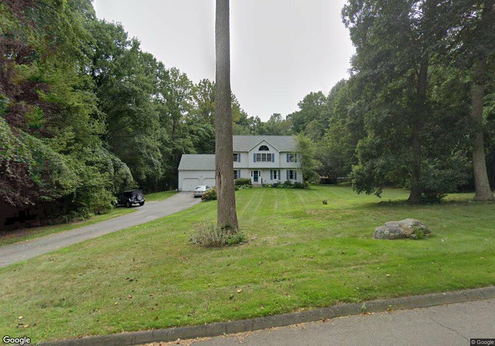
10 Michael Dr Clinton, CT 06413
Estimated Value: $713,000 - $755,222
About This Home
This home is located at 10 Michael Dr, Clinton, CT 06413 and is currently estimated at $735,056, approximately $307 per square foot. 10 Michael Dr is a home located in Middlesex County with nearby schools including Lewin G. Joel Jr. School, The Morgan School, and Our Lady of Mercy Preparatory Academy.
Ownership History
We collect this data history from publicly available records. To have your information removed, we recommend requesting removal directly through your county’s website.
Purchase Details
Purchase Details
Home Values in the Area
Average Home Value in this Area
Purchase History
We collect this data history from publicly available records. To have your information removed, we recommend requesting removal directly through your county’s website.
| Date | Buyer | Sale Price | Title Company |
|---|---|---|---|
| $467,250 | -- | ||
| $467,250 | -- | ||
| $224,355 | -- | ||
| $50,000 | -- | ||
| $50,000 | -- |
Mortgage History
We collect this data history from publicly available records. To have your information removed, we recommend requesting removal directly through your county’s website.
| Date | Status | Borrower | Loan Amount |
|---|---|---|---|
| Open | $343,800 | ||
| Closed | $96,133 |
Tax History
We collect this data history from publicly available records. To have your information removed, we recommend requesting removal directly through your county’s website.
| Year | Tax Paid | Tax Assessment Tax Assessment Total Assessment is a certain percentage of the fair market value that is determined by local assessors to be the total taxable value of land and additions on the property. | Land | Improvement |
|---|---|---|---|---|
| 2025 | $9,423 | $302,600 | $89,600 | $213,000 |
| 2024 | $9,157 | $302,600 | $89,600 | $213,000 |
| 2023 | $9,027 | $302,600 | $89,600 | $213,000 |
| 2022 | $8,558 | $286,900 | $89,600 | $197,300 |
| 2021 | $8,394 | $281,400 | $98,200 | $183,200 |
| 2020 | $8,794 | $281,400 | $98,200 | $183,200 |
| 2019 | $8,794 | $281,400 | $98,200 | $183,200 |
| 2018 | $8,594 | $281,400 | $98,200 | $183,200 |
| 2017 | $8,417 | $281,400 | $98,200 | $183,200 |
| 2016 | $7,637 | $281,400 | $98,200 | $183,200 |
| 2015 | $7,410 | $276,800 | $102,400 | $174,400 |
| 2014 | $7,109 | $270,600 | $102,400 | $168,200 |
Map
- 6 Diamond Rd
- 190 Cow Hill Rd
- 73 Airline Rd
- 244 Cow Hill Rd
- 20 Airline Rd
- 221 Duck Hole Rd
- 15 Baxter Rd
- 238 Scotland Rd
- 14 Oakwood Ln
- 28 Rocky Ledge Dr
- 11 Autumn Ln
- 43 Evergreen Park
- 190 Wildcat Rd
- 0 Skytop Dr
- 92 Scotland Rd Unit Lot. 3
- 111 Scotland Rd
- 34 Beekman Place
- 73 Cow Hill Rd
- 20 Forest Hills Dr
- 51 Nod Place
Ask me questions while you tour the home.