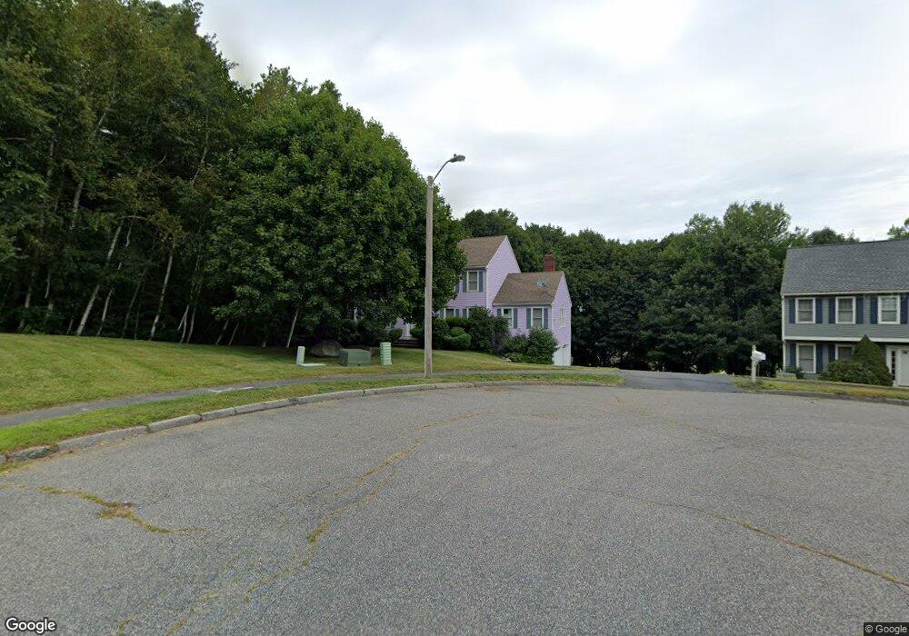
10 Minot Ave Shrewsbury, MA 01545
Estimated Value: $834,334 - $998,000
4
Beds
3
Baths
2,352
Sq Ft
$394/Sq Ft
Est. Value
About This Home
This home is located at 10 Minot Ave, Shrewsbury, MA 01545 and is currently estimated at $927,834, approximately $394 per square foot. 10 Minot Ave is a home located in Worcester County with nearby schools including Floral Street School, Sherwood Middle School, and Oak Middle School.
Ownership History
Date
Name
Owned For
Owner Type
Purchase Details
Closed on
Apr 30, 2008
Sold by
Hildebrand Linda H and Hildebrand William S
Bought by
Lian Wei and Zhou Yanhua
Current Estimated Value
Purchase Details
Closed on
Dec 19, 1997
Sold by
Sheehan Wayne E and Sheehan Kathleen A
Bought by
Hildebrand William S and Hilderbrand Linda H
Purchase Details
Closed on
Apr 4, 1996
Sold by
True Companies Corp
Bought by
Sheehan Wayne E and Sheehan Kathleen
Create a Home Valuation Report for This Property
The Home Valuation Report is an in-depth analysis detailing your home's value as well as a comparison with similar homes in the area
Home Values in the Area
Average Home Value in this Area
Purchase History
| Date | Buyer | Sale Price | Title Company |
|---|---|---|---|
| Lian Wei | $464,000 | -- | |
| Lian Wei | $464,000 | -- | |
| Lian Wei | $464,000 | -- | |
| Hildebrand William S | $268,000 | -- | |
| Hildebrand William S | $268,000 | -- | |
| Sheehan Wayne E | $236,000 | -- | |
| Sheehan Wayne E | $236,000 | -- |
Source: Public Records
Mortgage History
| Date | Status | Borrower | Loan Amount |
|---|---|---|---|
| Open | Sheehan Wayne E | $260,000 | |
| Closed | Sheehan Wayne E | $303,800 | |
| Closed | Sheehan Wayne E | $371,000 |
Source: Public Records
Tax History Compared to Growth
Tax History
| Year | Tax Paid | Tax Assessment Tax Assessment Total Assessment is a certain percentage of the fair market value that is determined by local assessors to be the total taxable value of land and additions on the property. | Land | Improvement |
|---|---|---|---|---|
| 2025 | $92 | $765,200 | $291,700 | $473,500 |
| 2024 | $9,114 | $736,200 | $277,800 | $458,400 |
| 2023 | $8,678 | $661,400 | $277,800 | $383,600 |
| 2022 | $7,649 | $542,100 | $218,200 | $323,900 |
| 2021 | $6,864 | $520,400 | $218,200 | $302,200 |
| 2020 | $6,578 | $527,500 | $218,200 | $309,300 |
| 2019 | $6,286 | $500,100 | $203,900 | $296,200 |
| 2018 | $6,327 | $499,800 | $192,000 | $307,800 |
| 2017 | $6,054 | $471,900 | $173,800 | $298,100 |
| 2016 | $6,076 | $467,400 | $162,800 | $304,600 |
| 2015 | $5,898 | $446,800 | $148,800 | $298,000 |
Source: Public Records
Map
Nearby Homes
- 39 Harvard Ave
- 39 Old Brook Rd
- 4 Horseneck Rd
- 18 Eastwood Rd
- 647 Main St
- 114 Grafton St
- 9 Arnold Rd
- 19 Grafton St
- 13 Kenilworth Rd
- 49 Gates Rd
- Lot 386R Clover Glen Cir
- 46-50 Wesleyan St
- 29 Elma Cir
- 3 Brookdale Cir
- 60 Harrington Farms Way Unit 60
- 243 Spring St
- 24 Harrington Farms Way Unit 24
- 28 Cherry St
- 65 Commons Dr Unit 502
- 65 Commons Dr Unit 410
- 8 Minot Ave
- 36 Trowbridge Ln
- 38 Trowbridge Ln
- 6 Minot Ave
- 34 Trowbridge Ln
- 40 Trowbridge Ln
- 9 Minot Ave
- 5 Minot Ave
- 32 Trowbridge Ln
- 7 Minot Ave
- 4 Minot Ave
- 42 Trowbridge Ln
- 42 Trowbridge Ln
- 3 Minot Ave
- 37 Trowbridge Ln
- 30 Trowbridge Ln
- 39 Trowbridge Ln
- 35 Trowbridge Ln
- 4 Ashmont St
- 41 Trowbridge Ln