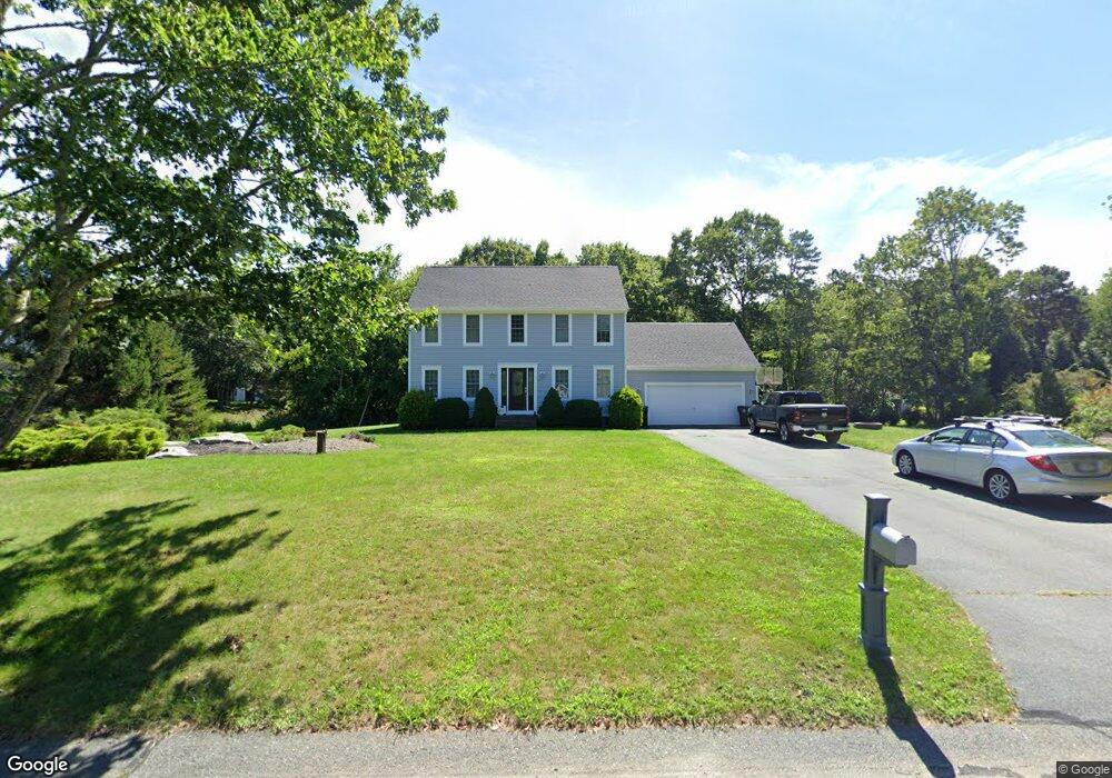
10 Mockingbird Path North Dartmouth, MA 02747
Estimated Value: $548,895 - $718,000
3
Beds
2
Baths
1,414
Sq Ft
$460/Sq Ft
Est. Value
About This Home
This home is located at 10 Mockingbird Path, North Dartmouth, MA 02747 and is currently estimated at $650,724, approximately $460 per square foot. 10 Mockingbird Path is a home located in Bristol County with nearby schools including Dartmouth High School.
Ownership History
Date
Name
Owned For
Owner Type
Purchase Details
Closed on
Feb 23, 2023
Sold by
Anderson Raymond H and Anderson Juliette
Bought by
S & Sunshine Living Ft
Current Estimated Value
Purchase Details
Closed on
Aug 4, 1997
Sold by
Long Realty Inc
Bought by
Anderson Raymond H and Anderson Juliette
Home Financials for this Owner
Home Financials are based on the most recent Mortgage that was taken out on this home.
Original Mortgage
$162,000
Interest Rate
7.55%
Mortgage Type
Purchase Money Mortgage
Create a Home Valuation Report for This Property
The Home Valuation Report is an in-depth analysis detailing your home's value as well as a comparison with similar homes in the area
Home Values in the Area
Average Home Value in this Area
Purchase History
| Date | Buyer | Sale Price | Title Company |
|---|---|---|---|
| S & Sunshine Living Ft | -- | None Available | |
| Anderson Raymond H | $180,000 | -- |
Source: Public Records
Mortgage History
| Date | Status | Borrower | Loan Amount |
|---|---|---|---|
| Previous Owner | Anderson Raymond H | $148,000 | |
| Previous Owner | Anderson Raymond H | $162,000 |
Source: Public Records
Tax History Compared to Growth
Tax History
| Year | Tax Paid | Tax Assessment Tax Assessment Total Assessment is a certain percentage of the fair market value that is determined by local assessors to be the total taxable value of land and additions on the property. | Land | Improvement |
|---|---|---|---|---|
| 2025 | $4,229 | $467,300 | $180,900 | $286,400 |
| 2024 | $4,540 | $496,700 | $180,900 | $315,800 |
| 2023 | $4,608 | $475,500 | $180,900 | $294,600 |
| 2022 | $4,334 | $418,300 | $180,900 | $237,400 |
| 2021 | $4,223 | $389,900 | $175,800 | $214,100 |
| 2020 | $4,206 | $386,600 | $174,000 | $212,600 |
| 2019 | $4,034 | $371,800 | $167,000 | $204,800 |
| 2018 | $3,779 | $359,100 | $170,500 | $188,600 |
| 2017 | $3,637 | $341,800 | $157,400 | $184,400 |
| 2016 | $3,350 | $316,600 | $134,300 | $182,300 |
| 2015 | $3,255 | $309,700 | $125,400 | $184,300 |
| 2014 | $3,152 | $301,900 | $122,000 | $179,900 |
Source: Public Records
Map
Nearby Homes
- 15 Stonewall Ave
- 818 Reed Rd
- 2 Donna Marie Dr
- 56 Lakeside Ave
- 55 Lakeside Ave
- 735 Reed Rd
- 1276 Old Fall River Rd
- 741 Old Fall River Rd
- Lot 16-18 Old Fall River Rd
- 1261 N Hixville Rd
- 751 Hixville Rd
- 2-1 N Hixville Rd
- 15 S Breault St
- 16 S Berryman St
- 29 Union Ave
- 96 Forge Rd
- 1525 N Hixville Rd
- 23 Donna St
- Block 30 Hixville Rd
- Block 27 Hixville Rd
- 6 Mockingbird Path
- 14 Mockingbird Path
- 11 Mockingbird Path
- 26 Goldfinch Dr
- 7 Mockingbird Path
- 5 Mockingbird Path
- 2 Mockingbird Path
- 15 Mockingbird Path
- 22 Goldfinch Dr
- 18 Mockingbird Path
- 19 Mockingbird Path
- 25 Goldfinch Dr
- 9 Nuthatch Ln
- 1 Mockingbird Path
- 21 Goldfinch Dr
- 8 Nuthatch Ln
- 17 Goldfinch Dr
- 7 Nuthatch Ln
- 14 Goldfinch Dr
- 3 Hummingbird Trail