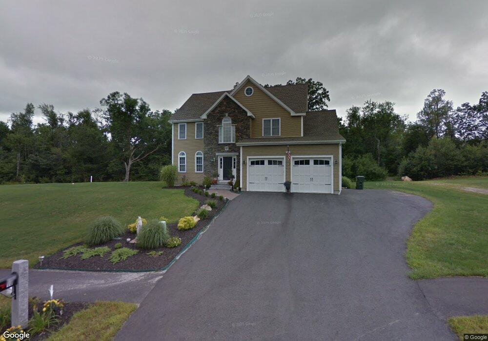
10 Morris Ln Rutland, MA 01543
Estimated Value: $669,000 - $731,000
4
Beds
3
Baths
2,319
Sq Ft
$301/Sq Ft
Est. Value
About This Home
This home is located at 10 Morris Ln, Rutland, MA 01543 and is currently estimated at $698,593, approximately $301 per square foot. 10 Morris Ln is a home with nearby schools including Wachusett Regional High School.
Ownership History
Date
Name
Owned For
Owner Type
Purchase Details
Closed on
Feb 10, 2010
Sold by
J M Soucy Contracting
Bought by
Asmar Hanibal A and Asmar Manuela
Current Estimated Value
Home Financials for this Owner
Home Financials are based on the most recent Mortgage that was taken out on this home.
Original Mortgage
$60,000
Outstanding Balance
$39,888
Interest Rate
5.12%
Mortgage Type
Purchase Money Mortgage
Estimated Equity
$658,705
Create a Home Valuation Report for This Property
The Home Valuation Report is an in-depth analysis detailing your home's value as well as a comparison with similar homes in the area
Home Values in the Area
Average Home Value in this Area
Purchase History
| Date | Buyer | Sale Price | Title Company |
|---|---|---|---|
| Asmar Hanibal A | $360,000 | -- |
Source: Public Records
Mortgage History
| Date | Status | Borrower | Loan Amount |
|---|---|---|---|
| Open | Asmar Hanibal A | $60,000 |
Source: Public Records
Tax History Compared to Growth
Tax History
| Year | Tax Paid | Tax Assessment Tax Assessment Total Assessment is a certain percentage of the fair market value that is determined by local assessors to be the total taxable value of land and additions on the property. | Land | Improvement |
|---|---|---|---|---|
| 2025 | $9,262 | $650,400 | $112,000 | $538,400 |
| 2024 | $9,168 | $618,200 | $100,500 | $517,700 |
| 2023 | $8,447 | $615,700 | $94,800 | $520,900 |
| 2022 | $7,882 | $499,200 | $80,200 | $419,000 |
| 2021 | $7,729 | $462,800 | $80,200 | $382,600 |
| 2020 | $7,151 | $406,100 | $75,400 | $330,700 |
| 2019 | $7,135 | $398,800 | $69,100 | $329,700 |
| 2018 | $6,831 | $376,800 | $69,100 | $307,700 |
| 2017 | $6,903 | $376,800 | $69,100 | $307,700 |
| 2016 | $6,458 | $371,800 | $66,600 | $305,200 |
| 2015 | $6,359 | $360,300 | $66,600 | $293,700 |
| 2014 | $6,165 | $360,300 | $66,600 | $293,700 |
Source: Public Records
Map
Nearby Homes
- 43 Irish Ln
- 39 Irish Ln
- 37 Irish Ln
- LOT 8 Pierre Cir
- 5 Brigham Rd
- 236 Turkey Hill Rd
- 211 Barre Paxton Rd Unit 4
- 7 Victoria Ave
- Lot 1 Welch Ave
- 4 Stevens Way
- Lot 11 Pleasantdale Rd
- 13 Johnson Way
- 14 Welch Ave Unit B
- 15 Athens Ave
- 20 Athens Ave
- 238 Barre Paxton Rd Unit 238
- 0 Barclay Rd
- 289 Richards Ave
- 47 Lakeshore Dr
- 230 West St