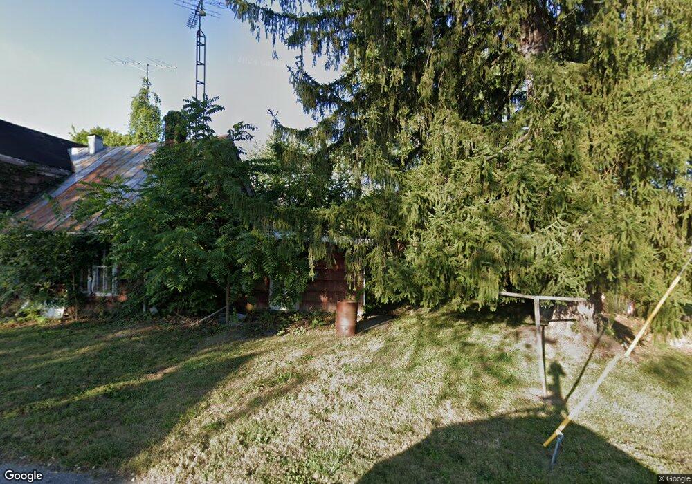
10 N Green St Greens Fork, IN 47345
Estimated Value: $75,000 - $145,000
1
Bed
1
Bath
1,096
Sq Ft
$98/Sq Ft
Est. Value
About This Home
This home is located at 10 N Green St, Greens Fork, IN 47345 and is currently estimated at $106,875, approximately $97 per square foot. 10 N Green St is a home with nearby schools including Hagerstown Elementary School, Hagerstown Junior/Senior High School, and Shady Maple School.
Ownership History
Date
Name
Owned For
Owner Type
Purchase Details
Closed on
Jun 4, 2018
Sold by
Mcfarland Gregory
Bought by
Heaston Walter A
Current Estimated Value
Purchase Details
Closed on
Nov 12, 2008
Sold by
Carrier Jamison
Bought by
Mcfarland Gregory
Purchase Details
Closed on
Feb 17, 2006
Sold by
Secretary Of Hud
Bought by
Carrier Jamison
Purchase Details
Closed on
Feb 9, 2005
Sold by
U S Bank
Bought by
Secretary Of Hud
Purchase Details
Closed on
Dec 7, 2004
Sold by
Dixon Bradic Sue
Bought by
Leader Mortgage Company
Create a Home Valuation Report for This Property
The Home Valuation Report is an in-depth analysis detailing your home's value as well as a comparison with similar homes in the area
Purchase History
| Date | Buyer | Sale Price | Title Company |
|---|---|---|---|
| Heaston Walter A | $40,000 | Abstracts Of Richmond | |
| Mcfarland Gregory | -- | -- | |
| Carrier Jamison | -- | -- | |
| Secretary Of Hud | -- | -- | |
| Leader Mortgage Company | -- | -- |
Source: Public Records
Tax History
| Year | Tax Paid | Tax Assessment Tax Assessment Total Assessment is a certain percentage of the fair market value that is determined by local assessors to be the total taxable value of land and additions on the property. | Land | Improvement |
|---|---|---|---|---|
| 2025 | $879 | $70,200 | $2,700 | $67,500 |
| 2024 | $879 | $60,600 | $2,300 | $58,300 |
| 2023 | $11 | $55,500 | $2,100 | $53,400 |
| 2022 | $1,112 | $55,600 | $2,100 | $53,500 |
| 2021 | $1,002 | $50,100 | $1,100 | $49,000 |
| 2020 | $968 | $48,400 | $1,100 | $47,300 |
| 2019 | $1,014 | $50,700 | $1,100 | $49,600 |
| 2018 | $383 | $50,100 | $1,100 | $49,000 |
| 2017 | $373 | $49,700 | $1,100 | $48,600 |
| 2016 | $326 | $45,800 | $1,100 | $44,700 |
| 2014 | $277 | $42,200 | $1,100 | $41,100 |
| 2013 | $277 | $38,700 | $1,100 | $37,600 |
Source: Public Records
Map
Nearby Homes
- 314 S Main St
- 6027 State Road 38
- 4839 King Rd
- 5159 State Road 38
- 6855 N Centerville Rd
- 8961 College Corner Rd
- 8171 George Early Rd
- 9004 Hidden Hills Dr
- 0 Gaar Jackson Rd
- 1722 N Jacksonburg Rd
- 4113 N Round Barn Rd
- 8620 Sugar Grove Rd
- 541 N Centerville Rd
- 7840 N Jacksonburg Rd
- 207 College Corner Rd
- 2620 Bryant Dr
- 6049 U S 35
- 502 N 1st St
- 9683 U S 40
- 204 S Mcminn Rd
- 12 N Green St
- 20 E Pearl St
- 14 N Green St
- 14 N Green St
- 13 N Green St
- 16 N Green St
- 15 N Green St
- 11 N Main St
- 11 N Green St
- 12 E Pearl St
- 14 E Pearl St Unit 12 EAST PEARL STREET
- 13 N Main St
- 13 N Green St
- 10 E Pearl St
- 17 N Green St
- 17 E Pearl St
- 19 E Pearl St
- 15 N Main St
- 112 Green St
- 112 N Green St
Your Personal Tour Guide
Ask me questions while you tour the home.