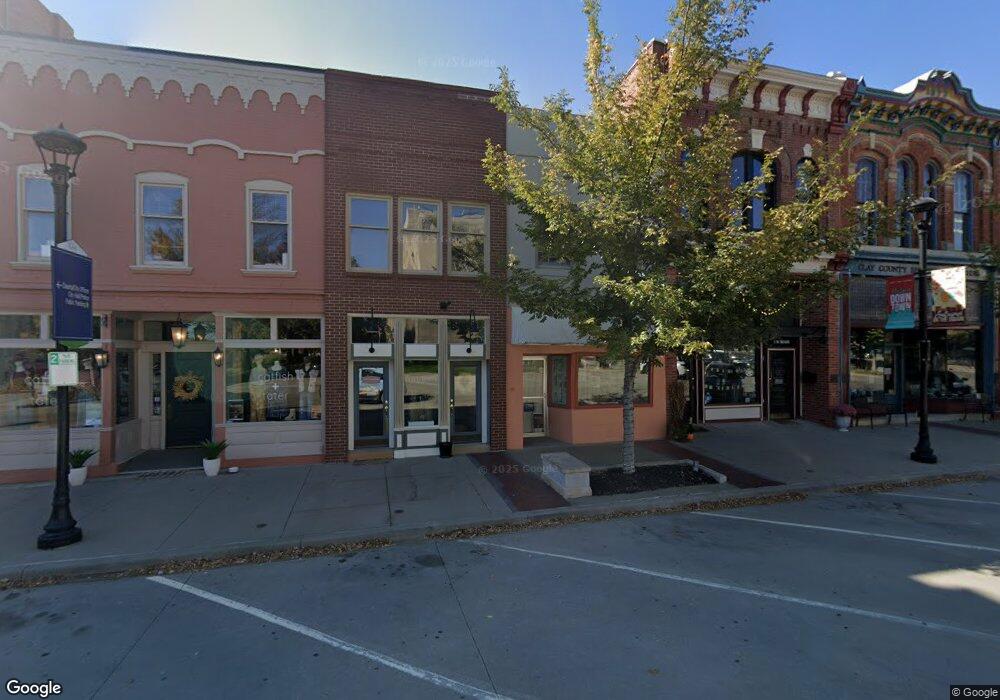
10 N Main St Liberty, MO 64068
--
Bed
--
Bath
--
Sq Ft
1,742
Sq Ft Lot
About This Home
This home is located at 10 N Main St, Liberty, MO 64068. 10 N Main St is a home located in Clay County with nearby schools including Franklin Elementary School, Heritage Middle School, and Liberty North High School.
Ownership History
Date
Name
Owned For
Owner Type
Purchase Details
Closed on
Dec 29, 2022
Sold by
Lozier Walter Clay and Lozier Barbara Lucey
Bought by
Mathes Investments Llc
Purchase Details
Closed on
Oct 15, 2001
Sold by
Walker Robert and Walker Marylyn
Bought by
Lozier Ii Walter Clay and Lozier Barbara Lucey
Home Financials for this Owner
Home Financials are based on the most recent Mortgage that was taken out on this home.
Original Mortgage
$88,000
Interest Rate
6.84%
Mortgage Type
Commercial
Purchase Details
Closed on
Nov 21, 2000
Sold by
Odell Vivian
Bought by
Odell Daniel G and Odell Wanda K
Create a Home Valuation Report for This Property
The Home Valuation Report is an in-depth analysis detailing your home's value as well as a comparison with similar homes in the area
Home Values in the Area
Average Home Value in this Area
Purchase History
| Date | Buyer | Sale Price | Title Company |
|---|---|---|---|
| Mathes Investments Llc | -- | Thomson Affinity Title | |
| Lozier Ii Walter Clay | -- | Realty Title Company | |
| Odell Daniel G | -- | Clay County Title Corporatio |
Source: Public Records
Mortgage History
| Date | Status | Borrower | Loan Amount |
|---|---|---|---|
| Previous Owner | Lozier Ii Walter Clay | $88,000 |
Source: Public Records
Tax History Compared to Growth
Tax History
| Year | Tax Paid | Tax Assessment Tax Assessment Total Assessment is a certain percentage of the fair market value that is determined by local assessors to be the total taxable value of land and additions on the property. | Land | Improvement |
|---|---|---|---|---|
| 2025 | $4,900 | $59,520 | -- | -- |
| 2024 | $4,900 | $50,880 | -- | -- |
| 2023 | $4,954 | $50,880 | $0 | $0 |
| 2022 | $4,219 | $42,240 | $0 | $0 |
| 2021 | $3,992 | $42,240 | $3,040 | $39,200 |
| 2020 | $3,520 | $33,760 | $0 | $0 |
| 2019 | $3,500 | $33,772 | $3,040 | $30,732 |
| 2018 | $3,651 | $34,400 | $0 | $0 |
| 2017 | $3,388 | $34,400 | $3,040 | $31,360 |
| 2016 | $3,388 | $33,760 | $3,040 | $30,720 |
| 2015 | $3,388 | $33,760 | $3,040 | $30,720 |
| 2014 | $3,411 | $33,760 | $3,040 | $30,720 |
Source: Public Records
Map
Nearby Homes
- 1988 Longview Dr
- 307 N Gallatin St
- 125 N Leonard St
- 0 N Water St
- 324 Harrison St
- 116 Dorsey St
- 409 N Morse Ave
- 134 S Lincoln St
- 21 Cedar St
- 471 E Kansas St
- 463 E Mill St
- 435 Ford St
- 40 S Jewell St
- 408 Doniphan St
- 206 Groom St
- 402 Doniphan St
- 443 Choctaw St
- 15 Valley Rd
- 539 N Lightburne St
- 412 N Fairview Ave