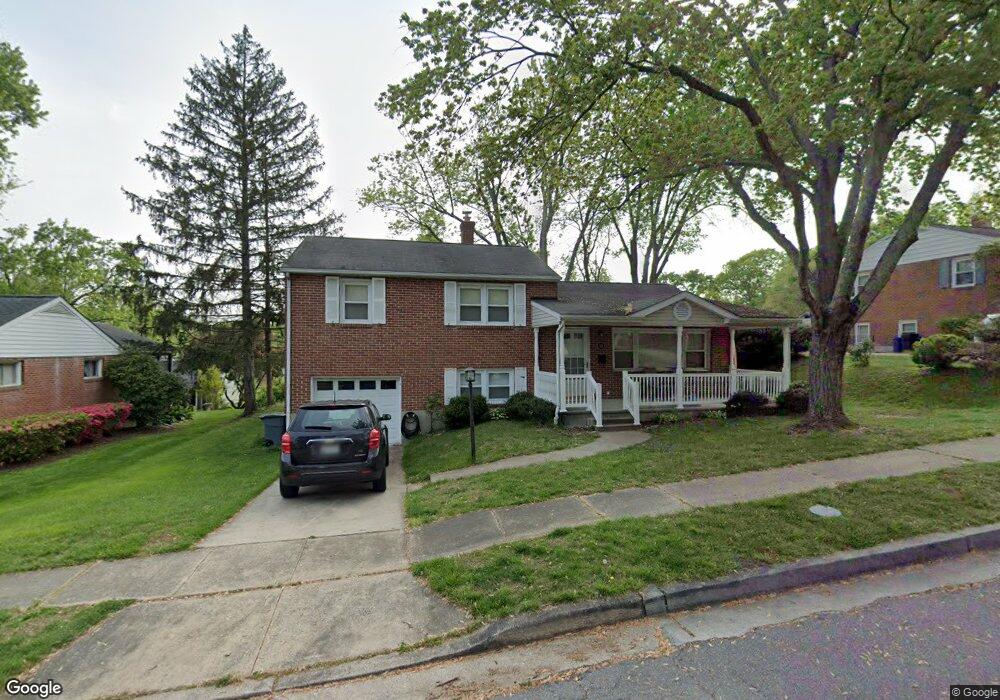
10 N Morerick Ave Catonsville, MD 21228
Estimated Value: $471,000 - $551,000
3
Beds
2
Baths
1,704
Sq Ft
$296/Sq Ft
Est. Value
About This Home
This home is located at 10 N Morerick Ave, Catonsville, MD 21228 and is currently estimated at $503,796, approximately $295 per square foot. 10 N Morerick Ave is a home located in Baltimore County with nearby schools including Westchester Elementary School, Catonsville Middle School, and Catonsville High School.
Ownership History
Date
Name
Owned For
Owner Type
Purchase Details
Closed on
Jan 27, 2010
Sold by
Hughes David Edward
Bought by
Hughes David Edward and Hughes Kristi Lynn
Current Estimated Value
Purchase Details
Closed on
Nov 10, 2008
Sold by
Dickler Roberta V
Bought by
Hughes David Edward and Newcomb Kristi Lynn
Home Financials for this Owner
Home Financials are based on the most recent Mortgage that was taken out on this home.
Original Mortgage
$250,000
Interest Rate
6.13%
Mortgage Type
Purchase Money Mortgage
Purchase Details
Closed on
Oct 30, 2008
Sold by
Dickler Roberta V
Bought by
Hughes David Edward and Newcomb Kristi Lynn
Home Financials for this Owner
Home Financials are based on the most recent Mortgage that was taken out on this home.
Original Mortgage
$250,000
Interest Rate
6.13%
Mortgage Type
Purchase Money Mortgage
Purchase Details
Closed on
Oct 10, 2003
Sold by
Harding David L
Bought by
Dickler Roberta
Create a Home Valuation Report for This Property
The Home Valuation Report is an in-depth analysis detailing your home's value as well as a comparison with similar homes in the area
Home Values in the Area
Average Home Value in this Area
Purchase History
We collect this data history from publicly available records. To have your information removed, we recommend requesting removal directly through your county’s website.
| Date | Buyer | Sale Price | Title Company |
|---|---|---|---|
| Hughes David Edward | -- | -- | |
| Hughes David Edward | $340,000 | -- | |
| Hughes David Edward | $340,000 | -- | |
| Dickler Roberta | $240,000 | -- |
Source: Public Records
Mortgage History
We collect this data history from publicly available records. To have your information removed, we recommend requesting removal directly through your county’s website.
| Date | Status | Borrower | Loan Amount |
|---|---|---|---|
| Previous Owner | Hughes David Edward | $250,000 | |
| Previous Owner | Hughes David Edward | $250,000 |
Source: Public Records
Tax History
| Year | Tax Paid | Tax Assessment Tax Assessment Total Assessment is a certain percentage of the fair market value that is determined by local assessors to be the total taxable value of land and additions on the property. | Land | Improvement |
|---|---|---|---|---|
| 2025 | $5,304 | $380,200 | -- | -- |
| 2024 | $5,304 | $361,000 | $127,200 | $233,800 |
| 2023 | $2,610 | $348,533 | $0 | $0 |
| 2022 | $4,868 | $336,067 | $0 | $0 |
| 2021 | $4,448 | $323,600 | $127,200 | $196,400 |
| 2020 | $4,448 | $311,667 | $0 | $0 |
| 2019 | $4,285 | $299,733 | $0 | $0 |
| 2018 | $4,147 | $287,800 | $91,200 | $196,600 |
| 2017 | $3,943 | $281,167 | $0 | $0 |
| 2016 | $3,984 | $274,533 | $0 | $0 |
| 2015 | $3,984 | $267,900 | $0 | $0 |
| 2014 | $3,984 | $267,900 | $0 | $0 |
Source: Public Records
Map
Nearby Homes
- 2005 Helmsby Rd
- 1900 Frederick Rd
- 11 Clay Lodge Ln Unit 104
- 11 Clay Lodge Ln Unit 403
- 11 Clay Lodge Ln Unit 101
- 1920 Rollingwood Rd
- 17 Clay Lodge Ln Unit 404
- 17 Clay Lodge Ln Unit 103
- 1907 Logwind Rd
- 1926 Edmondson Ave
- 305 Gralan Rd
- 2119 Edmondson Ave
- 29 Maple Ave
- 3 Stardust Ct
- 11 Seminole Ave
- 1504 Ivanhoe Ave
- 7 Montrose Ave
- 124 Oakdale Ave
- 2029 Norhurst Way S
- 2107 Oak Lodge Rd
- 6 N Morerick Ave
- 8 N Morerick Ave
- 4 N Morerick Ave
- 3 Monmouth Rd
- 5 Monmouth Rd
- 7 N Morerick Ave
- 2 N Morerick Ave
- 9 N Morerick Ave
- 1 Monmouth Rd
- 7 Monmouth Rd
- 5 N Morerick Ave
- 11 N Morerick Ave
- 3 N Morerick Ave
- 9 Monmouth Rd
- 4 Monmouth Rd
- 1 N Morerick Ave
- 1917 Devere Ln
- 13 N Morerick Ave
- 6 Monmouth Rd
- 2 Monmouth Rd
Your Personal Tour Guide
Ask me questions while you tour the home.