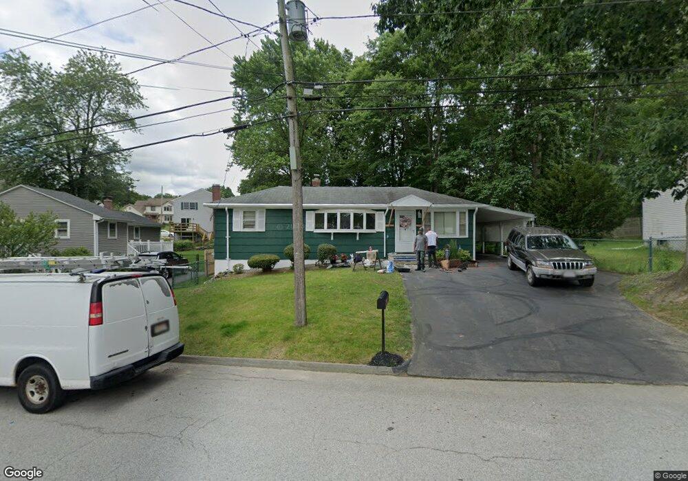
10 Nanita St Worcester, MA 01604
Grafton Hill NeighborhoodEstimated Value: $362,258 - $390,000
2
Beds
1
Bath
1,006
Sq Ft
$372/Sq Ft
Est. Value
About This Home
This home is located at 10 Nanita St, Worcester, MA 01604 and is currently estimated at $374,315, approximately $372 per square foot. 10 Nanita St is a home located in Worcester County with nearby schools including Roosevelt Elementary School, Jacob Hiatt Magnet School, and Chandler Magnet.
Ownership History
Date
Name
Owned For
Owner Type
Purchase Details
Closed on
Aug 1, 2018
Sold by
Pignataro Ft
Bought by
Pignataro Vincent J and Pignataro Tina
Current Estimated Value
Home Financials for this Owner
Home Financials are based on the most recent Mortgage that was taken out on this home.
Original Mortgage
$180,500
Outstanding Balance
$156,757
Interest Rate
4.5%
Mortgage Type
New Conventional
Estimated Equity
$217,558
Purchase Details
Closed on
Oct 11, 2017
Sold by
Pignataro Frank D and Pignataro Vincent J
Bought by
Pignataro Ft
Purchase Details
Closed on
Sep 29, 2017
Sold by
Pignataro Arlene A
Bought by
Pignataro Frank P and Pignataro Vincent J
Create a Home Valuation Report for This Property
The Home Valuation Report is an in-depth analysis detailing your home's value as well as a comparison with similar homes in the area
Home Values in the Area
Average Home Value in this Area
Purchase History
| Date | Buyer | Sale Price | Title Company |
|---|---|---|---|
| Pignataro Vincent J | $190,000 | -- | |
| Pignataro Ft | -- | -- | |
| Pignataro Frank P | -- | -- |
Source: Public Records
Mortgage History
| Date | Status | Borrower | Loan Amount |
|---|---|---|---|
| Open | Pignataro Vincent J | $180,500 |
Source: Public Records
Tax History Compared to Growth
Tax History
| Year | Tax Paid | Tax Assessment Tax Assessment Total Assessment is a certain percentage of the fair market value that is determined by local assessors to be the total taxable value of land and additions on the property. | Land | Improvement |
|---|---|---|---|---|
| 2025 | $3,997 | $303,000 | $107,200 | $195,800 |
| 2024 | $3,923 | $285,300 | $107,200 | $178,100 |
| 2023 | $3,777 | $263,400 | $93,200 | $170,200 |
| 2022 | $3,398 | $223,400 | $74,500 | $148,900 |
| 2021 | $3,248 | $199,500 | $59,600 | $139,900 |
| 2020 | $3,128 | $184,000 | $59,700 | $124,300 |
| 2019 | $2,934 | $163,000 | $53,600 | $109,400 |
| 2018 | $2,852 | $150,800 | $53,600 | $97,200 |
| 2017 | $2,864 | $149,000 | $53,600 | $95,400 |
| 2016 | $2,791 | $135,400 | $40,600 | $94,800 |
| 2015 | $2,717 | $135,400 | $40,600 | $94,800 |
| 2014 | $2,646 | $135,400 | $40,600 | $94,800 |
Source: Public Records
Map
Nearby Homes
- 119 Orton Street Extension
- 24 Benham St Unit B
- 11 Phoenix St
- 21 Middlesex Ave Unit 102
- 3 Lorenzo St
- 25 Crawford St
- 13 Elton St
- 496 Hamilton St
- 15 Anderson Ave
- 22 Anderson Ave
- 334 Bridle Path
- 63 Progressive St
- 65 Progressive St
- 4 Harold St
- 360 Hamilton St
- 340 Hamilton St
- 21-23 Maranda St
- 25-27 Maranda St
- 2 Touraine St
- 276 Coburn Ave