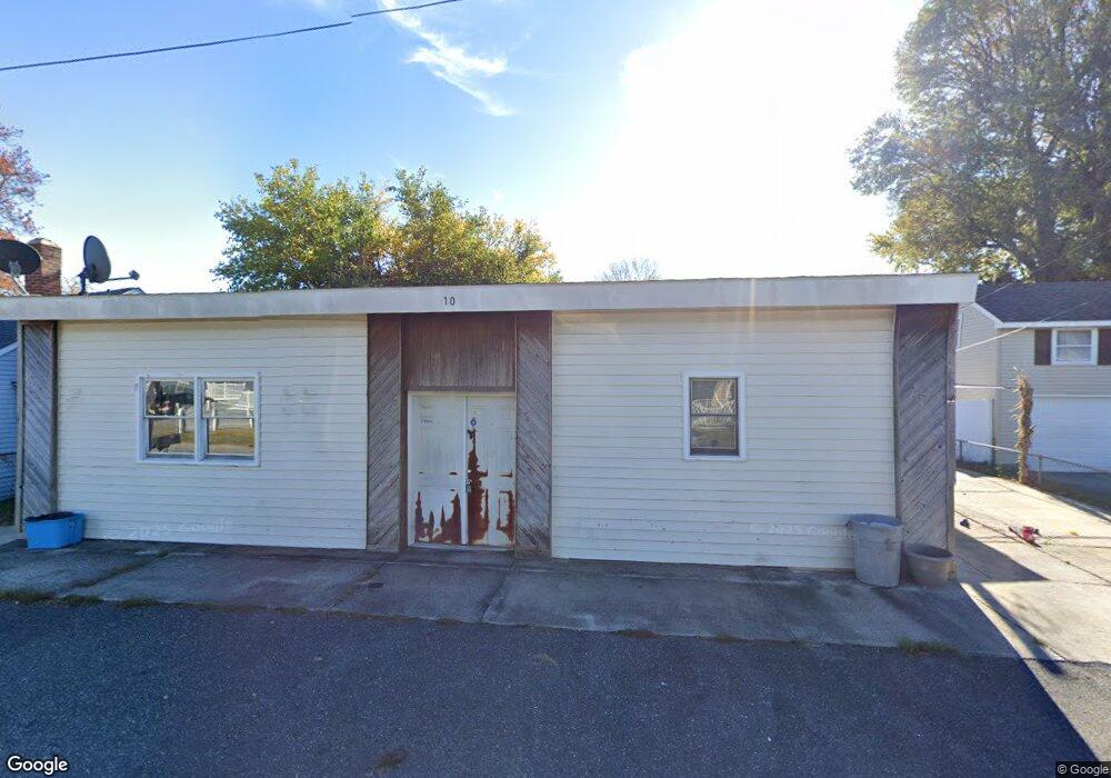
10 New Jersey Ave Villas, NJ 08251
Estimated Value: $343,000 - $451,000
--
Bed
--
Bath
1,363
Sq Ft
$278/Sq Ft
Est. Value
About This Home
This home is located at 10 New Jersey Ave, Villas, NJ 08251 and is currently estimated at $379,387, approximately $278 per square foot. 10 New Jersey Ave is a home located in Cape May County with nearby schools including David C. Douglass Veterans Memorial School, Carl T. Mitnick School, and Maud Abrams School.
Ownership History
Date
Name
Owned For
Owner Type
Purchase Details
Closed on
Nov 18, 2014
Sold by
Maloney Realty
Bought by
Haberwood Llc
Current Estimated Value
Purchase Details
Closed on
Mar 13, 2014
Sold by
Land Frank Edward
Bought by
Maloney Realty
Purchase Details
Closed on
Jul 10, 2013
Sold by
Maloney Realty
Bought by
Land Frank Edward
Purchase Details
Closed on
Aug 7, 2002
Sold by
Falcone Jack V
Bought by
Maloney Realty
Create a Home Valuation Report for This Property
The Home Valuation Report is an in-depth analysis detailing your home's value as well as a comparison with similar homes in the area
Home Values in the Area
Average Home Value in this Area
Purchase History
| Date | Buyer | Sale Price | Title Company |
|---|---|---|---|
| Haberwood Llc | $138,000 | The Title Company Of Jersey | |
| Maloney Realty | -- | None Available | |
| Land Frank Edward | $130,000 | The Title Company Of Jersey | |
| Maloney Realty | $83,500 | -- |
Source: Public Records
Tax History Compared to Growth
Tax History
| Year | Tax Paid | Tax Assessment Tax Assessment Total Assessment is a certain percentage of the fair market value that is determined by local assessors to be the total taxable value of land and additions on the property. | Land | Improvement |
|---|---|---|---|---|
| 2025 | $2,989 | $147,700 | $82,600 | $65,100 |
| 2024 | $2,989 | $147,700 | $82,600 | $65,100 |
| 2023 | $2,942 | $147,700 | $82,600 | $65,100 |
| 2022 | $2,855 | $147,700 | $82,600 | $65,100 |
| 2021 | $2,757 | $147,700 | $82,600 | $65,100 |
| 2020 | $2,721 | $147,700 | $82,600 | $65,100 |
| 2019 | $2,656 | $147,700 | $82,600 | $65,100 |
| 2018 | $2,595 | $147,700 | $82,600 | $65,100 |
| 2017 | $2,595 | $147,700 | $82,600 | $65,100 |
| 2016 | $2,560 | $147,700 | $82,600 | $65,100 |
| 2015 | $2,478 | $147,700 | $82,600 | $65,100 |
| 2014 | $2,388 | $147,700 | $82,600 | $65,100 |
Source: Public Records
Map
Nearby Homes
- 39 New Jersey Ave
- 14 E New York Ave
- 15 E Delaware Pkwy
- 39 E Pacific Ave
- 134 W Delaware Pkwy
- 22 Maryland Ave
- 1300 Millman Blvd Unit B
- 42 Franklin Ave
- 422 E Tampa Ave
- 203 Bay Ave
- 21 Locust Rd
- 413 E Saint Johns Ave
- 5 Millman Ln
- 201 Millman Ln
- 1203 Millman Ln
- 222 E Weber Ave
- 35 Maple Ave
- 246 New Jersey Ave
- 229 W Ocean Ave
- 206 Frances Ave Unit A
- 6 New Jersey Ave
- 14 New Jersey Ave
- 7 W New York Ave
- 3 New Jersey Ave
- 13 W New York Ave
- 18 New Jersey Ave
- 9 New Jersey Ave
- 5 W New York Ave
- 17 W New York Ave
- 11 New Jersey Ave
- 19 W New York Ave
- 3 W New York Ave
- 1259 Bayshore Rd
- 2 New Jersey Ave
- 21 New Jersey Ave
- 2 Pennsylvania Ave
- 8 Pennsylvania Ave
- 24 New Jersey Ave
- 10 Pennsylvania Ave
- 23 W New York Ave