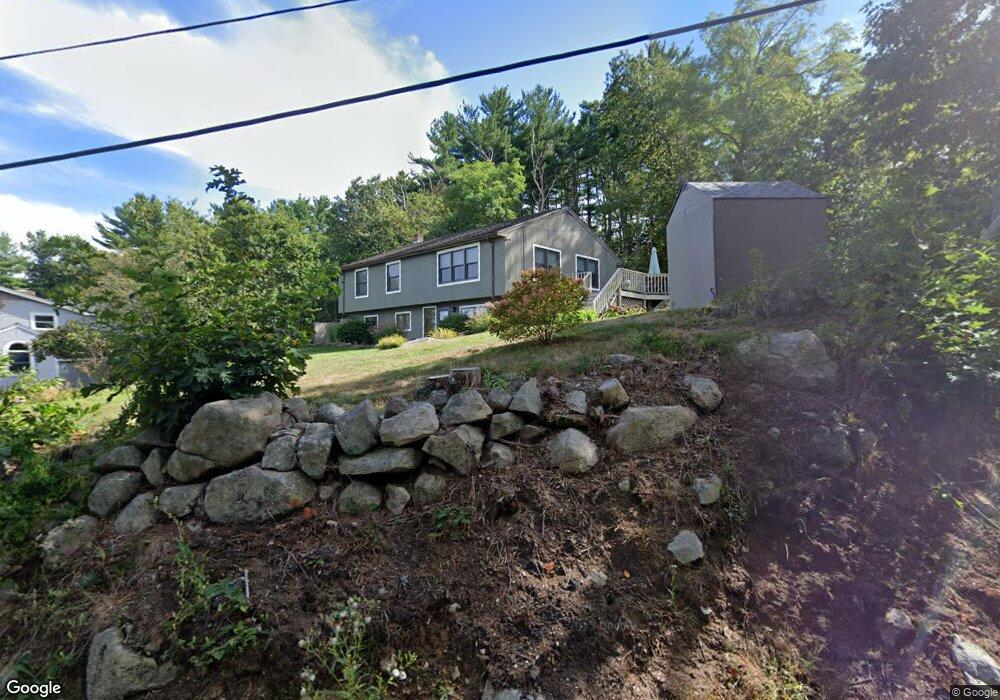
10 New Way Ln Gloucester, MA 01930
West Gloucester NeighborhoodEstimated Value: $587,000 - $731,000
3
Beds
1
Bath
1,232
Sq Ft
$520/Sq Ft
Est. Value
About This Home
This home is located at 10 New Way Ln, Gloucester, MA 01930 and is currently estimated at $640,484, approximately $519 per square foot. 10 New Way Ln is a home located in Essex County with nearby schools including West Parish, Ralph B O'maley Middle School, and Gloucester High School.
Ownership History
Date
Name
Owned For
Owner Type
Purchase Details
Closed on
Jun 2, 2009
Sold by
Mcdermott William P
Bought by
Mcdermott William P
Current Estimated Value
Purchase Details
Closed on
Nov 1, 1986
Bought by
Alves Christopher M and Alves D
Create a Home Valuation Report for This Property
The Home Valuation Report is an in-depth analysis detailing your home's value as well as a comparison with similar homes in the area
Home Values in the Area
Average Home Value in this Area
Purchase History
| Date | Buyer | Sale Price | Title Company |
|---|---|---|---|
| Mcdermott William P | -- | -- | |
| Alves Christopher M | $30,000 | -- |
Source: Public Records
Mortgage History
| Date | Status | Borrower | Loan Amount |
|---|---|---|---|
| Previous Owner | Alves Christopher M | $10,000 | |
| Previous Owner | Alves Christopher M | $100,000 | |
| Previous Owner | Alves Christopher M | $104,000 | |
| Previous Owner | Alves Christopher M | $108,000 |
Source: Public Records
Tax History Compared to Growth
Tax History
| Year | Tax Paid | Tax Assessment Tax Assessment Total Assessment is a certain percentage of the fair market value that is determined by local assessors to be the total taxable value of land and additions on the property. | Land | Improvement |
|---|---|---|---|---|
| 2025 | $5,754 | $592,000 | $200,100 | $391,900 |
| 2024 | $5,906 | $607,000 | $190,500 | $416,500 |
| 2023 | $5,566 | $525,600 | $170,100 | $355,500 |
| 2022 | $5,230 | $445,900 | $148,000 | $297,900 |
| 2021 | $5,124 | $411,900 | $134,500 | $277,400 |
| 2020 | $4,825 | $391,300 | $134,500 | $256,800 |
| 2019 | $4,874 | $384,100 | $134,500 | $249,600 |
| 2018 | $4,606 | $356,200 | $134,500 | $221,700 |
| 2017 | $4,372 | $331,500 | $128,100 | $203,400 |
| 2016 | $4,344 | $319,200 | $133,600 | $185,600 |
| 2015 | $4,155 | $304,400 | $133,600 | $170,800 |
Source: Public Records
Map
Nearby Homes
- 368 Essex Ave
- 12 Woodward Ave
- 227 Essex Ave
- 5 Samoset Rd Unit A
- 11 Overlook Ave
- 587 Essex Ave
- 7 Leaman Dr
- 109 Riverview Rd
- 359 Western Ave
- 15 Harvard St
- 196 Washington St
- 139 Eastern Ave
- 8 Summer St Unit 103
- 65 Poplar St
- 188 Atlantic St
- 5 Washington Square
- 19 Mystic Ave
- 78 Grove St
- 16 Cleveland Place Unit 11
- 33 Middle St