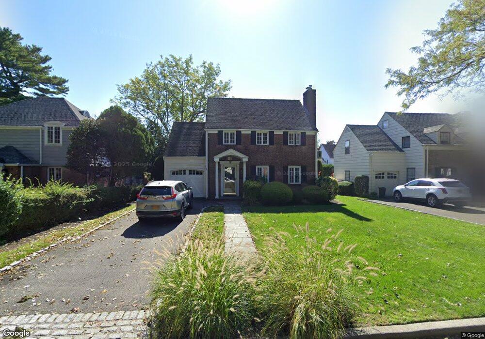
10 Normandy Ln Manhasset, NY 11030
Estimated Value: $1,313,486 - $1,752,000
3
Beds
2
Baths
1,699
Sq Ft
$902/Sq Ft
Est. Value
About This Home
This home is located at 10 Normandy Ln, Manhasset, NY 11030 and is currently estimated at $1,532,743, approximately $902 per square foot. 10 Normandy Ln is a home located in Nassau County with nearby schools including Manhasset Secondary School, St Mary's Elementary School, and Our Lady of Grace Montessori School.
Ownership History
Date
Name
Owned For
Owner Type
Purchase Details
Closed on
Jan 13, 2015
Sold by
Bruno Laura A
Bought by
Guo Jianlan and Zhu Jie
Current Estimated Value
Purchase Details
Closed on
Oct 14, 2010
Sold by
Bruno Laura A
Bought by
Bruno Laura A
Purchase Details
Closed on
Jul 29, 1997
Sold by
Papa Julia and Papa Michael
Bought by
Bruno Robert and Bruno Laura
Create a Home Valuation Report for This Property
The Home Valuation Report is an in-depth analysis detailing your home's value as well as a comparison with similar homes in the area
Home Values in the Area
Average Home Value in this Area
Purchase History
| Date | Buyer | Sale Price | Title Company |
|---|---|---|---|
| Guo Jianlan | $998,500 | None Available | |
| Bruno Laura A | -- | -- | |
| Bruno Robert | $399,000 | -- |
Source: Public Records
Tax History Compared to Growth
Tax History
| Year | Tax Paid | Tax Assessment Tax Assessment Total Assessment is a certain percentage of the fair market value that is determined by local assessors to be the total taxable value of land and additions on the property. | Land | Improvement |
|---|---|---|---|---|
| 2025 | $13,424 | $829 | $420 | $409 |
| 2024 | $4,218 | $836 | $424 | $412 |
| 2023 | $14,263 | $990 | $502 | $488 |
| 2022 | $14,263 | $979 | $496 | $483 |
| 2021 | $13,247 | $1,051 | $533 | $518 |
| 2020 | $13,989 | $1,253 | $1,148 | $105 |
| 2019 | $12,411 | $1,253 | $1,148 | $105 |
| 2018 | $11,762 | $1,253 | $0 | $0 |
| 2017 | $6,532 | $1,194 | $1,148 | $46 |
| 2016 | $10,304 | $1,194 | $1,090 | $104 |
| 2015 | $3,598 | $1,194 | $1,090 | $104 |
| 2014 | $3,598 | $1,194 | $1,090 | $104 |
| 2013 | $3,603 | $1,257 | $1,148 | $109 |
Source: Public Records
Map
Nearby Homes
- 80 Clapham Ave
- 42 Mora Ct
- 17 Highland Terrace
- 14 Combes Dr
- 15 Gaynor Ave Unit 2H
- 300 Thompson Shore Rd
- 90 Gaynor Ave
- 44 Old ox Rd
- 7 Terrace Dr Unit 3H
- 11 Valley View Rd
- 60 Thayer Rd
- 305 Nassau Ave
- 5-A Second
- 256 Schenck Ave
- 87 Arleigh Rd
- 125 Colonial Rd
- 53 Vista Hill Rd
- 414 Hunt Ln
- 7 Shore Rd
- 65 Old Mill Rd