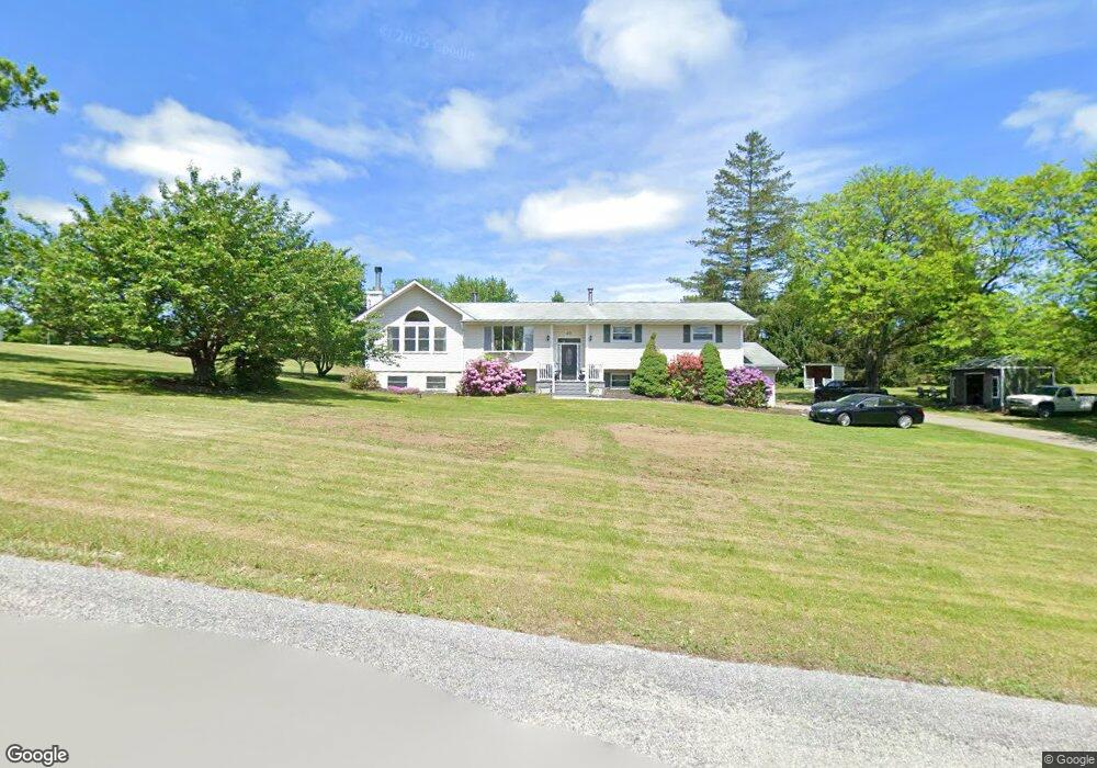
10 Oak Tree Rd Newton, NJ 07860
Estimated Value: $583,951 - $843,000
--
Bed
--
Bath
3,948
Sq Ft
$183/Sq Ft
Est. Value
About This Home
This home is located at 10 Oak Tree Rd, Newton, NJ 07860 and is currently estimated at $722,488, approximately $183 per square foot. 10 Oak Tree Rd is a home located in Sussex County with nearby schools including Fredon Township School, Kittatinny Regional High School, and Lakeland Andover School.
Ownership History
Date
Name
Owned For
Owner Type
Purchase Details
Closed on
Apr 9, 1998
Sold by
Bylsma Frank T and Bylsma Linda S
Bought by
Wagner Jeffrey N and Contessa Nicole Marie
Current Estimated Value
Home Financials for this Owner
Home Financials are based on the most recent Mortgage that was taken out on this home.
Original Mortgage
$132,100
Outstanding Balance
$24,814
Interest Rate
6.98%
Estimated Equity
$697,674
Purchase Details
Closed on
Jul 13, 1996
Sold by
Barberis John J and Barberis Christine
Bought by
Byslma Frank T and Byslma Linda S
Home Financials for this Owner
Home Financials are based on the most recent Mortgage that was taken out on this home.
Original Mortgage
$125,000
Interest Rate
8.37%
Create a Home Valuation Report for This Property
The Home Valuation Report is an in-depth analysis detailing your home's value as well as a comparison with similar homes in the area
Home Values in the Area
Average Home Value in this Area
Purchase History
| Date | Buyer | Sale Price | Title Company |
|---|---|---|---|
| Wagner Jeffrey N | $165,200 | -- | |
| Byslma Frank T | $161,000 | -- |
Source: Public Records
Mortgage History
| Date | Status | Borrower | Loan Amount |
|---|---|---|---|
| Open | Wagner Jeffrey N | $132,100 | |
| Previous Owner | Byslma Frank T | $125,000 |
Source: Public Records
Tax History Compared to Growth
Tax History
| Year | Tax Paid | Tax Assessment Tax Assessment Total Assessment is a certain percentage of the fair market value that is determined by local assessors to be the total taxable value of land and additions on the property. | Land | Improvement |
|---|---|---|---|---|
| 2025 | $10,757 | $345,100 | $105,500 | $239,600 |
| 2024 | $10,301 | $345,100 | $105,500 | $239,600 |
| 2023 | $10,301 | $345,100 | $105,500 | $239,600 |
| 2022 | $10,094 | $345,100 | $105,500 | $239,600 |
| 2021 | $10,322 | $345,100 | $105,500 | $239,600 |
| 2020 | $10,267 | $345,100 | $105,500 | $239,600 |
| 2019 | $10,139 | $345,100 | $105,500 | $239,600 |
| 2018 | $9,966 | $345,100 | $105,500 | $239,600 |
| 2017 | $10,008 | $345,100 | $105,500 | $239,600 |
| 2016 | $9,918 | $345,100 | $105,500 | $239,600 |
| 2015 | $9,604 | $345,100 | $105,500 | $239,600 |
| 2014 | $9,442 | $345,100 | $105,500 | $239,600 |
Source: Public Records
Map
Nearby Homes
- 5 Scenic Dr
- 208 Willows Rd
- 11 Betony Ct
- 516 Ridge Rd
- 5 Augusta Ct
- 17 Youngs Rd
- 520 Ridge Rd
- 63 Van Horn Rd
- 285 Stickles Pond Rd
- 51 Paulinskill Lake Rd
- 20 Anderson Hill Rd
- 219 Woodside Ave
- 15 Bernard Dr
- 5 Babbitt Ct
- 0 Martin St
- 3 Roy Rd
- 7 Martin St
- 21 Carriage Ln Unit 21
- 40 Carriage Ln Unit 40
- 76 Carriage Ln Unit 76
- 16 Lower Hill Rd
- 9 Oak Tree Rd
- 2 Oak Tree Rd
- 6 Oak Tree Rd
- 13 Oak Tree Rd
- 7 Oak Tree Rd
- 14 Lower Hill Rd
- 19 Lower Hill Rd
- 11 Oak Tree Rd
- 17 Lower Hill Rd
- 1 Oak Tree Rd
- 3 Oak Tree Rd
- 11 Scenic Dr
- 5 Oak Tree Rd
- 15 Lower Hill Rd
- 9 Scenic Dr
- 13 Scenic Dr
- 18 Upper Hill Rd
- 16 Upper Hill Rd
- 11 Lower Hill Rd