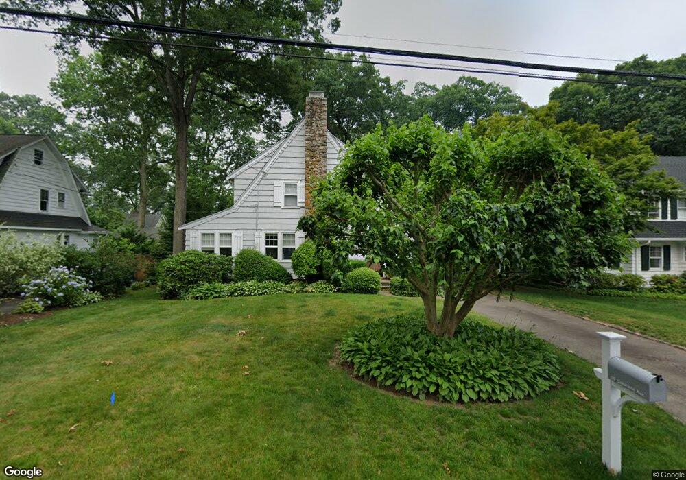
10 Oakshade Ave Darien, CT 06820
Estimated Value: $1,758,573 - $2,159,000
4
Beds
2
Baths
2,208
Sq Ft
$861/Sq Ft
Est. Value
About This Home
This home is located at 10 Oakshade Ave, Darien, CT 06820 and is currently estimated at $1,900,143, approximately $860 per square foot. 10 Oakshade Ave is a home located in Fairfield County with nearby schools including Holmes Elementary School, Middlesex Middle School, and Darien High School.
Ownership History
Date
Name
Owned For
Owner Type
Purchase Details
Closed on
Dec 18, 2020
Sold by
Maschoff Kurt M
Bought by
Maschoff Michelle C
Current Estimated Value
Purchase Details
Closed on
Oct 15, 1999
Sold by
Oday Brian and Hoey Susan
Bought by
Maschoff Kurt M and Maschoff Michelle C
Purchase Details
Closed on
Apr 1, 1991
Sold by
Hodges Douglas and Hodges Martha
Bought by
Oday Brian and Hoey Susan
Purchase Details
Closed on
Jun 9, 1988
Sold by
Brockway Robt
Bought by
Hughes Douglas
Create a Home Valuation Report for This Property
The Home Valuation Report is an in-depth analysis detailing your home's value as well as a comparison with similar homes in the area
Home Values in the Area
Average Home Value in this Area
Purchase History
| Date | Buyer | Sale Price | Title Company |
|---|---|---|---|
| Maschoff Michelle C | -- | None Available | |
| Maschoff Kurt M | $550,000 | -- | |
| Oday Brian | $360,000 | -- | |
| Hughes Douglas | $397,000 | -- |
Source: Public Records
Mortgage History
| Date | Status | Borrower | Loan Amount |
|---|---|---|---|
| Previous Owner | Hughes Douglas | $150,000 | |
| Previous Owner | Hughes Douglas | $417,000 | |
| Previous Owner | Hughes Douglas | $485,712 |
Source: Public Records
Tax History Compared to Growth
Tax History
| Year | Tax Paid | Tax Assessment Tax Assessment Total Assessment is a certain percentage of the fair market value that is determined by local assessors to be the total taxable value of land and additions on the property. | Land | Improvement |
|---|---|---|---|---|
| 2025 | $15,220 | $983,220 | $757,890 | $225,330 |
| 2024 | $14,444 | $983,220 | $757,890 | $225,330 |
| 2023 | $12,242 | $695,170 | $505,260 | $189,910 |
| 2022 | $11,978 | $695,170 | $505,260 | $189,910 |
| 2021 | $11,707 | $695,170 | $505,260 | $189,910 |
| 2020 | $11,352 | $695,170 | $505,260 | $189,910 |
| 2019 | $11,449 | $695,170 | $505,260 | $189,910 |
| 2018 | $10,878 | $676,480 | $462,070 | $214,410 |
| 2017 | $10,932 | $676,480 | $462,070 | $214,410 |
| 2016 | $10,668 | $676,480 | $462,070 | $214,410 |
| 2015 | $10,384 | $676,480 | $462,070 | $214,410 |
| 2014 | $10,098 | $672,770 | $462,070 | $210,700 |
Source: Public Records
Map
Nearby Homes
- 76 Deepwood Rd
- 30 Lake Dr
- 415 West Ave
- 98 Holmes Ave
- 88 Maple Tree Ave Unit G
- 261 Hollow Tree Ridge Rd
- 69 Maple Tree Ave Unit 4
- 30 Maple Tree Ave Unit D
- 35 Maple Tree Ave Unit 6
- 596 Glenbrook Rd Unit 36
- 19 William St
- 406 Courtland Ave Unit D
- 333 West Ave Unit 3
- 31 Chatfield St
- 30 Lenox Ave
- 825 Hope St Unit 4
- 311 Noroton Ave
- 34 Crescent St Unit 2D
- 166 Hollow Tree Ridge Rd
- 43 Crescent St Unit 11
- 8 Oakshade Ave
- 12 Oakshade Ave
- 9 Sunnyside Ave
- 6 Oakshade Ave
- 14 Oakshade Ave
- 11 Sunnyside Ave
- 7 Sunnyside Ave
- 13 Sunnyside Ave
- 9 Oakshade Ave
- 5 Sunnyside Ave
- 11 Oakshade Ave
- 7 Oakshade Ave
- 16 Oakshade Ave
- 13 Oakshade Ave
- 5 Oakshade Ave
- 15 Oakshade Ave
- 17 Sunnyside Ave
- 18 Oakshade Ave
- 4 Oakshade Ave
- 1 Sunnyside Ave