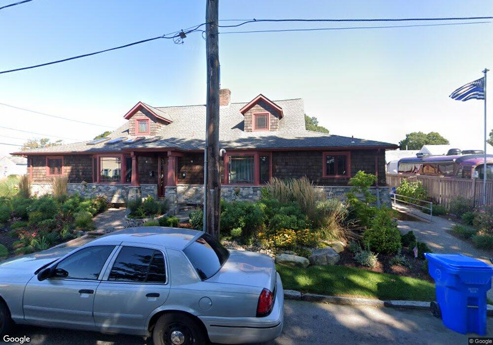
10 Ocean Ave Unit 12 Riverside, RI 02915
Riverside NeighborhoodEstimated Value: $828,000 - $962,000
8
Beds
4
Baths
3,680
Sq Ft
$246/Sq Ft
Est. Value
About This Home
This home is located at 10 Ocean Ave Unit 12, Riverside, RI 02915 and is currently estimated at $905,364, approximately $246 per square foot. 10 Ocean Ave Unit 12 is a home located in Providence County with nearby schools including East Providence High School, St Luke Elementary School, and St Mary Academy-Bay View.
Ownership History
Date
Name
Owned For
Owner Type
Purchase Details
Closed on
Aug 7, 1998
Sold by
Lietar Jean Pierre and Lietar Sharon
Bought by
Miller David L and Burns Suzanne P
Current Estimated Value
Home Financials for this Owner
Home Financials are based on the most recent Mortgage that was taken out on this home.
Original Mortgage
$178,425
Interest Rate
6.92%
Create a Home Valuation Report for This Property
The Home Valuation Report is an in-depth analysis detailing your home's value as well as a comparison with similar homes in the area
Home Values in the Area
Average Home Value in this Area
Purchase History
| Date | Buyer | Sale Price | Title Company |
|---|---|---|---|
| Miller David L | $198,500 | -- |
Source: Public Records
Mortgage History
| Date | Status | Borrower | Loan Amount |
|---|---|---|---|
| Open | Miller David L | $113,000 | |
| Open | Miller David L | $200,000 | |
| Closed | Miller David L | $178,425 |
Source: Public Records
Tax History Compared to Growth
Tax History
| Year | Tax Paid | Tax Assessment Tax Assessment Total Assessment is a certain percentage of the fair market value that is determined by local assessors to be the total taxable value of land and additions on the property. | Land | Improvement |
|---|---|---|---|---|
| 2025 | $10,779 | $824,700 | $178,300 | $646,400 |
| 2024 | $9,195 | $599,800 | $148,600 | $451,200 |
| 2023 | $8,853 | $599,800 | $148,600 | $451,200 |
| 2022 | $8,536 | $390,500 | $90,100 | $300,400 |
| 2021 | $8,396 | $390,500 | $90,100 | $300,400 |
| 2020 | $8,040 | $390,500 | $90,100 | $300,400 |
| 2019 | $7,818 | $390,500 | $90,100 | $300,400 |
| 2018 | $7,052 | $308,200 | $77,500 | $230,700 |
| 2017 | $6,894 | $308,200 | $77,500 | $230,700 |
| 2016 | $6,861 | $308,200 | $77,500 | $230,700 |
| 2015 | $6,522 | $284,200 | $76,900 | $207,300 |
| 2014 | $6,522 | $284,200 | $76,900 | $207,300 |
Source: Public Records
Map
Nearby Homes
- 299 Narragansett Ave
- 164 Bay Spring Ave
- 29 Lake Ave
- 0 Carousel Dr
- 4 Spinnaker Dr
- 25 Park Square Ave
- 1 3rd St
- 150 Alfred Drowne Rd
- 0 Bogman Rd
- 4 Buckingham St
- 5 Booth Ave
- 140 Promenade St
- 41 White Ave
- 6 Conway Dr
- 45 Washington Rd
- 210 Promenade St
- 20 Townsend St
- 3 White Ave
- 7 Carpenter Ave
- 85 Hilton Ave
- 9 Royal Ave
- 1145 Bullocks Point Ave
- 1160 Bullocks Point Ave
- 20 Ocean Ave
- 15 Royal Ave
- 1159 Bullocks Point Ave
- 1135 Bullocks Point Ave
- 255 Riverside Dr
- 282 Terrace Ave
- 1165 Bullocks Point Ave
- 278 Terrace Ave
- 330 Sea View Ave
- 274 Terrace Ave
- 1126 Bullocks Point Ave
- 10 Royal Ave
- 286 Terrace Ave
- 336 Sea View Ave
- 14 Royal Ave
- 266 Terrace Ave
- 1125 Bullocks Point Ave