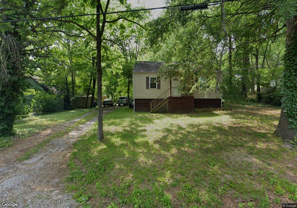
10 Opal Rd Rossville, GA 30741
Estimated Value: $147,000 - $168,000
2
Beds
1
Bath
832
Sq Ft
$189/Sq Ft
Est. Value
About This Home
This home is located at 10 Opal Rd, Rossville, GA 30741 and is currently estimated at $157,076, approximately $188 per square foot. 10 Opal Rd is a home located in Walker County with nearby schools including Stone Creek Elementary School, Rossville Middle School, and Ridgeland High School.
Ownership History
Date
Name
Owned For
Owner Type
Purchase Details
Closed on
Sep 28, 2012
Sold by
Rice & Vandergriff Llc
Bought by
Vandergriff Brian
Current Estimated Value
Purchase Details
Closed on
Jul 27, 2007
Sold by
Not Provided
Bought by
Rice
Purchase Details
Closed on
Mar 31, 2006
Sold by
Shelby Melanie R
Bought by
Shelby Marilyn Renae
Purchase Details
Closed on
Mar 30, 2006
Sold by
Not Provided
Bought by
Rice
Purchase Details
Closed on
Jul 6, 1998
Sold by
Mashburn Roxie Life Est
Bought by
Shelby Melanie R
Purchase Details
Closed on
Sep 25, 1986
Sold by
Mashburn Homer
Bought by
Mashburn Roxie Life Est
Purchase Details
Closed on
Jan 1, 1972
Bought by
Mashburn Homer
Create a Home Valuation Report for This Property
The Home Valuation Report is an in-depth analysis detailing your home's value as well as a comparison with similar homes in the area
Purchase History
| Date | Buyer | Sale Price | Title Company |
|---|---|---|---|
| Vandergriff Brian | $16,000 | -- | |
| Rice | $25,000 | -- | |
| Shelby Marilyn Renae | -- | -- | |
| Rice | -- | -- | |
| Shelby Melanie R | -- | -- | |
| Mashburn Roxie Life Est | -- | -- | |
| Mashburn Homer | -- | -- |
Source: Public Records
Tax History
| Year | Tax Paid | Tax Assessment Tax Assessment Total Assessment is a certain percentage of the fair market value that is determined by local assessors to be the total taxable value of land and additions on the property. | Land | Improvement |
|---|---|---|---|---|
| 2025 | $1,116 | $50,620 | $11,283 | $39,337 |
| 2024 | $1,024 | $44,273 | $6,447 | $37,826 |
| 2023 | $933 | $38,987 | $3,224 | $35,763 |
| 2022 | $872 | $33,680 | $3,224 | $30,456 |
| 2021 | $604 | $19,975 | $1,612 | $18,363 |
| 2020 | $507 | $15,609 | $1,612 | $13,997 |
| 2019 | $515 | $15,609 | $1,612 | $13,997 |
| 2018 | $413 | $15,609 | $1,612 | $13,997 |
| 2017 | $558 | $15,609 | $1,612 | $13,997 |
| 2016 | $512 | $15,609 | $1,612 | $13,997 |
| 2015 | $532 | $15,420 | $1,952 | $13,468 |
| 2014 | $454 | $15,420 | $1,952 | $13,468 |
| 2013 | -- | $15,420 | $1,952 | $13,468 |
Source: Public Records
Map
Nearby Homes
- 323 N Jenkins Rd
- 57 Circle Dr
- 45 Virginia Ave
- 406 Jenkins Rd
- 13 Travis Rd
- 25 Carolyn Ln
- 82 Virginia Ave
- 0 Mission Ridge Lot 2 Rd Unit 1520986
- 0 Mission Ridge Lot 1 Rd Unit 1520987
- 0 Catherine St
- 7 Catherine St
- 145 Mission Ridge Rd
- 0 Sunset Cir Unit 1517664
- 0 Sunset Cir Unit 1524868
- 0 Mission Ridge Rd Unit 1523146
- 0 Mission Ridge Rd Unit RTC3035902
- 7 Broadway St
- 843 Schmitt Rd
- 934 Hulana St
- 823 Schmitt Rd
Your Personal Tour Guide
Ask me questions while you tour the home.