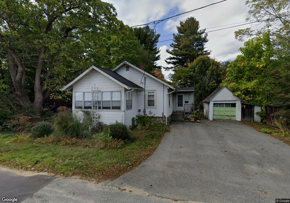
10 Ordway Ave Haverhill, MA 01830
Riverside NeighborhoodEstimated Value: $411,276 - $486,000
1
Bed
1
Bath
1,244
Sq Ft
$354/Sq Ft
Est. Value
About This Home
This home is located at 10 Ordway Ave, Haverhill, MA 01830 and is currently estimated at $440,819, approximately $354 per square foot. 10 Ordway Ave is a home located in Essex County with nearby schools including Golden Hill, Dr. Paul Nettle Middle School, and Haverhill High School.
Ownership History
Date
Name
Owned For
Owner Type
Purchase Details
Closed on
Jun 27, 2002
Sold by
Mclaughlin Joel D and Schleicher Jill M
Bought by
Scholes Wendy Lee
Current Estimated Value
Home Financials for this Owner
Home Financials are based on the most recent Mortgage that was taken out on this home.
Original Mortgage
$184,300
Interest Rate
6.92%
Mortgage Type
Purchase Money Mortgage
Purchase Details
Closed on
Jun 28, 1996
Sold by
Barry Thomas J and Barry Marjorie
Bought by
Mclaughlin Joel D and Schleicher Jill M
Purchase Details
Closed on
Jun 2, 1989
Sold by
Ashe Alvida
Bought by
Barry Thomas
Create a Home Valuation Report for This Property
The Home Valuation Report is an in-depth analysis detailing your home's value as well as a comparison with similar homes in the area
Home Values in the Area
Average Home Value in this Area
Purchase History
| Date | Buyer | Sale Price | Title Company |
|---|---|---|---|
| Scholes Wendy Lee | $190,000 | -- | |
| Mclaughlin Joel D | $90,000 | -- | |
| Barry Thomas | $105,000 | -- |
Source: Public Records
Mortgage History
| Date | Status | Borrower | Loan Amount |
|---|---|---|---|
| Open | Barry Thomas | $183,000 | |
| Closed | Barry Thomas | $184,300 | |
| Previous Owner | Barry Thomas | $50,000 | |
| Previous Owner | Barry Thomas | $80,250 |
Source: Public Records
Tax History Compared to Growth
Tax History
| Year | Tax Paid | Tax Assessment Tax Assessment Total Assessment is a certain percentage of the fair market value that is determined by local assessors to be the total taxable value of land and additions on the property. | Land | Improvement |
|---|---|---|---|---|
| 2025 | $3,647 | $340,500 | $175,900 | $164,600 |
| 2024 | $3,519 | $330,700 | $172,400 | $158,300 |
| 2023 | $3,535 | $317,000 | $172,400 | $144,600 |
| 2022 | $3,551 | $279,200 | $163,600 | $115,600 |
| 2021 | $3,333 | $248,000 | $146,000 | $102,000 |
| 2020 | $3,229 | $237,400 | $137,200 | $100,200 |
| 2019 | $3,066 | $219,800 | $119,600 | $100,200 |
| 2018 | $2,948 | $206,700 | $112,600 | $94,100 |
| 2017 | $2,967 | $197,900 | $109,000 | $88,900 |
| 2016 | $2,634 | $171,500 | $84,400 | $87,100 |
| 2015 | $2,633 | $171,500 | $84,400 | $87,100 |
Source: Public Records
Map
Nearby Homes
- 144 Old Ferry Rd Unit H
- 28 Coffin Ave
- 19 Orchard Ave Unit F
- 23 Orchard Ave Unit E
- 63 Old Ferry Rd
- 49 Douglas St
- 358 Main St
- 47 Gardner St
- 65 Madison St Unit 65
- 104 Keeley St Unit A
- 404 Main St
- 54 Lincoln Ave
- 6 Highland Ave
- 33 Groveland Commons Way
- 20 Francis Ave
- 425 Main St
- 3 Marjorie St
- 280 E Broadway
- 7 Marjorie St
- 18-1/2 Cannon Hill Ave
- 7 Ordway Ave Unit 7
- 14 Ordway Ave
- 11 Ordway Ave Unit 11
- 23 Woods Ave
- 13 Ordway Ave Unit 13
- 15 Woods Ave
- 484 Groveland St
- 492 Groveland St
- 496 Groveland St
- 476 Groveland St
- 474 Groveland St
- 145 Old Ferry Rd Unit C174
- 145 Old Ferry Rd Unit C175
- 145 Old Ferry Rd
- 500 Groveland St
- 18 Woods Ave
- 28 Woods Ave
- 28 Woods Ave
- 4 Woods Ave
- 4 Woods Ave