Estimated Value: $242,000 - $291,000
3
Beds
1
Bath
1,500
Sq Ft
$175/Sq Ft
Est. Value
About This Home
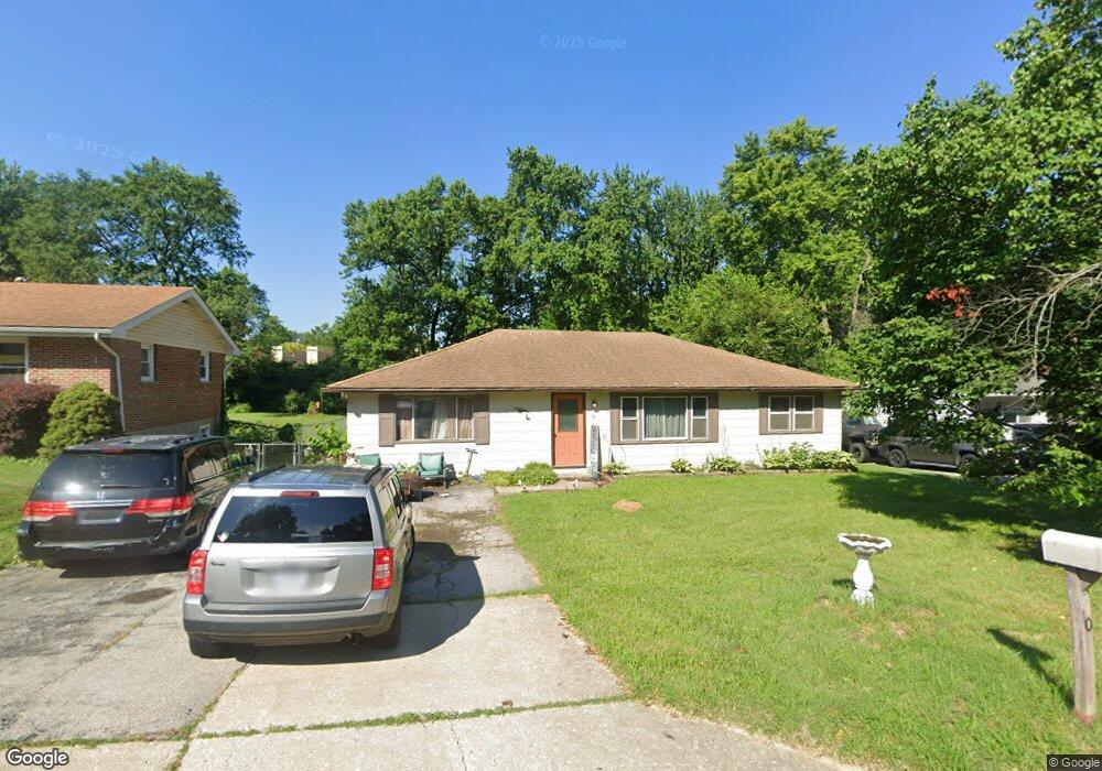
This home is located at 10 Paul Ave, Saint Charles, MO 63301 and is currently estimated at $262,828, approximately $175 per square foot. 10 Paul Ave is a home located in St. Charles County with nearby schools including George M. Null Elementary School, Hardin Middle School, and Jefferson Intermediate School.
Ownership History
Date
Name
Owned For
Owner Type
Purchase Details
Closed on
Sep 26, 2018
Sold by
Sieve Annette L and Sieve James H
Bought by
Cvre Llc
Current Estimated Value
Home Financials for this Owner
Home Financials are based on the most recent Mortgage that was taken out on this home.
Interest Rate
4.65%
Purchase Details
Closed on
Jan 8, 1997
Sold by
Va
Bought by
Sieve James H and Sieve Annette L
Home Financials for this Owner
Home Financials are based on the most recent Mortgage that was taken out on this home.
Original Mortgage
$62,900
Interest Rate
7.75%
Mortgage Type
Seller Take Back
Create a Home Valuation Report for This Property
The Home Valuation Report is an in-depth analysis detailing your home's value as well as a comparison with similar homes in the area
Home Values in the Area
Average Home Value in this Area
Purchase History
| Date | Buyer | Sale Price | Title Company |
|---|---|---|---|
| Cvre Llc | -- | -- | |
| Sieve James H | $64,900 | -- |
Source: Public Records
Mortgage History
| Date | Status | Borrower | Loan Amount |
|---|---|---|---|
| Closed | Cvre Llc | -- | |
| Previous Owner | Sieve James H | $62,900 |
Source: Public Records
Tax History
| Year | Tax Paid | Tax Assessment Tax Assessment Total Assessment is a certain percentage of the fair market value that is determined by local assessors to be the total taxable value of land and additions on the property. | Land | Improvement |
|---|---|---|---|---|
| 2025 | $2,738 | $43,858 | -- | -- |
| 2023 | $2,734 | $42,581 | $0 | $0 |
| 2022 | $2,009 | $29,070 | $0 | $0 |
| 2021 | $2,011 | $29,070 | $0 | $0 |
| 2020 | $2,200 | $30,613 | $0 | $0 |
| 2019 | $2,181 | $30,613 | $0 | $0 |
| 2018 | $1,922 | $25,605 | $0 | $0 |
| 2017 | $1,896 | $25,605 | $0 | $0 |
| 2016 | $1,540 | $19,966 | $0 | $0 |
| 2015 | $1,538 | $19,966 | $0 | $0 |
| 2014 | $1,649 | $21,157 | $0 | $0 |
Source: Public Records
Map
Nearby Homes
- 7 Wayne St
- 2713 Treadway Ave
- 2512 Chesstal St
- 2520 Chartom Mar Dr
- 729 Norwich Dr
- 2520 Fair Oaks Dr
- 1116 Chargene St
- 1200 Chargene St
- 1468 Hawks Nest Ct Unit C
- 1464 Hawks Nest Ct Unit H
- 1464 Hawks Nest Ct Unit F
- 450 Nantucket Dr
- 1456 Hawks Nest Ct Unit F
- 2652 Falcons Way Unit 59
- 2661 Falcons Way Unit 82
- 454 Nantucket Dr
- 108 King Dr Unit 2D
- 1710 Forest Hills Dr Unit C
- 4 Lewis And Clark Ct
- 1620 Forest Hills Dr Unit D