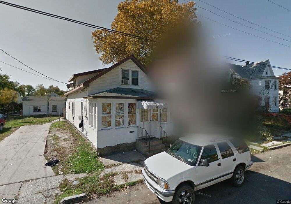
10 Pearl St Unit 10 Penns Grove, NJ 08069
Estimated Value: $82,000 - $192,000
5
Beds
2
Baths
800
Sq Ft
$184/Sq Ft
Est. Value
About This Home
This home is located at 10 Pearl St Unit 10, Penns Grove, NJ 08069 and is currently estimated at $147,072, approximately $183 per square foot. 10 Pearl St Unit 10 is a home located in Salem County with nearby schools including Lafayette-Pershing Elementary School, Field Street Elementary School, and Paul W. Carleton Elementary School.
Ownership History
Date
Name
Owned For
Owner Type
Purchase Details
Closed on
Mar 31, 2010
Sold by
Kandys Porperties Llc
Bought by
Wtc Properties Llc
Current Estimated Value
Home Financials for this Owner
Home Financials are based on the most recent Mortgage that was taken out on this home.
Original Mortgage
$83,235
Interest Rate
5.12%
Mortgage Type
Purchase Money Mortgage
Purchase Details
Closed on
Jun 29, 2007
Sold by
Estate Of Elizabeth J Faul
Bought by
Kandys Properties Llc
Home Financials for this Owner
Home Financials are based on the most recent Mortgage that was taken out on this home.
Original Mortgage
$65,000
Interest Rate
6.48%
Mortgage Type
Purchase Money Mortgage
Create a Home Valuation Report for This Property
The Home Valuation Report is an in-depth analysis detailing your home's value as well as a comparison with similar homes in the area
Home Values in the Area
Average Home Value in this Area
Purchase History
| Date | Buyer | Sale Price | Title Company |
|---|---|---|---|
| Wtc Properties Llc | $84,000 | -- | |
| Kandys Properties Llc | $65,000 | -- |
Source: Public Records
Mortgage History
| Date | Status | Borrower | Loan Amount |
|---|---|---|---|
| Closed | Wtc Properties Llc | $83,235 | |
| Previous Owner | Kandys Properties Llc | $65,000 |
Source: Public Records
Tax History Compared to Growth
Tax History
| Year | Tax Paid | Tax Assessment Tax Assessment Total Assessment is a certain percentage of the fair market value that is determined by local assessors to be the total taxable value of land and additions on the property. | Land | Improvement |
|---|---|---|---|---|
| 2025 | $4,437 | $80,000 | $13,000 | $67,000 |
| 2024 | $4,288 | $80,000 | $13,000 | $67,000 |
| 2023 | $4,288 | $80,000 | $13,000 | $67,000 |
| 2022 | $4,134 | $80,000 | $13,000 | $67,000 |
| 2021 | $4,450 | $90,000 | $13,000 | $77,000 |
| 2020 | $4,508 | $90,000 | $13,000 | $77,000 |
| 2019 | $4,527 | $90,000 | $13,000 | $77,000 |
| 2018 | $4,490 | $111,300 | $21,000 | $90,300 |
| 2017 | $4,505 | $111,300 | $21,000 | $90,300 |
| 2016 | $4,335 | $111,300 | $21,000 | $90,300 |
| 2015 | $4,153 | $111,300 | $21,000 | $90,300 |
| 2014 | $4,107 | $111,300 | $21,000 | $90,300 |
Source: Public Records
Map
Nearby Homes