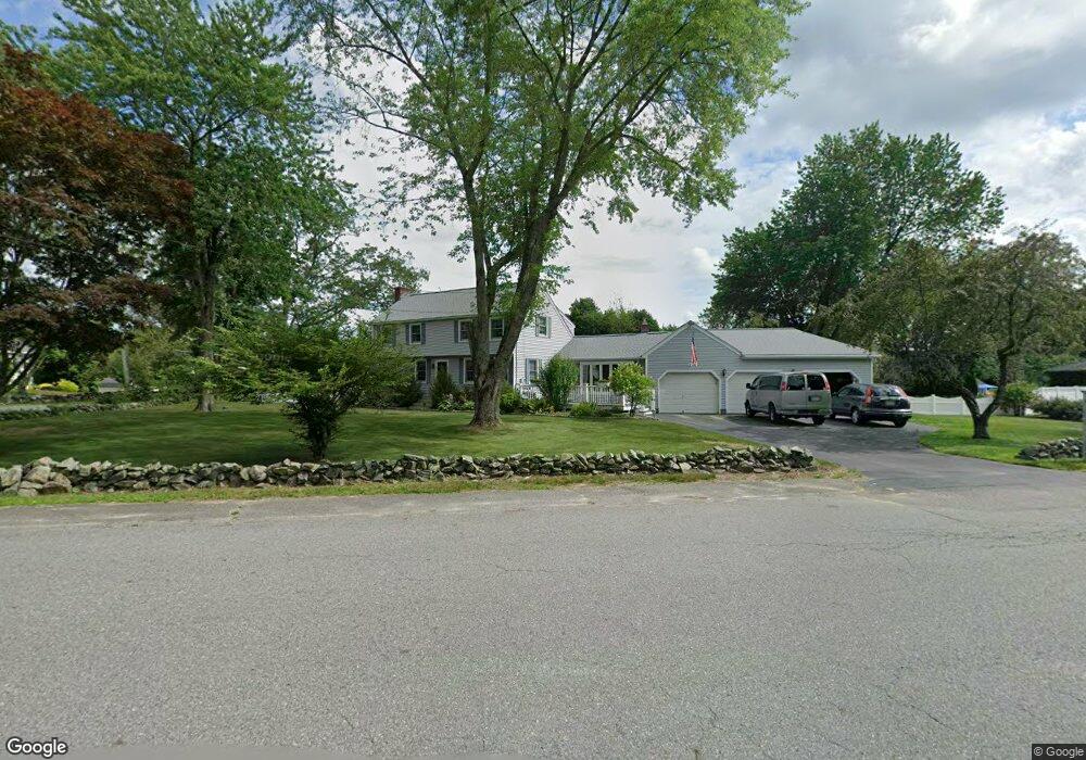
10 Pelczar Rd Dracut, MA 01826
Estimated Value: $758,063 - $844,000
4
Beds
3
Baths
2,416
Sq Ft
$328/Sq Ft
Est. Value
About This Home
This home is located at 10 Pelczar Rd, Dracut, MA 01826 and is currently estimated at $792,266, approximately $327 per square foot. 10 Pelczar Rd is a home located in Middlesex County with nearby schools including Joseph A. Campbell Elementary School, Richardson Middle School, and Dracut Senior High School.
Ownership History
Date
Name
Owned For
Owner Type
Purchase Details
Closed on
May 25, 1983
Bought by
Linscott Robert A
Current Estimated Value
Create a Home Valuation Report for This Property
The Home Valuation Report is an in-depth analysis detailing your home's value as well as a comparison with similar homes in the area
Home Values in the Area
Average Home Value in this Area
Purchase History
| Date | Buyer | Sale Price | Title Company |
|---|---|---|---|
| Linscott Robert A | -- | -- |
Source: Public Records
Mortgage History
| Date | Status | Borrower | Loan Amount |
|---|---|---|---|
| Closed | Linscott Robert A | $95,000 | |
| Closed | Linscott Robert A | $65,000 |
Source: Public Records
Tax History Compared to Growth
Tax History
| Year | Tax Paid | Tax Assessment Tax Assessment Total Assessment is a certain percentage of the fair market value that is determined by local assessors to be the total taxable value of land and additions on the property. | Land | Improvement |
|---|---|---|---|---|
| 2025 | $6,999 | $691,600 | $251,600 | $440,000 |
| 2024 | $6,784 | $649,200 | $239,700 | $409,500 |
| 2023 | $6,731 | $581,300 | $208,500 | $372,800 |
| 2022 | $6,586 | $535,900 | $189,600 | $346,300 |
| 2021 | $6,354 | $488,400 | $172,200 | $316,200 |
| 2020 | $6,142 | $460,100 | $167,000 | $293,100 |
| 2019 | $28,311 | $426,700 | $159,000 | $267,700 |
| 2018 | $4,893 | $415,200 | $159,000 | $256,200 |
| 2017 | $5,819 | $415,200 | $159,000 | $256,200 |
| 2016 | $5,762 | $388,300 | $159,800 | $228,500 |
| 2015 | $5,555 | $372,100 | $159,800 | $212,300 |
| 2014 | $5,190 | $358,200 | $159,800 | $198,400 |
Source: Public Records
Map
Nearby Homes
- 931 Methuen St Unit 6
- 12 Hayfield Rd
- 31 Varnum Ave
- 820 Methuen St Unit 820
- 51 Bellevue Ave
- 821 Merrimack Ave
- 785 Broadway Rd
- 14 Mount Pleasant Ave
- 44 Hopkins Cir Unit 44
- 46 Hopkins Cir
- 72 Sherwood Dr Unit 72
- 42 Hopkins Cir
- 2 Francis Dr Unit 412
- 4 Francis Dr Unit 105
- 2 Francis Dr Unit 213
- 4 Francis Dr Unit 207
- 2 Nollet Dr
- 315 Broadway Rd Unit 7
- 241 Broadway Rd Unit 50
- 67 Foxhill Ln Unit 67
- 114 Parker Rd
- 20 Pelczar Rd
- 211 Parker Rd
- 221 Parker Rd
- 11 Pelczar Rd
- 11 Farm Pond Rd
- 110 Parker Rd
- 205 Parker Rd
- 30 Pelczar Rd
- 5 (Lot 24) Cart Path Rd
- 1 Cartpath Rd
- 86(Lot 9) Cart Path Rd
- 254 Parker Rd
- 21 Farm Pond Rd
- 10 Farm Pond Rd
- 40 Pelczar Rd
- 2 Cartpath Rd
- 141 Cartpath Rd
- 16 Cart Path Rd
- 20 Farm Pond Rd