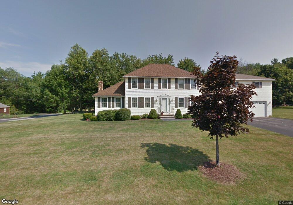
10 Pheasant Ln Dracut, MA 01826
Estimated Value: $741,264 - $859,000
4
Beds
3
Baths
2,180
Sq Ft
$372/Sq Ft
Est. Value
About This Home
This home is located at 10 Pheasant Ln, Dracut, MA 01826 and is currently estimated at $811,566, approximately $372 per square foot. 10 Pheasant Ln is a home located in Middlesex County with nearby schools including Greenmont Avenue School, Richardson Middle School, and Dracut Senior High School.
Ownership History
Date
Name
Owned For
Owner Type
Purchase Details
Closed on
Dec 6, 2006
Sold by
Ladebauche Robert P
Bought by
Ladebauche Pauline G
Current Estimated Value
Home Financials for this Owner
Home Financials are based on the most recent Mortgage that was taken out on this home.
Original Mortgage
$287,000
Outstanding Balance
$172,446
Interest Rate
6.4%
Estimated Equity
$639,120
Purchase Details
Closed on
Apr 2, 1999
Sold by
Draco Homes Inc
Bought by
Ladebuache Robert P and Ladebuache Pauline G
Home Financials for this Owner
Home Financials are based on the most recent Mortgage that was taken out on this home.
Original Mortgage
$120,100
Interest Rate
6.78%
Mortgage Type
Purchase Money Mortgage
Create a Home Valuation Report for This Property
The Home Valuation Report is an in-depth analysis detailing your home's value as well as a comparison with similar homes in the area
Home Values in the Area
Average Home Value in this Area
Purchase History
| Date | Buyer | Sale Price | Title Company |
|---|---|---|---|
| Ladebauche Pauline G | -- | -- | |
| Ladebuache Robert P | $237,100 | -- |
Source: Public Records
Mortgage History
| Date | Status | Borrower | Loan Amount |
|---|---|---|---|
| Open | Ladebauche Pauline G | $287,000 | |
| Previous Owner | Ladebuache Robert P | $130,000 | |
| Previous Owner | Ladebuache Robert P | $120,100 |
Source: Public Records
Tax History
| Year | Tax Paid | Tax Assessment Tax Assessment Total Assessment is a certain percentage of the fair market value that is determined by local assessors to be the total taxable value of land and additions on the property. | Land | Improvement |
|---|---|---|---|---|
| 2025 | $7,519 | $743,000 | $251,600 | $491,400 |
| 2024 | $7,330 | $701,400 | $239,700 | $461,700 |
| 2023 | $7,102 | $613,300 | $208,500 | $404,800 |
| 2022 | $7,002 | $569,700 | $189,600 | $380,100 |
| 2021 | $6,916 | $531,600 | $172,200 | $359,400 |
| 2020 | $6,675 | $500,000 | $167,000 | $333,000 |
| 2019 | $6,366 | $463,000 | $159,000 | $304,000 |
| 2018 | $6,360 | $449,800 | $159,000 | $290,800 |
| 2017 | $6,293 | $449,800 | $159,000 | $290,800 |
| 2016 | $6,304 | $424,800 | $159,800 | $265,000 |
| 2015 | $6,392 | $428,100 | $159,800 | $268,300 |
| 2014 | $5,947 | $410,400 | $159,800 | $250,600 |
Source: Public Records
Map
Nearby Homes
- 19 Esther Way Unit Lot 10
- 29 Saddle Rd
- 28 Bridal Path Rd
- 23 Frank St Unit 2
- 26 Frank St
- 1573 Bridge St
- 1563 Bridge St
- 315 Broadway Rd Unit 1
- 315 Broadway Rd Unit 7
- 287 Fox Ave
- 54 Montaup Ave
- 170 E Richardson Rd
- 1391 Bridge St
- 69 Arlington St
- 40 Arlington Ave
- 551 Hildreth St Unit 21
- 551 Hildreth St Unit 10
- 277 Loon Hill Rd
- 10 Lanseigne St
- 5 Lori Ln
- 369 Old Marsh Hill Rd
- 26 Pheasant Ln
- 377 Old Marsh Hill Rd
- 11 Pheasant Ln
- 21 Pheasant Ln
- 372 Old Marsh Hill Rd
- 364 Old Marsh Hill Rd
- 30 Pheasant Ln
- 350 Old Marsh Hill Rd
- 386 Old Marsh Hill Rd
- 31 Pheasant Ln
- 341 Old Marsh Hill Rd
- 50 Pheasant Ln
- 51 Pheasant Ln
- 387 Old Marsh Hill Rd
- 332 Old Marsh Hill Rd
- 333 Old Marsh Hill Rd
- 326 Old Marsh Hill Rd
- 412 Old Marsh Hill Rd
- 125 Marsh Hill Rd
Your Personal Tour Guide
Ask me questions while you tour the home.