Estimated Value: $1,066,000 - $1,246,000
3
Beds
3
Baths
2,328
Sq Ft
$485/Sq Ft
Est. Value
About This Home
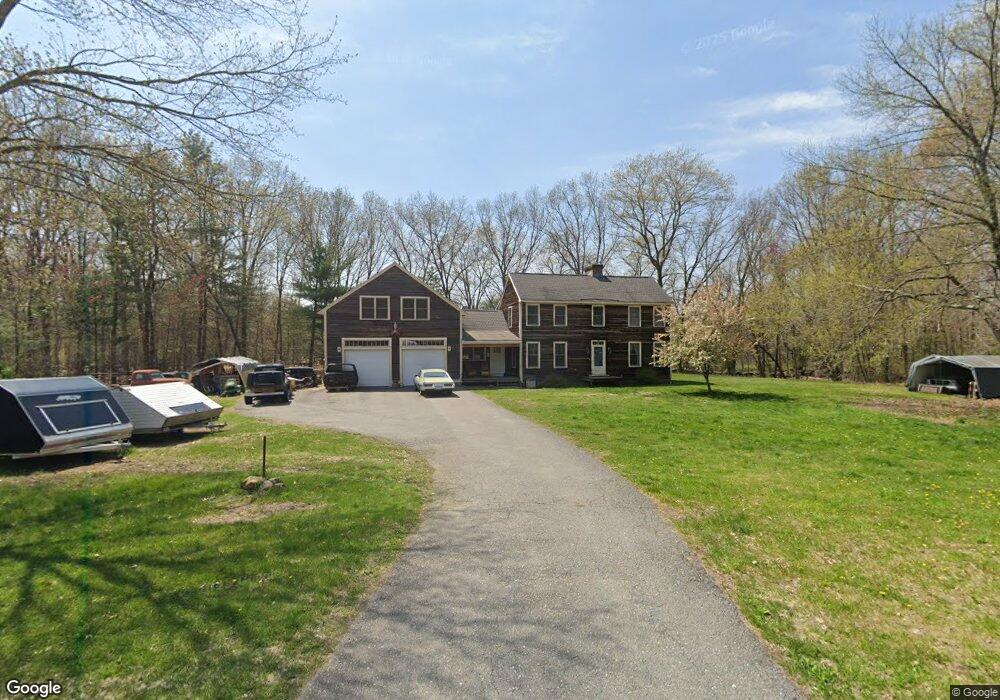
This home is located at 10 Pine St, Acton, MA 01720 and is currently estimated at $1,129,298, approximately $485 per square foot. 10 Pine St is a home located in Middlesex County with nearby schools including Acton-Boxborough Regional High School, Maynard Knowledge Beginnings, and The Imago School.
Create a Home Valuation Report for This Property
The Home Valuation Report is an in-depth analysis detailing your home's value as well as a comparison with similar homes in the area
Home Values in the Area
Average Home Value in this Area
Tax History
| Year | Tax Paid | Tax Assessment Tax Assessment Total Assessment is a certain percentage of the fair market value that is determined by local assessors to be the total taxable value of land and additions on the property. | Land | Improvement |
|---|---|---|---|---|
| 2025 | $16,870 | $983,700 | $322,500 | $661,200 |
| 2024 | $15,721 | $943,100 | $322,500 | $620,600 |
| 2023 | $15,391 | $876,500 | $293,400 | $583,100 |
| 2022 | $15,097 | $776,200 | $256,600 | $519,600 |
| 2021 | $14,798 | $731,500 | $238,200 | $493,300 |
| 2020 | $13,949 | $725,000 | $238,200 | $486,800 |
| 2019 | $13,346 | $689,000 | $238,200 | $450,800 |
| 2018 | $13,285 | $685,500 | $238,200 | $447,300 |
| 2017 | $12,936 | $678,700 | $238,200 | $440,500 |
| 2016 | $12,653 | $658,000 | $238,200 | $419,800 |
| 2015 | $12,262 | $643,700 | $238,200 | $405,500 |
| 2014 | $11,758 | $604,500 | $238,200 | $366,300 |
Source: Public Records
Map
Nearby Homes
- 63 Conant St
- 40 High St
- 71 Liberty St
- 30 Brewster Ln
- 131 Main St
- 129 Main St Unit 129
- 36 Brown St
- 25 Nylander Way
- 70 River St
- 1 Vanderbelt Rd
- 12 Brown St
- 184 Main St Unit 3
- 128 Parker St Unit 3B
- 1 Drummer Rd Unit A5
- 7 Hillcrest Dr
- 70 Powder Mill Rd
- 68 Powder Mill Rd
- 66 Powder Mill Rd
- 2 & 6 Powder Mill Rd
- 31 Drummer Rd Unit 31
Your Personal Tour Guide
Ask me questions while you tour the home.