Estimated Value: $717,000 - $775,000
3
Beds
3
Baths
1,500
Sq Ft
$495/Sq Ft
Est. Value
About This Home
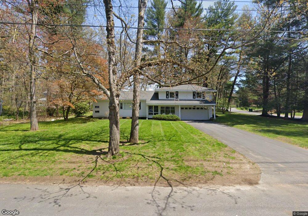
This home is located at 10 Pinewood Rd, Acton, MA 01720 and is currently estimated at $742,753, approximately $495 per square foot. 10 Pinewood Rd is a home located in Middlesex County with nearby schools including Acton-Boxborough Regional High School, Maynard Knowledge Beginnings, and The Imago School.
Ownership History
Date
Name
Owned For
Owner Type
Purchase Details
Closed on
Jun 5, 2020
Sold by
Costa Catherine A
Bought by
Catherine A Costa Ret
Current Estimated Value
Purchase Details
Closed on
Sep 29, 1976
Bought by
Costa Enzio R
Create a Home Valuation Report for This Property
The Home Valuation Report is an in-depth analysis detailing your home's value as well as a comparison with similar homes in the area
Home Values in the Area
Average Home Value in this Area
Purchase History
| Date | Buyer | Sale Price | Title Company |
|---|---|---|---|
| Catherine A Costa Ret | -- | None Available | |
| Costa Enzio R | -- | -- |
Source: Public Records
Tax History Compared to Growth
Tax History
| Year | Tax Paid | Tax Assessment Tax Assessment Total Assessment is a certain percentage of the fair market value that is determined by local assessors to be the total taxable value of land and additions on the property. | Land | Improvement |
|---|---|---|---|---|
| 2025 | $10,930 | $637,300 | $315,200 | $322,100 |
| 2024 | $10,814 | $648,700 | $315,200 | $333,500 |
| 2023 | $10,204 | $581,100 | $286,700 | $294,400 |
| 2022 | $9,585 | $492,800 | $249,100 | $243,700 |
| 2021 | $9,494 | $469,300 | $230,700 | $238,600 |
| 2020 | $9,029 | $469,300 | $230,700 | $238,600 |
| 2019 | $8,873 | $458,100 | $230,700 | $227,400 |
| 2018 | $8,169 | $421,500 | $230,700 | $190,800 |
| 2017 | $7,971 | $418,200 | $230,700 | $187,500 |
| 2016 | $7,696 | $400,200 | $230,700 | $169,500 |
| 2015 | $7,496 | $393,500 | $230,700 | $162,800 |
| 2014 | $7,420 | $381,500 | $230,700 | $150,800 |
Source: Public Records
Map
Nearby Homes
- 5 Oakwood Rd
- 8 Laurel Ct
- 70 River St
- 86 School St
- 71 School St
- 2 Clover Hill Rd
- 128 Audubon Dr
- 12 Brewster Ln
- 40 High St
- 169 Main St
- 118 Parker St Unit 16
- 8 High St Unit G1
- 129 Main St Unit 129
- 129 Main St
- 131 Main St
- 19 Railroad St Unit C2
- 128 Parker St Unit 3B
- 132 Parker St Unit G5
- 23 John Swift Rd
- 491 Main St