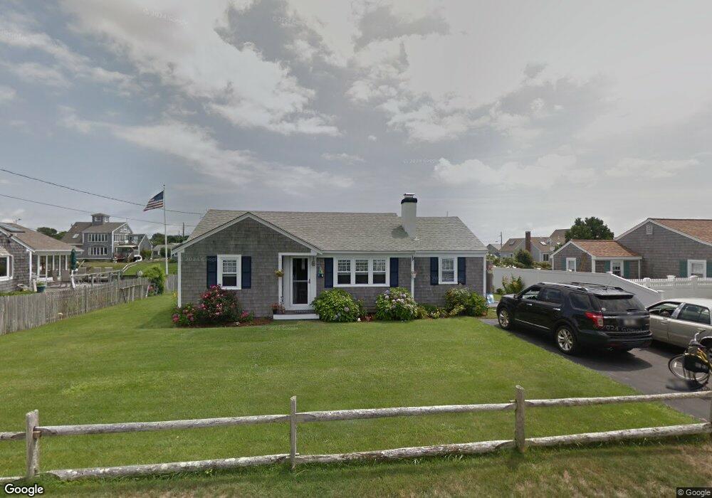
10 Port Way West Dennis, MA 02670
West Dennis NeighborhoodEstimated Value: $965,000 - $2,374,589
3
Beds
1
Bath
1,162
Sq Ft
$1,445/Sq Ft
Est. Value
About This Home
This home is located at 10 Port Way, West Dennis, MA 02670 and is currently estimated at $1,678,647, approximately $1,444 per square foot. 10 Port Way is a home located in Barnstable County with nearby schools including Dennis-Yarmouth Regional High School and St. Pius X. School.
Ownership History
Date
Name
Owned For
Owner Type
Purchase Details
Closed on
Apr 23, 2009
Sold by
Dooley Joseph D and Dooley Pamela E
Bought by
Galanis Gregory L and Galanis Karen E
Current Estimated Value
Home Financials for this Owner
Home Financials are based on the most recent Mortgage that was taken out on this home.
Original Mortgage
$417,000
Outstanding Balance
$263,469
Interest Rate
4.93%
Mortgage Type
Purchase Money Mortgage
Estimated Equity
$1,415,178
Create a Home Valuation Report for This Property
The Home Valuation Report is an in-depth analysis detailing your home's value as well as a comparison with similar homes in the area
Home Values in the Area
Average Home Value in this Area
Purchase History
| Date | Buyer | Sale Price | Title Company |
|---|---|---|---|
| Galanis Gregory L | $705,000 | -- |
Source: Public Records
Mortgage History
| Date | Status | Borrower | Loan Amount |
|---|---|---|---|
| Open | Galanis Gregory L | $417,000 |
Source: Public Records
Tax History Compared to Growth
Tax History
| Year | Tax Paid | Tax Assessment Tax Assessment Total Assessment is a certain percentage of the fair market value that is determined by local assessors to be the total taxable value of land and additions on the property. | Land | Improvement |
|---|---|---|---|---|
| 2025 | $7,901 | $1,824,800 | $1,011,100 | $813,700 |
| 2024 | $7,789 | $1,774,300 | $972,300 | $802,000 |
| 2023 | $6,201 | $1,327,800 | $883,900 | $443,900 |
| 2022 | $4,328 | $772,900 | $546,000 | $226,900 |
| 2021 | $4,376 | $725,700 | $535,300 | $190,400 |
| 2020 | $4,326 | $709,100 | $535,300 | $173,800 |
| 2019 | $4,142 | $671,300 | $524,800 | $146,500 |
| 2018 | $2,836 | $707,200 | $572,400 | $134,800 |
| 2017 | $4,196 | $682,200 | $551,600 | $130,600 |
| 2016 | $4,637 | $710,100 | $598,500 | $111,600 |
| 2015 | $4,545 | $710,100 | $598,500 | $111,600 |
| 2014 | $4,509 | $710,100 | $598,500 | $111,600 |
Source: Public Records
Map
Nearby Homes
- 2 Rita Mary Way
- 14 Schoolhouse Ln
- 178 School St
- 209 Main St Unit 3
- 209 Main St Unit 6
- 209 Main St Unit 1
- 209 Main St Unit 2
- 209 Main St Unit 4
- 209 Main St Unit 5
- 23 Doric Ave
- 401 Main St Unit 201
- 401 Main St Unit 101
- 181 Pleasant St
- 308 Old Main St
- 45 Seth Ln
- 467 Main St
- 40 Kelley Rd
- 6 Baker Way
- 29 Bass River Rd
- 61 Trotters Ln