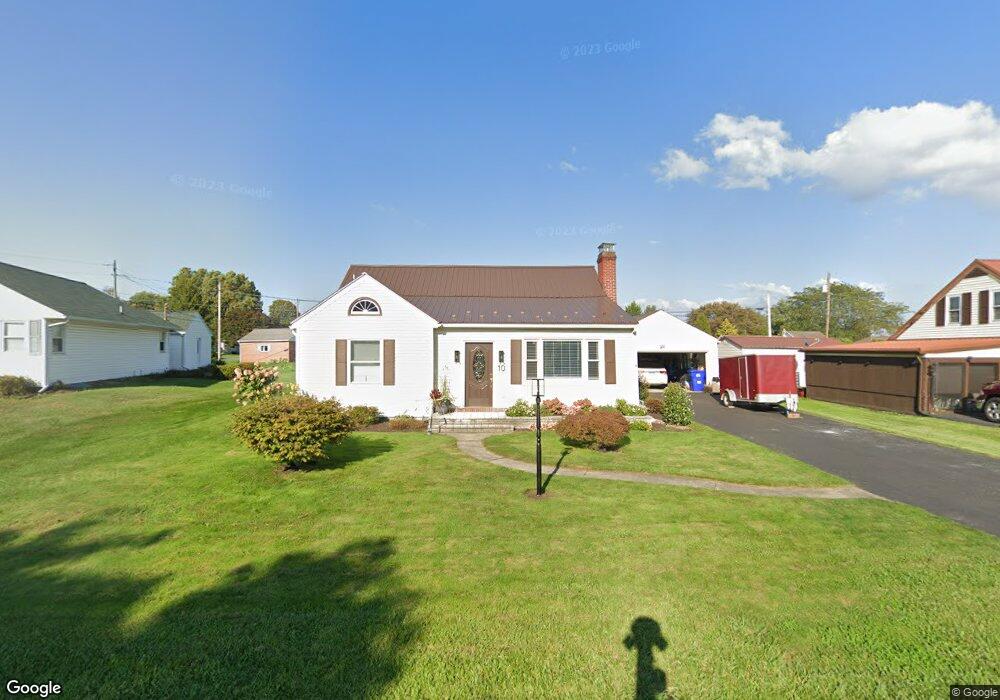
10 Queen Ave Shamokin Dam, PA 17876
Estimated Value: $219,000 - $262,000
--
Bed
--
Bath
--
Sq Ft
10,454
Sq Ft Lot
About This Home
This home is located at 10 Queen Ave, Shamokin Dam, PA 17876 and is currently estimated at $242,766. 10 Queen Ave is a home located in Snyder County with nearby schools including Selinsgrove Area Elementary School, Selinsgrove Intermediate School, and Selinsgrove Area Middle School.
Ownership History
Date
Name
Owned For
Owner Type
Purchase Details
Closed on
Jun 5, 2022
Sold by
Groff Donald E
Bought by
Hostetler Joshua J and Hostetler Cortney L
Current Estimated Value
Home Financials for this Owner
Home Financials are based on the most recent Mortgage that was taken out on this home.
Original Mortgage
$198,000
Interest Rate
5.55%
Mortgage Type
New Conventional
Purchase Details
Closed on
Mar 22, 2018
Sold by
Deppen Dorothy C and Groff Barbara A
Bought by
Groff Donald E and Groff Barbara A
Home Financials for this Owner
Home Financials are based on the most recent Mortgage that was taken out on this home.
Original Mortgage
$155,000
Interest Rate
4.32%
Mortgage Type
New Conventional
Create a Home Valuation Report for This Property
The Home Valuation Report is an in-depth analysis detailing your home's value as well as a comparison with similar homes in the area
Home Values in the Area
Average Home Value in this Area
Purchase History
| Date | Buyer | Sale Price | Title Company |
|---|---|---|---|
| Hostetler Joshua J | $233,000 | -- | |
| Groff Donald E | $175,000 | None Available |
Source: Public Records
Mortgage History
| Date | Status | Borrower | Loan Amount |
|---|---|---|---|
| Previous Owner | Hostetler Joshua J | $198,000 | |
| Previous Owner | Groff Donald E | $155,000 |
Source: Public Records
Tax History Compared to Growth
Tax History
| Year | Tax Paid | Tax Assessment Tax Assessment Total Assessment is a certain percentage of the fair market value that is determined by local assessors to be the total taxable value of land and additions on the property. | Land | Improvement |
|---|---|---|---|---|
| 2025 | $2,152 | $19,720 | $3,290 | $16,430 |
| 2024 | $2,057 | $19,720 | $3,290 | $16,430 |
| 2023 | $765 | $19,720 | $3,290 | $16,430 |
| 2022 | $1,968 | $19,720 | $3,290 | $16,430 |
| 2021 | $1,968 | $19,720 | $3,290 | $16,430 |
| 2020 | $1,948 | $19,720 | $3,290 | $16,430 |
| 2019 | $1,929 | $19,720 | $3,290 | $16,430 |
| 2018 | $1,929 | $19,720 | $3,290 | $16,430 |
| 2017 | $1,909 | $19,720 | $3,290 | $16,430 |
| 2016 | $913 | $19,720 | $3,290 | $16,430 |
| 2015 | $61,748 | $19,720 | $3,290 | $16,430 |
| 2014 | $61,748 | $19,720 | $3,290 | $16,430 |
Source: Public Records
Map
Nearby Homes
- 18 Maple St
- 109 9th Ave
- 118 W 11th Ave
- 3266 N Old Trail Unit 3268
- 3424 N Old Trail
- 36 Rome Ct
- 2103 N Susquehanna Trail
- 20 Banyan St
- 25 Banyan St
- 6721 Park Rd
- 103 S Chestnut St
- 1764 N Susquehanna Trail
- 512 Rolling Green Dr
- 835 S River Ave
- Levenson Plan at Millheim
- Layton 2 Plan at Millheim
- Morehart Plan at Millheim
- Mansfield Plan at Millheim
- Layton 1 Plan at Millheim
- Hawthorne Plan at Millheim