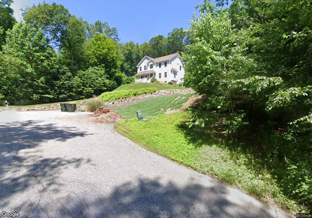
10 Randall Rd Oxford, CT 06478
Estimated Value: $700,359 - $808,000
4
Beds
3
Baths
2,392
Sq Ft
$318/Sq Ft
Est. Value
About This Home
This home is located at 10 Randall Rd, Oxford, CT 06478 and is currently estimated at $761,590, approximately $318 per square foot. 10 Randall Rd is a home with nearby schools including Quaker Farms School, Oxford Middle School, and Oxford High School.
Ownership History
Date
Name
Owned For
Owner Type
Purchase Details
Closed on
Nov 24, 2010
Sold by
C Edwards Co
Bought by
Cohen Matthew B and Cohen Kimberly R
Current Estimated Value
Home Financials for this Owner
Home Financials are based on the most recent Mortgage that was taken out on this home.
Original Mortgage
$274,900
Interest Rate
4.25%
Mortgage Type
Purchase Money Mortgage
Create a Home Valuation Report for This Property
The Home Valuation Report is an in-depth analysis detailing your home's value as well as a comparison with similar homes in the area
Home Values in the Area
Average Home Value in this Area
Purchase History
| Date | Buyer | Sale Price | Title Company |
|---|---|---|---|
| Cohen Matthew B | $419,900 | -- | |
| Cohen Matthew B | $419,900 | -- |
Source: Public Records
Mortgage History
| Date | Status | Borrower | Loan Amount |
|---|---|---|---|
| Open | Cohen Matthew B | $197,457 | |
| Closed | Cohen Matthew B | $274,900 |
Source: Public Records
Tax History Compared to Growth
Tax History
| Year | Tax Paid | Tax Assessment Tax Assessment Total Assessment is a certain percentage of the fair market value that is determined by local assessors to be the total taxable value of land and additions on the property. | Land | Improvement |
|---|---|---|---|---|
| 2025 | $7,648 | $382,200 | $78,960 | $303,240 |
| 2024 | $6,705 | $259,800 | $86,500 | $173,300 |
| 2023 | $6,368 | $259,800 | $86,500 | $173,300 |
| 2022 | $6,329 | $259,800 | $86,500 | $173,300 |
| 2021 | $6,019 | $261,700 | $86,500 | $175,200 |
| 2020 | $5,981 | $250,900 | $86,900 | $164,000 |
| 2019 | $5,981 | $250,900 | $86,900 | $164,000 |
| 2018 | $5,783 | $250,900 | $86,900 | $164,000 |
| 2017 | $5,572 | $250,900 | $86,900 | $164,000 |
| 2016 | $6,074 | $250,900 | $86,900 | $164,000 |
| 2015 | $6,495 | $260,200 | $69,900 | $190,300 |
| 2014 | $6,471 | $260,200 | $69,900 | $190,300 |
Source: Public Records
Map
Nearby Homes
- 89 Old Church Rd
- 147 Riggs St
- 6 Autumn Ridge Rd
- 0 Christian St Unit 24096996
- 945 Mackenzie Ln Unit 945
- 0 Seth Den Rd
- 7 Council Dr
- 184 Riggs St
- 0 Larkey Rd
- 143 Dorman Rd
- 185 Country Club Dr
- lot1B Deerwood Rd
- lot1 Deerwood Rd
- 7 Deerwood Rd
- 217 Chip Shot Ln
- Parcel B Old Moose Hill Rd
- Parcel A Old Moose Hill Rd
- 106 Country Club Dr
- 495 Quaker Farms Rd
- 4 Christopher Ct
- 6 Butternut Ridge Rd
- 6 Butternut Ridge Rd
- 4 Butternut Ridge Rd
- 6 Randall Dr
- 5 Randall Dr
- 1 Randall Dr
- 3 Randall Dr
- 2 Randall Dr
- 8 Randall Rd
- 8 Butternut Ridge Rd
- LOT# 1 Randall Dr
- LOT# 2 Randall Dr
- LOT# 3 Randall Dr
- LOT 1 Randall Dr
- LOT 2 Randall Dr
- 0 Butternut Ridge Rd
- 10 Butternut Ridge Rd
- 5 Butternut Ridge Rd
- 9 Butternut Ridge Rd
- 443 Oxford Rd