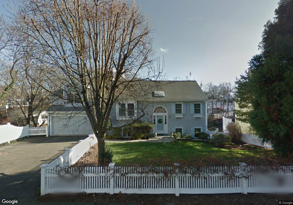
10 Raymond St Darien, CT 06820
Estimated Value: $1,253,694 - $1,566,000
3
Beds
3
Baths
1,777
Sq Ft
$793/Sq Ft
Est. Value
About This Home
This home is located at 10 Raymond St, Darien, CT 06820 and is currently estimated at $1,408,924, approximately $792 per square foot. 10 Raymond St is a home located in Fairfield County with nearby schools including Tokeneke Elementary School, Middlesex Middle School, and Darien High School.
Ownership History
Date
Name
Owned For
Owner Type
Purchase Details
Closed on
May 4, 1998
Sold by
Tibbetts Aldred P
Bought by
Brownlee Susan S
Current Estimated Value
Home Financials for this Owner
Home Financials are based on the most recent Mortgage that was taken out on this home.
Original Mortgage
$368,000
Outstanding Balance
$71,529
Interest Rate
7.04%
Mortgage Type
Purchase Money Mortgage
Estimated Equity
$1,337,395
Purchase Details
Closed on
Jul 8, 1996
Sold by
Brophy Mary A
Bought by
Tibbetts Tr Alfred P
Create a Home Valuation Report for This Property
The Home Valuation Report is an in-depth analysis detailing your home's value as well as a comparison with similar homes in the area
Home Values in the Area
Average Home Value in this Area
Purchase History
| Date | Buyer | Sale Price | Title Company |
|---|---|---|---|
| Brownlee Susan S | $460,000 | -- | |
| Tibbetts Tr Alfred P | $450,000 | -- |
Source: Public Records
Mortgage History
| Date | Status | Borrower | Loan Amount |
|---|---|---|---|
| Open | Tibbetts Tr Alfred P | $150,000 | |
| Closed | Tibbetts Tr Alfred P | $85,300 | |
| Open | Tibbetts Tr Alfred P | $368,000 |
Source: Public Records
Tax History
| Year | Tax Paid | Tax Assessment Tax Assessment Total Assessment is a certain percentage of the fair market value that is determined by local assessors to be the total taxable value of land and additions on the property. | Land | Improvement |
|---|---|---|---|---|
| 2025 | $9,419 | $608,440 | $412,510 | $195,930 |
| 2024 | $8,938 | $608,440 | $412,510 | $195,930 |
| 2023 | $8,455 | $480,130 | $317,310 | $162,820 |
| 2022 | $8,273 | $480,130 | $317,310 | $162,820 |
| 2021 | $10,354 | $480,130 | $317,310 | $162,820 |
| 2020 | $7,782 | $475,650 | $312,830 | $162,820 |
| 2019 | $7,834 | $475,650 | $312,830 | $162,820 |
| 2018 | $10,001 | $500,360 | $294,560 | $205,800 |
| 2017 | $8,086 | $500,360 | $294,560 | $205,800 |
| 2016 | $7,891 | $500,360 | $294,560 | $205,800 |
| 2015 | $7,681 | $500,360 | $294,560 | $205,800 |
| 2014 | $7,510 | $500,360 | $294,560 | $205,800 |
Source: Public Records
Map
Nearby Homes
- 14 5 Mile River Rd
- 5 Little Brook Rd
- 9 Arnold Ln
- 3 Bittersweet Trail
- 166 Rowayton Ave Unit 2
- 90 5 Mile River Rd
- 40 Arnold Ln
- 22 Harstrom Place
- 2 Red Rose Cir
- 1 Mckinley St
- 6 Acorn Ln
- 19 Circle Rd
- 119 Rowayton Woods Dr Unit 119
- 171 Raymond St
- 40 Tory Hill Ln
- 9 Knollwood Rd
- 10 Cross Rd
- 18 Winding Ln
- 18 Tokeneke Trail
- 6 Richmond Rd
- 6 Raymond St
- 11 Raymond St
- 13 Raymond St
- 14 Raymond St
- 12 Jacob St
- 15 Raymond St
- 14 Raymond Heights
- 20 Raymond St
- 11 Raymond Heights
- 7 Raymond Heights
- 19 Jacob St
- 9 Raymond Heights
- 0 Raymond St Unit 99035954
- 0 Raymond St
- 0 Raymond St Unit 17719
- 0 Raymond St Unit 170487568
- 0 Raymond St Unit 170345495
- 19 Raymond St
- 18 Raymond Heights
- 13 Raymond Heights
Your Personal Tour Guide
Ask me questions while you tour the home.