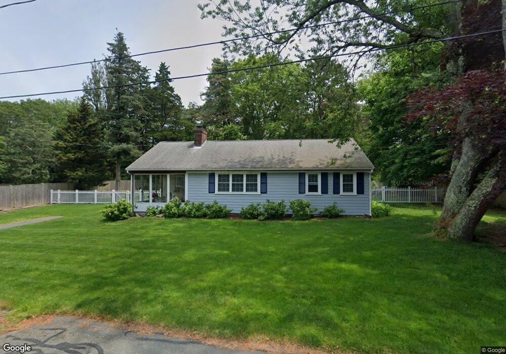
10 Richards Way East Sandwich, MA 02537
Estimated Value: $566,067 - $858,000
3
Beds
1
Bath
924
Sq Ft
$732/Sq Ft
Est. Value
About This Home
This home is located at 10 Richards Way, East Sandwich, MA 02537 and is currently estimated at $676,017, approximately $731 per square foot. 10 Richards Way is a home located in Barnstable County with nearby schools including Sandwich Middle High School, Waldorf School of Cape Cod, and Riverview School.
Ownership History
Date
Name
Owned For
Owner Type
Purchase Details
Closed on
Mar 14, 2008
Sold by
Santapaola Robert M and Santapaola Susan A
Bought by
Lambert Gerald T and Lambert Judith M
Current Estimated Value
Home Financials for this Owner
Home Financials are based on the most recent Mortgage that was taken out on this home.
Original Mortgage
$195,000
Outstanding Balance
$121,352
Interest Rate
5.72%
Mortgage Type
Purchase Money Mortgage
Estimated Equity
$554,665
Create a Home Valuation Report for This Property
The Home Valuation Report is an in-depth analysis detailing your home's value as well as a comparison with similar homes in the area
Home Values in the Area
Average Home Value in this Area
Purchase History
| Date | Buyer | Sale Price | Title Company |
|---|---|---|---|
| Lambert Gerald T | $322,500 | -- |
Source: Public Records
Mortgage History
| Date | Status | Borrower | Loan Amount |
|---|---|---|---|
| Open | Lambert Gerald T | $195,000 |
Source: Public Records
Tax History Compared to Growth
Tax History
| Year | Tax Paid | Tax Assessment Tax Assessment Total Assessment is a certain percentage of the fair market value that is determined by local assessors to be the total taxable value of land and additions on the property. | Land | Improvement |
|---|---|---|---|---|
| 2025 | $4,846 | $458,500 | $251,000 | $207,500 |
| 2024 | $4,536 | $420,000 | $224,200 | $195,800 |
| 2023 | $4,421 | $384,400 | $203,800 | $180,600 |
| 2022 | $4,060 | $308,500 | $162,800 | $145,700 |
| 2021 | $1,925 | $286,200 | $156,500 | $129,700 |
| 2020 | $1,855 | $289,400 | $166,400 | $123,000 |
| 2019 | $3,544 | $247,500 | $132,400 | $115,100 |
| 2018 | $3,574 | $243,800 | $136,400 | $107,400 |
| 2017 | $3,413 | $228,600 | $132,000 | $96,600 |
| 2016 | $3,400 | $235,000 | $138,900 | $96,100 |
| 2015 | $3,253 | $219,500 | $125,100 | $94,400 |
Source: Public Records
Map
Nearby Homes
- 37 Ploughed Neck Rd
- 4 Cowslip Path
- 420 Massachusetts 6a
- 21 Quiet St
- 99 N Shore Blvd Unit 1
- 99 N Shore Blvd Unit A
- 49 Atkins Rd
- 49 Atkins Rd
- 390 Massachusetts 6a
- 56 N Shore Blvd
- 46 Roos Rd
- 36 Atkins Rd Unit D2
- 32 N Shore Boulevard Extension
- 20 Crestview Dr
- 46 Roos Rd
- 507 Massachusetts 6a Unit 9
- 21 Manor Dr
- 394 Quaker Meetinghouse Rd
- 394 Quaker Meeting House Rd
- 2 Marie Ln
- 12 Richards Way
- 13 Richards Way
- 13 Richards Way
- 52 Marshview Cir
- 5 Richards Way
- 56 Marshview Cir
- 16 Richards Way
- 6 Richards Way
- 50 Ploughed Neck Rd
- 52 Ploughed Neck Rd
- 48 Ploughed Neck Rd
- 4 Richards Way
- 2 Ploughed Neck Rd
- 53 Ploughed Neck Rd
- 53 Ploughed Neck Rd
- 56 Ploughed Neck Rd
- 42 Ploughed Neck Rd
- 40 Ploughed Neck Rd
- 60 Ploughed Neck Rd
- 58 Ploughed Neck Rd